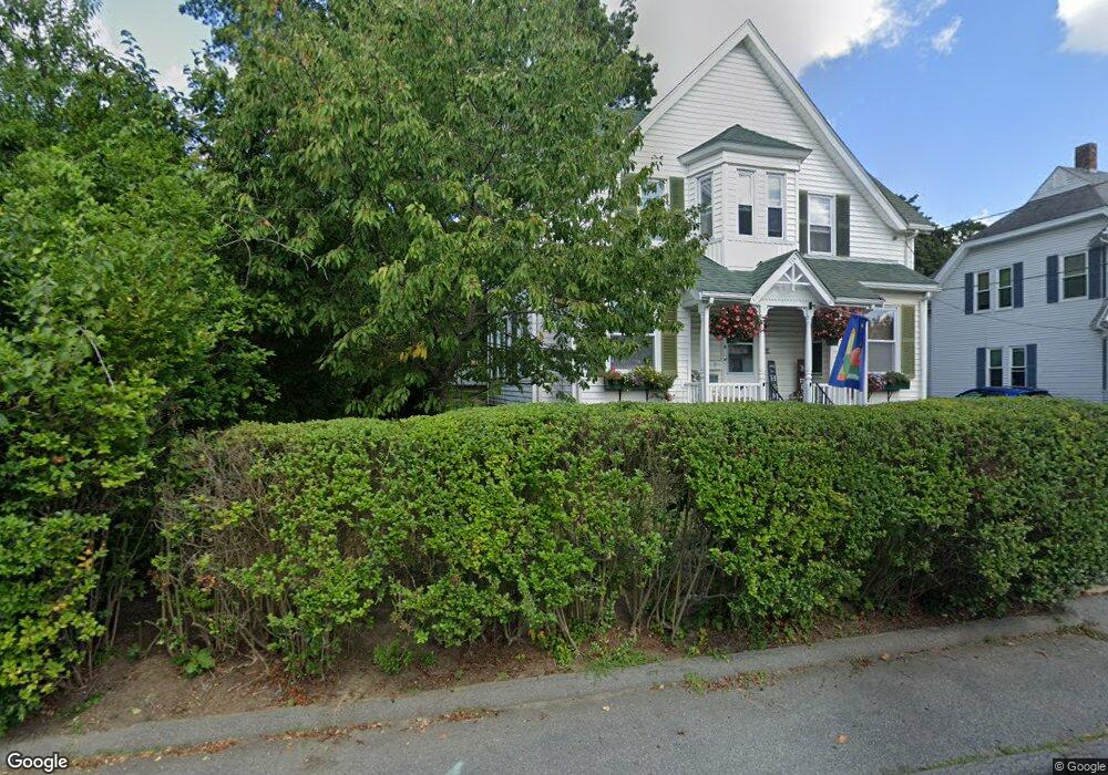
4 W Weir St Taunton, MA 02780
Estimated Value: $530,000 - $629,000
5
Beds
2
Baths
2,429
Sq Ft
$230/Sq Ft
Est. Value
About This Home
This home is located at 4 W Weir St, Taunton, MA 02780 and is currently estimated at $559,662, approximately $230 per square foot. 4 W Weir St is a home located in Bristol County with nearby schools including Mulcahey Elementary School, Taunton High School, and John F. Parker Middle School.
Ownership History
Date
Name
Owned For
Owner Type
Purchase Details
Closed on
Jun 6, 2013
Sold by
Dinneen Catherine I and Dinneen Joan T
Bought by
4 W Weir Street T and Dinneen Ryan J
Current Estimated Value
Purchase Details
Closed on
Sep 22, 2004
Sold by
Dinneen James C and Dinneen Janet B
Bought by
Four West Weir St Rt and Dinneen Joan T
Create a Home Valuation Report for This Property
The Home Valuation Report is an in-depth analysis detailing your home's value as well as a comparison with similar homes in the area
Home Values in the Area
Average Home Value in this Area
Purchase History
| Date | Buyer | Sale Price | Title Company |
|---|---|---|---|
| 4 W Weir Street T | -- | -- | |
| Dinneen Catherine I | -- | -- | |
| Four West Weir St Rt | -- | -- |
Source: Public Records
Tax History Compared to Growth
Tax History
| Year | Tax Paid | Tax Assessment Tax Assessment Total Assessment is a certain percentage of the fair market value that is determined by local assessors to be the total taxable value of land and additions on the property. | Land | Improvement |
|---|---|---|---|---|
| 2025 | $5,037 | $460,400 | $99,500 | $360,900 |
| 2024 | $4,497 | $401,900 | $99,500 | $302,400 |
| 2023 | $4,389 | $364,200 | $99,500 | $264,700 |
| 2022 | $4,210 | $319,400 | $83,000 | $236,400 |
| 2021 | $4,031 | $283,900 | $75,400 | $208,500 |
| 2020 | $3,826 | $257,500 | $75,400 | $182,100 |
| 2019 | $3,639 | $230,900 | $75,400 | $155,500 |
| 2018 | $3,595 | $228,700 | $75,600 | $153,100 |
| 2017 | $3,200 | $203,700 | $71,700 | $132,000 |
| 2016 | $3,100 | $197,700 | $69,600 | $128,100 |
| 2015 | $3,058 | $203,700 | $69,600 | $134,100 |
| 2014 | $2,998 | $205,200 | $67,900 | $137,300 |
Source: Public Records
Map
Nearby Homes