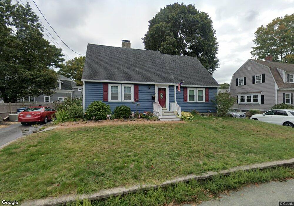
4 Wales Ave Randolph, MA 02368
North Randolph NeighborhoodEstimated Value: $529,000 - $596,000
2
Beds
1
Bath
1,238
Sq Ft
$454/Sq Ft
Est. Value
About This Home
This home is located at 4 Wales Ave, Randolph, MA 02368 and is currently estimated at $561,845, approximately $453 per square foot. 4 Wales Ave is a home located in Norfolk County with nearby schools including Randolph High School, Boston Higashi School, and Lighthouse Baptist Christian Academy.
Ownership History
Date
Name
Owned For
Owner Type
Purchase Details
Closed on
Oct 8, 2003
Sold by
Perry John R and Perry John R
Bought by
Rinehart Michael and Rinehart Robyn
Current Estimated Value
Home Financials for this Owner
Home Financials are based on the most recent Mortgage that was taken out on this home.
Original Mortgage
$243,000
Interest Rate
6.35%
Mortgage Type
Purchase Money Mortgage
Create a Home Valuation Report for This Property
The Home Valuation Report is an in-depth analysis detailing your home's value as well as a comparison with similar homes in the area
Home Values in the Area
Average Home Value in this Area
Purchase History
| Date | Buyer | Sale Price | Title Company |
|---|---|---|---|
| Rinehart Michael | $256,900 | -- | |
| Rinehart Michael | $256,900 | -- |
Source: Public Records
Mortgage History
| Date | Status | Borrower | Loan Amount |
|---|---|---|---|
| Open | Rinehart Michael | $20,000 | |
| Open | Rinehart Michael | $311,250 | |
| Closed | Rinehart Michael | $303,750 | |
| Closed | Rinehart Michael | $271,000 | |
| Closed | Rinehart Michael | $25,000 | |
| Closed | Rinehart Michael | $243,000 |
Source: Public Records
Tax History Compared to Growth
Tax History
| Year | Tax Paid | Tax Assessment Tax Assessment Total Assessment is a certain percentage of the fair market value that is determined by local assessors to be the total taxable value of land and additions on the property. | Land | Improvement |
|---|---|---|---|---|
| 2025 | $5,716 | $492,300 | $222,200 | $270,100 |
| 2024 | $5,528 | $482,800 | $217,800 | $265,000 |
| 2023 | $5,318 | $440,200 | $198,000 | $242,200 |
| 2022 | $5,349 | $393,300 | $165,000 | $228,300 |
| 2021 | $5,040 | $341,000 | $137,500 | $203,500 |
| 2020 | $4,913 | $329,500 | $137,500 | $192,000 |
| 2019 | $4,666 | $311,500 | $131,000 | $180,500 |
| 2018 | $4,546 | $286,300 | $119,000 | $167,300 |
| 2017 | $4,498 | $278,000 | $113,300 | $164,700 |
| 2016 | $4,311 | $247,900 | $103,000 | $144,900 |
| 2015 | $4,192 | $231,600 | $98,100 | $133,500 |
Source: Public Records
Map
Nearby Homes
- 426 N Main St
- 18 Nelson Dr Unit 2F
- 22 Nelson Dr Unit 2E
- 10 Grove Square
- 41 West St Unit C2
- 47 West St Unit A2
- 21 West St Unit A4
- 153 West St
- 10 Westland Rd
- 591 N Main St
- 12 Cottage St
- 14 Clark St
- 33 Clark St Unit A
- 17 Mazzeo Dr
- 57 Althea Rd
- 17 Mill St
- 257 Allen St
- 15 Thompson Dr Unit 15
- 107 Chestnut Cir
- 151 Bittersweet Ln Unit 208
- 6 Wales Ave
- 420 N Main St
- 3 Wales Ave
- 3 Wales Ave Unit 1
- 7 Nelson Dr Unit 5
- 7 Nelson Dr Unit 4
- 7 Nelson Dr Unit 3
- 7 Nelson Dr Unit 2
- 7 Nelson Dr Unit 1
- 7 Nelson Dr Unit 3-7
- 5 Wales Ave
- 427 No Main St
- 8 Wales Ave
- 410 N Main St
- 410 N Main St Unit 2
- 440 N Main St Unit B
- 440 N Main St Unit A
- 440 N Main St
- 440 N Main St
- 13 Nelson Dr Unit 5