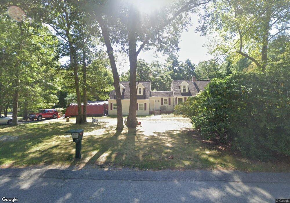
4 Wamsutta Way East Freetown, MA 02717
Estimated Value: $537,000 - $686,000
2
Beds
2
Baths
1,536
Sq Ft
$396/Sq Ft
Est. Value
About This Home
This home is located at 4 Wamsutta Way, East Freetown, MA 02717 and is currently estimated at $608,476, approximately $396 per square foot. 4 Wamsutta Way is a home located in Bristol County with nearby schools including George R Austin Intermediate School, Freetown-Lakeville Middle School, and Apponequet Regional High School.
Ownership History
Date
Name
Owned For
Owner Type
Purchase Details
Closed on
Jul 13, 1982
Bought by
Viens Henry and Viens Nancy
Current Estimated Value
Create a Home Valuation Report for This Property
The Home Valuation Report is an in-depth analysis detailing your home's value as well as a comparison with similar homes in the area
Home Values in the Area
Average Home Value in this Area
Purchase History
| Date | Buyer | Sale Price | Title Company |
|---|---|---|---|
| Viens Henry | $10,300 | -- |
Source: Public Records
Mortgage History
| Date | Status | Borrower | Loan Amount |
|---|---|---|---|
| Open | Viens Henry | $195,000 | |
| Closed | Viens Henry | $50,000 | |
| Closed | Viens Henry | $116,000 |
Source: Public Records
Tax History Compared to Growth
Tax History
| Year | Tax Paid | Tax Assessment Tax Assessment Total Assessment is a certain percentage of the fair market value that is determined by local assessors to be the total taxable value of land and additions on the property. | Land | Improvement |
|---|---|---|---|---|
| 2025 | $4,835 | $487,900 | $182,100 | $305,800 |
| 2024 | $4,803 | $460,500 | $171,800 | $288,700 |
| 2023 | $4,661 | $435,200 | $154,700 | $280,500 |
| 2022 | $4,479 | $371,400 | $131,100 | $240,300 |
| 2021 | $4,190 | $329,900 | $119,200 | $210,700 |
| 2020 | $4,144 | $318,300 | $114,600 | $203,700 |
| 2019 | $3,916 | $297,800 | $109,200 | $188,600 |
| 2018 | $3,731 | $280,300 | $109,200 | $171,100 |
| 2017 | $3,628 | $272,400 | $109,200 | $163,200 |
| 2016 | $3,461 | $264,400 | $106,000 | $158,400 |
| 2015 | $3,397 | $263,300 | $106,000 | $157,300 |
| 2014 | $3,211 | $254,600 | $103,800 | $150,800 |
Source: Public Records
Map
Nearby Homes
- 144 Chace Rd
- 150 Quanapoag Rd
- Lot 2/3 Quanapoag Rd
- 0 Costa Dr
- 599 Quanapoag Rd
- 195 Slab Bridge Rd
- 1475 Braley Rd Unit 17
- 264 Collins Corner Rd
- 13 Luscomb Ln
- 16 Swallow St
- 4597 Acushnet Ave
- 1069 Cherokee St
- 353 Upland St
- 64 Blaze Rd
- 300 High Hill Rd
- 319 Northwest St
- 210 Heritage Dr
- 34 Poplar Rd
- 145 Heritage Dr
- 24 Bells Brook Rd
- 15 Algonquin Way
- 5 Wamsutta Way
- 133 Bullock Rd
- 135 Bullock Rd
- 13 Algonquin Way
- 129 Bullock Rd
- 18 Algonquin Way
- 16 Algonquin Way
- 137 Bullock Rd
- 14 Algonquin Way
- 21 Algonquin Way
- 11 Algonquin Way
- 127 Bullock Rd
- 139 Bullock Rd
- 12 Algonquin Way
- 130 Bullock Rd
- 132 Bullock Rd
- 3 Fall Brook Ln
- 128 Bullock Rd
- 125 Bullock Rd