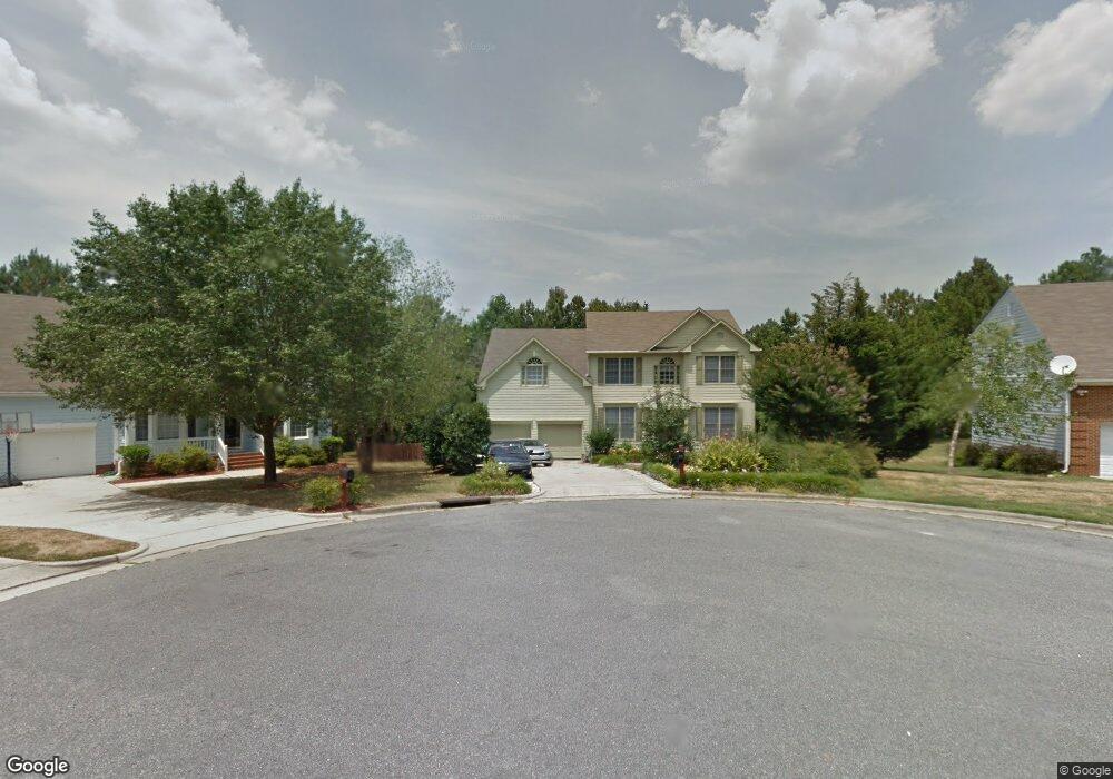
4 Waterview Ct Durham, NC 27703
Eastern Durham NeighborhoodEstimated Value: $437,756 - $526,000
4
Beds
3
Baths
2,460
Sq Ft
$195/Sq Ft
Est. Value
About This Home
This home is located at 4 Waterview Ct, Durham, NC 27703 and is currently estimated at $478,939, approximately $194 per square foot. 4 Waterview Ct is a home located in Durham County with nearby schools including Oak Grove Elementary, John W Neal Middle School, and Southern School of Energy & Sustainability.
Ownership History
Date
Name
Owned For
Owner Type
Purchase Details
Closed on
Aug 31, 2021
Sold by
Persaud Roy and Hamilton Persaud Karen
Bought by
Bethea Lawrence E and Nobel Drive Trust
Current Estimated Value
Purchase Details
Closed on
Jun 27, 2003
Sold by
Pirola John Richard and Pirola Elizabeth W
Bought by
Persaud Roy and Hamilton Persaud Karen
Home Financials for this Owner
Home Financials are based on the most recent Mortgage that was taken out on this home.
Original Mortgage
$163,900
Interest Rate
6.32%
Mortgage Type
Purchase Money Mortgage
Create a Home Valuation Report for This Property
The Home Valuation Report is an in-depth analysis detailing your home's value as well as a comparison with similar homes in the area
Home Values in the Area
Average Home Value in this Area
Purchase History
| Date | Buyer | Sale Price | Title Company |
|---|---|---|---|
| Bethea Lawrence E | -- | None Available | |
| Persaud Roy | $205,000 | -- |
Source: Public Records
Mortgage History
| Date | Status | Borrower | Loan Amount |
|---|---|---|---|
| Previous Owner | Persaud Roy | $163,900 |
Source: Public Records
Tax History
| Year | Tax Paid | Tax Assessment Tax Assessment Total Assessment is a certain percentage of the fair market value that is determined by local assessors to be the total taxable value of land and additions on the property. | Land | Improvement |
|---|---|---|---|---|
| 2025 | $4,452 | $449,101 | $69,441 | $379,660 |
| 2024 | $2,103 | $251,286 | $44,385 | $206,901 |
| 2023 | $3,292 | $251,286 | $44,385 | $206,901 |
| 2022 | $3,216 | $251,286 | $44,385 | $206,901 |
| 2021 | $3,201 | $251,286 | $44,385 | $206,901 |
| 2020 | $3,126 | $251,286 | $44,385 | $206,901 |
| 2019 | $3,126 | $251,286 | $44,385 | $206,901 |
| 2018 | $2,877 | $212,104 | $36,987 | $175,117 |
| 2017 | $2,856 | $212,104 | $36,987 | $175,117 |
| 2016 | $2,760 | $212,104 | $36,987 | $175,117 |
| 2015 | $2,897 | $209,305 | $41,258 | $168,047 |
| 2014 | $2,897 | $209,305 | $41,258 | $168,047 |
Source: Public Records
Map
Nearby Homes
- 601 Crossing Dr
- 615 Southshore Pkwy
- 517 Keith St
- 442 Gus Rd
- 501 Bellmeade Bay Dr
- 807 Outlaw Ave
- 604 Bellmeade Bay Dr
- 1112 Blackthorn Ln
- 208 Lick Creek Ln
- 411 Bellmeade Bay Dr
- 4 Jarvis Ct
- 610 Sherron Rd
- 2208 Gilman St
- 819 Ember Dr
- 3908 Holder Rd
- 1204 Constellation Cir
- 1202 Constellation Cir
- 1200 Constellation Cir
- 1126 Constellation Cir
- 907 Danbury Dr
- 6 Waterview Ct
- 600 Guy Walker Way
- 2 Waterview Ct
- 8 Waterview Ct
- 528 Guy Walker Way
- 7 Waterview Ct
- 5 Waterview Ct
- 723 Nichols Farm Dr
- 605 Guy Walker Way
- 15 Trescott Dr
- 3 Waterview Ct
- 1 Waterview Ct
- 609 Guy Walker Way
- 524 Guy Walker Way
- 719 Nichols Farm Dr
- 718 Nichols Farm Dr
- 13 Trescott Dr
- 527 Guy Walker Way
- 16 Trescott Dr
- 612 Guy Walker Way
Your Personal Tour Guide
Ask me questions while you tour the home.