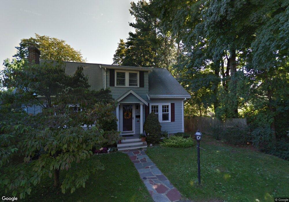
4 Wave Terrace Wakefield, MA 01880
Lakeside NeighborhoodEstimated Value: $819,000 - $968,000
2
Beds
2
Baths
2,106
Sq Ft
$418/Sq Ft
Est. Value
About This Home
This home is located at 4 Wave Terrace, Wakefield, MA 01880 and is currently estimated at $880,442, approximately $418 per square foot. 4 Wave Terrace is a home located in Middlesex County with nearby schools including Wakefield Memorial High School, St Joseph School, and Odyssey Day School.
Ownership History
Date
Name
Owned For
Owner Type
Purchase Details
Closed on
Mar 8, 2012
Sold by
Atkins Patricia L
Bought by
David and David Patricia Atkins
Current Estimated Value
Purchase Details
Closed on
Jul 25, 1996
Sold by
Lidrbauch James and Lidrbauch Charlotte
Bought by
Atkins David and Atkins Patricia
Purchase Details
Closed on
Jun 28, 1991
Sold by
Fisher Mark R and Fisher Kathleen M
Bought by
Romanick Charlotte and Lidrbauch James
Purchase Details
Closed on
Nov 24, 1987
Sold by
Garrity Dennis L
Bought by
Fisher Mark R
Create a Home Valuation Report for This Property
The Home Valuation Report is an in-depth analysis detailing your home's value as well as a comparison with similar homes in the area
Home Values in the Area
Average Home Value in this Area
Purchase History
| Date | Buyer | Sale Price | Title Company |
|---|---|---|---|
| David | -- | -- | |
| David | -- | -- | |
| Atkins David | $225,000 | -- | |
| Romanick Charlotte | $199,500 | -- | |
| Romanick Charlotte | $199,500 | -- | |
| Fisher Mark R | $204,000 | -- |
Source: Public Records
Mortgage History
| Date | Status | Borrower | Loan Amount |
|---|---|---|---|
| Previous Owner | Fisher Mark R | $174,000 | |
| Previous Owner | Fisher Mark R | $178,600 |
Source: Public Records
Tax History Compared to Growth
Tax History
| Year | Tax Paid | Tax Assessment Tax Assessment Total Assessment is a certain percentage of the fair market value that is determined by local assessors to be the total taxable value of land and additions on the property. | Land | Improvement |
|---|---|---|---|---|
| 2025 | $8,066 | $710,700 | $346,000 | $364,700 |
| 2024 | $8,145 | $724,000 | $352,500 | $371,500 |
| 2023 | $7,739 | $659,800 | $321,200 | $338,600 |
| 2022 | $7,194 | $583,900 | $284,300 | $299,600 |
| 2021 | $6,892 | $541,400 | $262,700 | $278,700 |
| 2020 | $6,403 | $501,400 | $243,300 | $258,100 |
| 2019 | $6,174 | $481,200 | $233,500 | $247,700 |
| 2018 | $5,870 | $453,300 | $219,900 | $233,400 |
| 2017 | $5,599 | $429,700 | $208,500 | $221,200 |
| 2016 | $5,269 | $390,600 | $190,900 | $199,700 |
| 2015 | $5,166 | $383,200 | $187,300 | $195,900 |
| 2014 | $4,708 | $368,400 | $180,000 | $188,400 |
Source: Public Records
Map
Nearby Homes
- 13 Highland St
- 24 Park St
- 22 Wayland Rd
- 48 Cordis St
- 29 Cordis St
- 16 Pleasant St
- 9 Avon St Unit 2
- 51 Crescent St
- 11 Wilson Ave
- 50 Albion St
- 6 Blue Jay Cir Unit 2
- 270 Lowell St
- 22 Jefferson Rd
- 1 Mansfield Dr
- 20 N Emerson St Unit 20
- 47 Emerson St
- 6 Avon Ct Unit 2
- 314 Water St Unit 5
- 34 Cedar St
- 26 Curve St