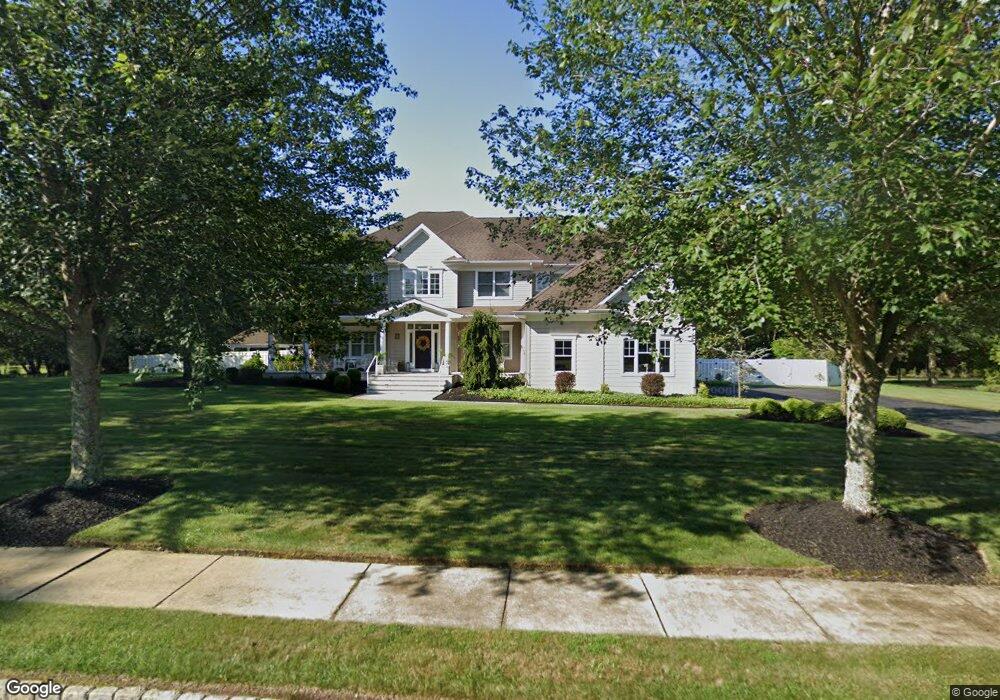
4 Wexford Ln Mays Landing, NJ 08330
Estimated Value: $784,719 - $1,235,000
--
Bed
--
Bath
4,184
Sq Ft
$243/Sq Ft
Est. Value
About This Home
This home is located at 4 Wexford Ln, Mays Landing, NJ 08330 and is currently estimated at $1,015,930, approximately $242 per square foot. 4 Wexford Ln is a home located in Atlantic County with nearby schools including George L. Hess Educational Complex, Joseph Shaner School, and William Davies Middle School.
Ownership History
Date
Name
Owned For
Owner Type
Purchase Details
Closed on
Dec 9, 2024
Sold by
Richards Carl
Bought by
Richards Janene
Current Estimated Value
Purchase Details
Closed on
Apr 28, 2006
Sold by
Select Construction Llc
Bought by
Richards Carl and Richards Janene
Home Financials for this Owner
Home Financials are based on the most recent Mortgage that was taken out on this home.
Original Mortgage
$250,000
Interest Rate
6.4%
Mortgage Type
Purchase Money Mortgage
Create a Home Valuation Report for This Property
The Home Valuation Report is an in-depth analysis detailing your home's value as well as a comparison with similar homes in the area
Home Values in the Area
Average Home Value in this Area
Purchase History
| Date | Buyer | Sale Price | Title Company |
|---|---|---|---|
| Richards Janene | -- | None Listed On Document | |
| Richards Carl | $555,400 | -- |
Source: Public Records
Mortgage History
| Date | Status | Borrower | Loan Amount |
|---|---|---|---|
| Previous Owner | Richards Carl | $250,000 |
Source: Public Records
Tax History Compared to Growth
Tax History
| Year | Tax Paid | Tax Assessment Tax Assessment Total Assessment is a certain percentage of the fair market value that is determined by local assessors to be the total taxable value of land and additions on the property. | Land | Improvement |
|---|---|---|---|---|
| 2025 | $17,316 | $504,700 | $68,400 | $436,300 |
| 2024 | $17,316 | $504,700 | $68,400 | $436,300 |
| 2023 | $16,282 | $504,700 | $68,400 | $436,300 |
| 2022 | $16,282 | $504,700 | $68,400 | $436,300 |
| 2021 | $16,246 | $504,700 | $68,400 | $436,300 |
| 2020 | $16,246 | $504,700 | $68,400 | $436,300 |
| 2019 | $16,287 | $504,700 | $68,400 | $436,300 |
| 2018 | $15,716 | $504,700 | $68,400 | $436,300 |
| 2017 | $15,469 | $504,700 | $68,400 | $436,300 |
| 2016 | $15,035 | $504,700 | $68,400 | $436,300 |
| 2015 | $14,525 | $504,700 | $68,400 | $436,300 |
| 2014 | $14,753 | $561,600 | $76,000 | $485,600 |
Source: Public Records
Map
Nearby Homes
- 355 Penny Ln
- 4678 Somers Point Rd
- 401 Clarkstown Rd
- 570 North St
- 574 North St
- 116 Post Rd
- 1033 Somers Point Rd
- 4465 Ocean Heights Ave
- 1410 Cantillon Blvd
- 144 Knights Bridge Way
- 1403 Loretta Ave
- 1404 Loretta Ave
- 105 Knights Bridge Way
- 1 Lafayette Ave
- 182 Giordano Mews
- 246 Old River Rd
- 109 Deal Ln
- 156 Marucci Place
- 1099 Somers Point Rd
- 112 Giunta Walk
- 12 Wexford Ln
- 2 Wexford Ln
- 14 Wexford Ln
- 4800 Somers Point Rd
- 4800 Mays Landing- Somers Point Rd
- 6 Wexford Ln
- 10 Wexford Ln
- 8 Wexford Ln
- 4844 Somers Point Rd
- 613 Ashland Ave
- 605 Ashland Ave
- 20 Buckingham Way
- 621 Ashland Ave
- 4 Homewood Ct
- 6 Homewood Ct
- 18 Buckingham Way
- 629 Ashland Ave
- 612 Ashland Ave
- 620 Ashland Ave
- 1 Homewood Ct