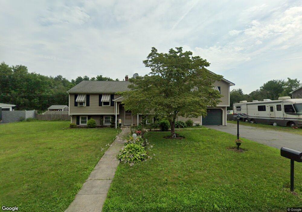
4 Wildrose Ln Acushnet, MA 02743
Sherwood Forest NeighborhoodEstimated Value: $585,959 - $714,000
Studio
1
Bath
2,552
Sq Ft
$258/Sq Ft
Est. Value
About This Home
This home is located at 4 Wildrose Ln, Acushnet, MA 02743 and is currently estimated at $658,990, approximately $258 per square foot. 4 Wildrose Ln is a home located in Bristol County with nearby schools including Acushnet Elementary School, Albert F Ford Middle School, and Alma del Mar Charter School.
Ownership History
Date
Name
Owned For
Owner Type
Purchase Details
Closed on
Jun 25, 2007
Sold by
Gatonska Jeanne C and Gatonska Mitchell P
Bought by
Raposa Holly J and Raposa Steven A
Current Estimated Value
Purchase Details
Closed on
Dec 18, 1998
Sold by
Rippon Ronald K and Rippon Ankea W
Bought by
Raposa Steven A and Raposa Holly J
Purchase Details
Closed on
Sep 26, 1995
Sold by
Botelho Bruce J and Shurtleff Claire H
Bought by
Rippon Ronald K and Rippon Ankea W
Purchase Details
Closed on
Sep 8, 1987
Sold by
Koska John T
Bought by
Botelho Bruce J
Create a Home Valuation Report for This Property
The Home Valuation Report is an in-depth analysis detailing your home's value as well as a comparison with similar homes in the area
Home Values in the Area
Average Home Value in this Area
Purchase History
| Date | Buyer | Sale Price | Title Company |
|---|---|---|---|
| Raposa Holly J | -- | -- | |
| Raposa Steven A | $187,000 | -- | |
| Rippon Ronald K | $194,000 | -- | |
| Botelho Bruce J | $130,000 | -- |
Source: Public Records
Mortgage History
| Date | Status | Borrower | Loan Amount |
|---|---|---|---|
| Open | Botelho Bruce J | $170,000 | |
| Previous Owner | Botelho Bruce J | $80,000 |
Source: Public Records
Tax History
| Year | Tax Paid | Tax Assessment Tax Assessment Total Assessment is a certain percentage of the fair market value that is determined by local assessors to be the total taxable value of land and additions on the property. | Land | Improvement |
|---|---|---|---|---|
| 2025 | $50 | $466,400 | $128,200 | $338,200 |
| 2024 | $4,991 | $437,400 | $121,200 | $316,200 |
| 2023 | $4,871 | $405,900 | $104,900 | $301,000 |
| 2022 | $4,463 | $336,300 | $100,200 | $236,100 |
| 2021 | $4,549 | $328,900 | $100,200 | $228,700 |
| 2020 | $4,544 | $326,000 | $100,200 | $225,800 |
| 2019 | $4,631 | $326,600 | $102,600 | $224,000 |
| 2018 | $4,502 | $312,200 | $102,600 | $209,600 |
| 2017 | $4,384 | $303,600 | $102,600 | $201,000 |
| 2016 | $4,127 | $284,000 | $95,600 | $188,400 |
| 2015 | $3,817 | $267,300 | $95,600 | $171,700 |
Source: Public Records
Map
Nearby Homes
- SS Charbonneau Ln
- 134 Nyes Ln
- 1015 Forbes St
- 329 Middle Rd
- 40 Foley Dr
- ES Acushnet Ave
- 765 Pine Hill Dr
- 145 Heritage Dr
- 34 Poplar Rd
- 0 Keene Rd Unit 73459818
- WS Phillips Rd
- ES Phillips Rd
- 898 Tobey St
- 7 Hamlin St
- 1044 Phillips Rd Unit 25
- 1044 Phillips Rd Unit 20
- 0 Land Way Unit 73479153
- 23 Coury Dr
- 2800 Acushnet Ave
- 1069 Cherokee St
Your Personal Tour Guide
Ask me questions while you tour the home.