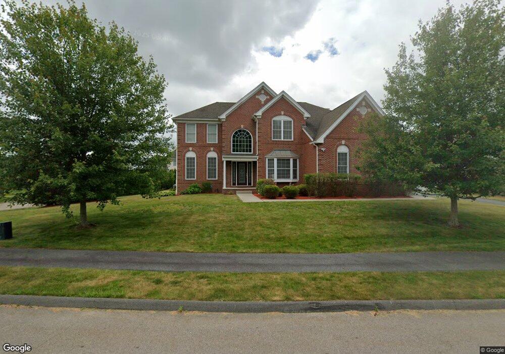
4 York Cir Walpole, MA 02032
Estimated Value: $1,390,620 - $1,525,000
4
Beds
3
Baths
3,656
Sq Ft
$401/Sq Ft
Est. Value
About This Home
This home is located at 4 York Cir, Walpole, MA 02032 and is currently estimated at $1,464,405, approximately $400 per square foot. 4 York Cir is a home located in Norfolk County with nearby schools including Fisher School, Walpole Middle School, and Walpole High School.
Ownership History
Date
Name
Owned For
Owner Type
Purchase Details
Closed on
Nov 1, 2024
Sold by
Govardhini Pavuluri Ret and Pavuluri
Bought by
Pavuluri Govardhini and Thotakura Ridhi
Current Estimated Value
Purchase Details
Closed on
Dec 14, 2023
Sold by
Pavuluri Govardhini
Bought by
Govardhini Pavuluri Ret and Pavuluri
Create a Home Valuation Report for This Property
The Home Valuation Report is an in-depth analysis detailing your home's value as well as a comparison with similar homes in the area
Home Values in the Area
Average Home Value in this Area
Purchase History
| Date | Buyer | Sale Price | Title Company |
|---|---|---|---|
| Pavuluri Govardhini | -- | None Available | |
| Pavuluri Govardhini | -- | None Available | |
| Govardhini Pavuluri Ret | -- | None Available | |
| Govardhini Pavuluri Ret | -- | None Available |
Source: Public Records
Tax History Compared to Growth
Tax History
| Year | Tax Paid | Tax Assessment Tax Assessment Total Assessment is a certain percentage of the fair market value that is determined by local assessors to be the total taxable value of land and additions on the property. | Land | Improvement |
|---|---|---|---|---|
| 2025 | $16,735 | $1,304,400 | $410,500 | $893,900 |
| 2024 | $16,113 | $1,218,800 | $394,600 | $824,200 |
| 2023 | $15,808 | $1,138,100 | $343,200 | $794,900 |
| 2022 | $13,420 | $928,100 | $306,500 | $621,600 |
| 2021 | $13,320 | $897,600 | $289,100 | $608,500 |
| 2020 | $12,440 | $829,900 | $272,800 | $557,100 |
| 2019 | $12,237 | $810,400 | $262,300 | $548,100 |
| 2018 | $11,613 | $760,500 | $253,000 | $507,500 |
| 2017 | $11,298 | $737,000 | $243,300 | $493,700 |
| 2016 | $11,230 | $721,700 | $251,200 | $470,500 |
| 2015 | $11,003 | $700,800 | $239,300 | $461,500 |
| 2014 | $10,874 | $690,000 | $255,800 | $434,200 |
Source: Public Records
Map
Nearby Homes
- 22 Coolidge Rd
- 7 Washington Green
- 20 Rockhill St
- 20 Rockhill St
- 363 - 367 Washington St
- 531 Walpole St
- 0 Charlotte Rd
- 291 Plimpton St
- 11 Park Ln
- 486 Washington St
- Unit 11 Powder House Ln Unit 11
- 8 Powder House Ln Unit 2
- Unit 12 Powder House Ln Unit 12
- Unit 3 Powder House Ln Unit 3
- 66 Gould St
- 70 Endicott St Unit 404
- 70 Endicott St Unit 1306
- 2 Alexandra Way
- 34 Austin St Unit 1L
- 5 Atwood Ave
- 8 York Cir
- 3 Hound Pack Cir
- 3 York Cir
- 7 Hound Pack Cir
- 50 Anderson Dr
- 12 York Cir
- 7 York Cir
- 46 Anderson Way
- 0 Hound Pack Cir
- 54 Anderson Way
- 54 Anderson Way
- 0000 Hound Pack Cir
- 00 Hound Pack Cir
- 16 York Cir
- 4 Hound Pack Cir
- 39 Anderson Way
- 58 Anderson Way
- 11 Hound Pack Cir
- 42 Anderson Way
- 00 York Cir