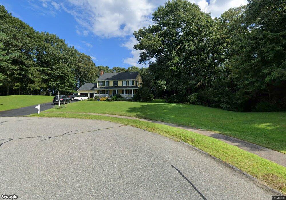
40 Abner Belcher Rd Wrentham, MA 02093
Estimated Value: $788,313 - $931,000
4
Beds
4
Baths
2,168
Sq Ft
$393/Sq Ft
Est. Value
About This Home
This home is located at 40 Abner Belcher Rd, Wrentham, MA 02093 and is currently estimated at $852,328, approximately $393 per square foot. 40 Abner Belcher Rd is a home located in Norfolk County with nearby schools including Delaney Elementary School, Charles E Roderick, and Mercymount Country Day School.
Ownership History
Date
Name
Owned For
Owner Type
Purchase Details
Closed on
Dec 22, 2000
Sold by
Oneil Richard J and Oneil April M
Bought by
Brawley Kevin J and Brawley Kathy A
Current Estimated Value
Purchase Details
Closed on
Feb 13, 1998
Sold by
Doughty Leslie A and Doughty Christopher C
Bought by
Oneil Richard J and Oneil April M
Purchase Details
Closed on
Jan 29, 1993
Sold by
Cafferelli Tr Joseph
Bought by
Doughty Christopher G and Doughty Leslie A
Create a Home Valuation Report for This Property
The Home Valuation Report is an in-depth analysis detailing your home's value as well as a comparison with similar homes in the area
Home Values in the Area
Average Home Value in this Area
Purchase History
| Date | Buyer | Sale Price | Title Company |
|---|---|---|---|
| Brawley Kevin J | $340,000 | -- | |
| Oneil Richard J | $255,000 | -- | |
| Doughty Christopher G | $205,480 | -- |
Source: Public Records
Mortgage History
| Date | Status | Borrower | Loan Amount |
|---|---|---|---|
| Open | Doughty Christopher G | $326,000 | |
| Closed | Doughty Christopher G | $30,000 |
Source: Public Records
Tax History Compared to Growth
Tax History
| Year | Tax Paid | Tax Assessment Tax Assessment Total Assessment is a certain percentage of the fair market value that is determined by local assessors to be the total taxable value of land and additions on the property. | Land | Improvement |
|---|---|---|---|---|
| 2025 | $8,296 | $715,800 | $302,100 | $413,700 |
| 2024 | $7,944 | $662,000 | $302,100 | $359,900 |
| 2023 | $7,831 | $620,500 | $274,500 | $346,000 |
| 2022 | $7,509 | $549,300 | $256,000 | $293,300 |
| 2021 | $6,952 | $494,100 | $223,400 | $270,700 |
| 2020 | $6,901 | $484,300 | $198,600 | $285,700 |
| 2019 | $6,662 | $471,800 | $198,600 | $273,200 |
| 2018 | $7,841 | $550,600 | $198,900 | $351,700 |
| 2017 | $7,601 | $533,400 | $195,000 | $338,400 |
| 2016 | $7,444 | $521,300 | $189,400 | $331,900 |
| 2015 | $7,538 | $503,200 | $182,100 | $321,100 |
| 2014 | $7,555 | $493,500 | $175,100 | $318,400 |
Source: Public Records
Map
Nearby Homes
- 791 South St Unit 5
- Lot 1 - Blueberry 2 Car Plan at King Philip Estates
- Lot 8 - Blueberry 2 Car Plan at King Philip Estates
- Lot 5 - Hughes 2 car Plan at King Philip Estates
- Lot 6 - Blueberry 3 Car Plan at King Philip Estates
- Lot 2 - Camden 2 Car Plan at King Philip Estates
- Lot 7 - Cedar Plan at King Philip Estates
- Lot 4 - Hemingway 2 Car Plan at King Philip Estates
- Lot 3 - Blueberry 2 Car Plan at King Philip Estates
- Lot 3 - 14 Earle Stewart Ln
- 50 Green St
- 11 Earle Stewart Ln
- 440 Chestnut St
- 80 Carriage House Ln
- 1204 South St
- 131 Creek St Unit 7
- 1222 South St
- 319 Taunton St
- 955 Summer St
- 4 Munroe Dr
- 25 Abner Belcher Rd
- 45 Roger Goodwin Dr
- 11 Cranberry Ln
- 30 Abner Belcher Rd
- 78 Oxbow Dr
- 160 West St
- 15 Abner Belcher Rd
- 35 Roger Goodwin Dr
- 40 Roger Goodwin Dr
- 20 Abner Belcher Rd
- 150 West St
- 70 Oxbow Dr
- 30 Roger Goodwin Dr
- 80 Oxbow Dr
- 7 Cranberry Ln
- 180 West St
- 40 Oxbow Dr
- 8 Cranberry Ln
- 77 Oxbow Dr
- 25 Roger Goodwin Dr