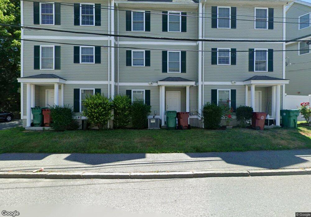
40 Andrews St Unit C Lowell, MA 01852
Sacred Heart NeighborhoodEstimated Value: $454,000 - $513,000
3
Beds
2
Baths
1,700
Sq Ft
$286/Sq Ft
Est. Value
About This Home
This home is located at 40 Andrews St Unit C, Lowell, MA 01852 and is currently estimated at $486,442, approximately $286 per square foot. 40 Andrews St Unit C is a home located in Middlesex County with nearby schools including Moody Elementary School, Abraham Lincoln Elementary School, and Greenhalge Elementary School.
Ownership History
Date
Name
Owned For
Owner Type
Purchase Details
Closed on
Aug 17, 2007
Sold by
40 Andrews Street Rt
Bought by
Sexton Joseph H and Sexton Mealea K
Current Estimated Value
Home Financials for this Owner
Home Financials are based on the most recent Mortgage that was taken out on this home.
Original Mortgage
$166,320
Outstanding Balance
$105,359
Interest Rate
6.67%
Mortgage Type
Purchase Money Mortgage
Estimated Equity
$381,083
Create a Home Valuation Report for This Property
The Home Valuation Report is an in-depth analysis detailing your home's value as well as a comparison with similar homes in the area
Home Values in the Area
Average Home Value in this Area
Purchase History
| Date | Buyer | Sale Price | Title Company |
|---|---|---|---|
| Sexton Joseph H | $216,000 | -- |
Source: Public Records
Mortgage History
| Date | Status | Borrower | Loan Amount |
|---|---|---|---|
| Open | Sexton Joseph H | $166,320 |
Source: Public Records
Tax History Compared to Growth
Tax History
| Year | Tax Paid | Tax Assessment Tax Assessment Total Assessment is a certain percentage of the fair market value that is determined by local assessors to be the total taxable value of land and additions on the property. | Land | Improvement |
|---|---|---|---|---|
| 2025 | $4,261 | $371,200 | $0 | $371,200 |
| 2024 | $4,016 | $337,200 | $0 | $337,200 |
| 2023 | $3,699 | $297,800 | $0 | $297,800 |
| 2022 | $3,514 | $276,900 | $0 | $276,900 |
| 2021 | $3,415 | $253,700 | $0 | $253,700 |
| 2020 | $2,915 | $218,200 | $0 | $218,200 |
| 2019 | $2,847 | $202,800 | $0 | $202,800 |
| 2018 | $2,710 | $188,300 | $0 | $188,300 |
| 2017 | $2,678 | $179,500 | $0 | $179,500 |
| 2016 | $2,521 | $166,300 | $0 | $166,300 |
| 2015 | $2,450 | $158,300 | $0 | $158,300 |
| 2013 | $2,388 | $159,100 | $0 | $159,100 |
Source: Public Records
Map
Nearby Homes
- 64 S Whipple St
- 5 Lenox St Unit 2
- 14 Watson St Unit 4
- 197 Moore St
- 9 Watson St
- 540 Lawrence St
- 59 Livingston St
- 46 Lyons St
- 96 Park Ave W Unit A4
- 15 Alton St Unit 10
- 35 Prospect St
- 762 Gorham St Unit 3
- 15 Whipple St
- 834 Central St
- 24 Richmond Ave
- 8 Cedar Ct
- 43 Cedar St
- 433 Lincoln St
- 42 Keene St
- 12 Cedar St
- 40 Andrews St Unit A
- 40 Andrews St Unit B
- 40 Andrews St Unit D
- 40 Andrews St Unit F
- 40 Andrews St Unit E
- 40 Andrews St Unit 4
- 40 Andrews St
- 23 Andrews St Unit 23
- 48R Andrews St
- 48 Andrews St Unit R
- 48 Andrews St
- 48A Andrews St
- 25 Agawam St
- 21 Andrews St Unit 21
- 17 Andrews St Unit 17
- 15 Andrews St Unit 15
- 13 Andrews St
- 21 Agawam St Unit D
- 21 Agawam St Unit 2C
- 21 Agawam St Unit B