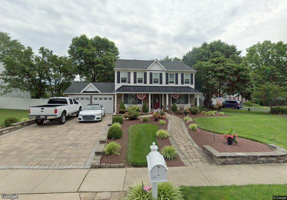
40 Angela Ave Morrisville, PA 19067
Estimated Value: $689,880 - $720,000
4
Beds
3
Baths
2,278
Sq Ft
$311/Sq Ft
Est. Value
About This Home
This home is located at 40 Angela Ave, Morrisville, PA 19067 and is currently estimated at $708,220, approximately $310 per square foot. 40 Angela Ave is a home located in Bucks County with nearby schools including Eleanor Roosevelt Elementary School, Pennwood Middle School, and Pennsbury High School.
Ownership History
Date
Name
Owned For
Owner Type
Purchase Details
Closed on
Jul 29, 1999
Sold by
Santicerma Anthony J and Santicerma Deborah A
Bought by
Shero Robert A and Shero Christine E
Current Estimated Value
Home Financials for this Owner
Home Financials are based on the most recent Mortgage that was taken out on this home.
Original Mortgage
$234,650
Outstanding Balance
$66,851
Interest Rate
7.54%
Estimated Equity
$641,369
Purchase Details
Closed on
Jul 6, 1988
Bought by
Santicerma Anthony J and Santicerma Deborah A
Create a Home Valuation Report for This Property
The Home Valuation Report is an in-depth analysis detailing your home's value as well as a comparison with similar homes in the area
Home Values in the Area
Average Home Value in this Area
Purchase History
| Date | Buyer | Sale Price | Title Company |
|---|---|---|---|
| Shero Robert A | $247,000 | T A Title Insurance Company | |
| Santicerma Anthony J | $198,100 | -- |
Source: Public Records
Mortgage History
| Date | Status | Borrower | Loan Amount |
|---|---|---|---|
| Open | Shero Robert A | $234,650 |
Source: Public Records
Tax History Compared to Growth
Tax History
| Year | Tax Paid | Tax Assessment Tax Assessment Total Assessment is a certain percentage of the fair market value that is determined by local assessors to be the total taxable value of land and additions on the property. | Land | Improvement |
|---|---|---|---|---|
| 2025 | $9,238 | $41,480 | $8,320 | $33,160 |
| 2024 | $9,238 | $41,480 | $8,320 | $33,160 |
| 2023 | $1,355 | $41,480 | $8,320 | $33,160 |
| 2022 | $8,576 | $41,480 | $8,320 | $33,160 |
| 2021 | $8,410 | $41,480 | $8,320 | $33,160 |
| 2020 | $8,410 | $41,480 | $8,320 | $33,160 |
| 2019 | $8,263 | $41,480 | $8,320 | $33,160 |
| 2018 | $8,160 | $41,480 | $8,320 | $33,160 |
| 2017 | $7,955 | $41,480 | $8,320 | $33,160 |
| 2016 | $7,955 | $41,480 | $8,320 | $33,160 |
| 2015 | $7,394 | $41,480 | $8,320 | $33,160 |
| 2014 | $7,394 | $41,480 | $8,320 | $33,160 |
Source: Public Records
Map
Nearby Homes
- 10 Makefield Rd
- 115 Winding Way
- 199 Share Dr
- 229 Walton Dr
- 670 Lincoln Hwy
- 184 Crestview Way
- 5 Patrick Ln
- 113 Juliet Rd
- 120 Vermont Ln
- 404 Alden Ave
- 413 Alden Ave
- 942 Roeloffs Ct
- 244 Guilford Rd
- 46 Moon Dr
- 252 N Olds Blvd
- 494 Keating Dr
- 329 Sherwood Dr
- 866 Weber Dr
- 581 Nottingham Dr
- 1080 Roelofs Rd Unit A