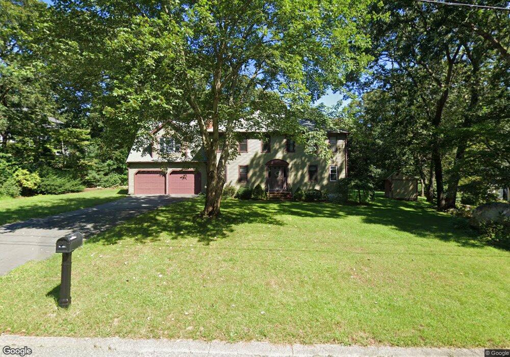
40 Arrowhead Rd Wrentham, MA 02093
Estimated Value: $842,000 - $1,094,000
6
Beds
4
Baths
3,629
Sq Ft
$272/Sq Ft
Est. Value
About This Home
This home is located at 40 Arrowhead Rd, Wrentham, MA 02093 and is currently estimated at $987,160, approximately $272 per square foot. 40 Arrowhead Rd is a home located in Norfolk County with nearby schools including Delaney Elementary School, Charles E Roderick, and Cadence Academy Preschool - North Attleborough.
Ownership History
Date
Name
Owned For
Owner Type
Purchase Details
Closed on
Jul 24, 2012
Sold by
Sen Shubhro
Bought by
Sen Shubhro and Sen Mary
Current Estimated Value
Purchase Details
Closed on
Aug 20, 1992
Sold by
King Willard F and King Georgia M
Bought by
Sen Shubhro
Home Financials for this Owner
Home Financials are based on the most recent Mortgage that was taken out on this home.
Original Mortgage
$190,475
Interest Rate
8.12%
Mortgage Type
Purchase Money Mortgage
Purchase Details
Closed on
Sep 1, 1987
Sold by
Arabian Rt
Bought by
King Willard F
Create a Home Valuation Report for This Property
The Home Valuation Report is an in-depth analysis detailing your home's value as well as a comparison with similar homes in the area
Home Values in the Area
Average Home Value in this Area
Purchase History
| Date | Buyer | Sale Price | Title Company |
|---|---|---|---|
| Sen Shubhro | -- | -- | |
| Sen Shubhro | $200,500 | -- | |
| Sen Shubhro | -- | -- | |
| Sen Shubhro | $200,500 | -- | |
| King Willard F | $239,900 | -- |
Source: Public Records
Mortgage History
| Date | Status | Borrower | Loan Amount |
|---|---|---|---|
| Previous Owner | King Willard F | $206,000 | |
| Previous Owner | King Willard F | $190,000 | |
| Previous Owner | King Willard F | $190,475 |
Source: Public Records
Tax History Compared to Growth
Tax History
| Year | Tax Paid | Tax Assessment Tax Assessment Total Assessment is a certain percentage of the fair market value that is determined by local assessors to be the total taxable value of land and additions on the property. | Land | Improvement |
|---|---|---|---|---|
| 2025 | $9,980 | $861,100 | $275,900 | $585,200 |
| 2024 | $9,580 | $798,300 | $275,900 | $522,400 |
| 2023 | $9,834 | $779,200 | $251,000 | $528,200 |
| 2022 | $9,167 | $670,600 | $226,100 | $444,500 |
| 2021 | $8,595 | $610,900 | $202,300 | $408,600 |
| 2020 | $8,878 | $623,000 | $184,800 | $438,200 |
| 2019 | $8,512 | $602,800 | $184,800 | $418,000 |
| 2018 | $8,980 | $630,600 | $185,000 | $445,600 |
| 2017 | $8,798 | $617,400 | $181,400 | $436,000 |
| 2016 | $8,622 | $603,800 | $176,200 | $427,600 |
| 2015 | $8,652 | $577,600 | $169,400 | $408,200 |
| 2014 | $8,511 | $555,900 | $162,900 | $393,000 |
Source: Public Records
Map
Nearby Homes
- 120 Hawes St
- 483 Thurston St
- 319 Taunton St
- 65 Pond St
- 362 East St
- 1 Lorraine Metcalf Dr
- 10 Nature View Dr
- 15 Nature View Dr
- 270 Dedham St
- 9 Oak Dr
- 11 Earle Stewart Ln
- 80 Mill St
- Lot 1 - Blueberry 2 Car Plan at King Philip Estates
- Lot 8 - Blueberry 2 Car Plan at King Philip Estates
- Lot 5 - Hughes 2 car Plan at King Philip Estates
- Lot 6 - Blueberry 3 Car Plan at King Philip Estates
- Lot 2 - Camden 2 Car Plan at King Philip Estates
- Lot 7 - Cedar Plan at King Philip Estates
- Lot 4 - Hemingway 2 Car Plan at King Philip Estates
- Lot 3 - Blueberry 2 Car Plan at King Philip Estates