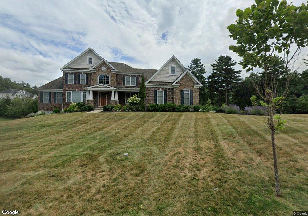
40 Balancing Rock Rd Canton, MA 02021
Estimated Value: $1,781,493 - $2,436,000
5
Beds
6
Baths
5,041
Sq Ft
$403/Sq Ft
Est. Value
About This Home
This home is located at 40 Balancing Rock Rd, Canton, MA 02021 and is currently estimated at $2,032,623, approximately $403 per square foot. 40 Balancing Rock Rd is a home.
Ownership History
Date
Name
Owned For
Owner Type
Purchase Details
Closed on
Sep 30, 2016
Sold by
Toll Ma Land Lp
Bought by
Madineedi Mangadhara R and Madineedi Kamala M
Current Estimated Value
Home Financials for this Owner
Home Financials are based on the most recent Mortgage that was taken out on this home.
Original Mortgage
$895,000
Outstanding Balance
$716,827
Interest Rate
3.43%
Mortgage Type
Unknown
Estimated Equity
$1,315,796
Create a Home Valuation Report for This Property
The Home Valuation Report is an in-depth analysis detailing your home's value as well as a comparison with similar homes in the area
Home Values in the Area
Average Home Value in this Area
Purchase History
| Date | Buyer | Sale Price | Title Company |
|---|---|---|---|
| Madineedi Mangadhara R | $1,286,675 | -- |
Source: Public Records
Mortgage History
| Date | Status | Borrower | Loan Amount |
|---|---|---|---|
| Open | Madineedi Mangadhara R | $895,000 |
Source: Public Records
Tax History Compared to Growth
Tax History
| Year | Tax Paid | Tax Assessment Tax Assessment Total Assessment is a certain percentage of the fair market value that is determined by local assessors to be the total taxable value of land and additions on the property. | Land | Improvement |
|---|---|---|---|---|
| 2025 | $17,206 | $1,739,700 | $339,300 | $1,400,400 |
| 2024 | $16,831 | $1,688,200 | $326,300 | $1,361,900 |
| 2023 | $15,813 | $1,496,000 | $326,300 | $1,169,700 |
| 2022 | $15,746 | $1,387,300 | $310,800 | $1,076,500 |
| 2021 | $15,428 | $1,264,600 | $282,500 | $982,100 |
| 2020 | $14,862 | $1,215,200 | $269,100 | $946,100 |
| 2019 | $15,085 | $1,216,500 | $244,500 | $972,000 |
| 2018 | $14,658 | $1,180,200 | $235,200 | $945,000 |
| 2017 | $9,149 | $715,300 | $251,500 | $463,800 |
| 2016 | $3,139 | $245,400 | $245,400 | $0 |
Source: Public Records
Map
Nearby Homes
- 3 Spotted Turtle Path Unit 24-2
- 50 Indian Ln
- 106 Indian Ln
- 888 Turnpike St
- 30 Manitou Rd
- 11 Ledgewood Dr
- 33 Kelly Way Unit 33
- 14 Iris Ct Unit 14
- 15 Kensington Dr
- 280 Deady Ave
- 0 Washington St Unit 72888098
- 0 Washington St Unit 71897113
- 43 Ledgebrook Ave
- Lot 2 Pondview Ln
- Lot 1 Pondview Ln
- 545 Page St Unit 208
- 8 Sawyer Ave
- 98 Glen Echo Blvd
- 32 Doty Dr
- 120 Charles Ave
- 10 Pulpit Rd
- 35 Balancing Rock Rd
- 30 Balancing Rock Rd
- 50 Balancing Rock Rd
- 25 Balancing Rock Rd
- 45 Balancing Rock Rd
- 15 Balancing Rock Rd
- 20 Balancing Rock Rd
- 60 Balancing Rock Rd
- 55 Balancing Rock Rd
- 20 Pulpit Rd
- 5 Balancing Rock Rd
- 10 Saw Mill Pond Rd
- 65 Balancing Rock Rd
- 22 Wayside Ln
- 70 Balancing Rock Rd
- 20 Saw Mill Pond Rd
- 10 Balancing Rock Rd
- 5 Saw Mill Pond Rd
- 75 Balancing Rock Rd