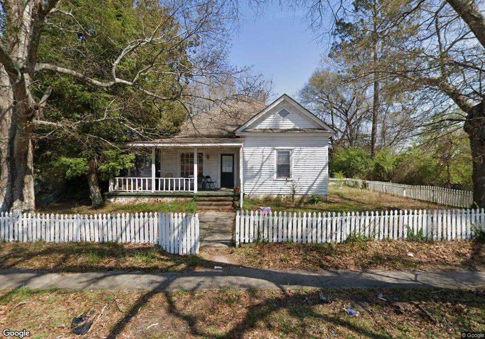
40 Barnard Ave Lagrange, GA 30241
Estimated Value: $154,000 - $223,000
4
Beds
2
Baths
1,957
Sq Ft
$96/Sq Ft
Est. Value
About This Home
This home is located at 40 Barnard Ave, Lagrange, GA 30241 and is currently estimated at $188,613, approximately $96 per square foot. 40 Barnard Ave is a home located in Troup County with nearby schools including Franklin Forest Elementary School, Hollis Hand Elementary School, and Ethel W. Kight Elementary School.
Ownership History
Date
Name
Owned For
Owner Type
Purchase Details
Closed on
Dec 8, 2003
Sold by
Richard Torrace and Douglas Hard
Bought by
Dukes Charles D
Current Estimated Value
Purchase Details
Closed on
Jun 1, 1996
Sold by
Rick Torrance Const Co
Bought by
Richard Torrace and Douglas Hard
Purchase Details
Closed on
Apr 30, 1992
Sold by
Torrance Insulation Co
Bought by
Rick Torrance Const Co
Purchase Details
Closed on
Apr 13, 1987
Sold by
Richard Torrance
Bought by
Torrance Insulation Co
Purchase Details
Closed on
Sep 17, 1984
Sold by
Roy L Keown
Bought by
Richard Torrance
Purchase Details
Closed on
Aug 24, 1984
Sold by
West Point Pepperell
Bought by
Roy L Keown
Purchase Details
Closed on
Jan 1, 1965
Sold by
Dunson Mills
Bought by
West Point Pepperell
Create a Home Valuation Report for This Property
The Home Valuation Report is an in-depth analysis detailing your home's value as well as a comparison with similar homes in the area
Purchase History
| Date | Buyer | Sale Price | Title Company |
|---|---|---|---|
| Dukes Charles D | $145,000 | -- | |
| Richard Torrace | -- | -- | |
| Rick Torrance Const Co | -- | -- | |
| Torrance Insulation Co | $32,800 | -- | |
| Richard Torrance | -- | -- | |
| Roy L Keown | -- | -- | |
| West Point Pepperell | -- | -- |
Source: Public Records
Tax History
| Year | Tax Paid | Tax Assessment Tax Assessment Total Assessment is a certain percentage of the fair market value that is determined by local assessors to be the total taxable value of land and additions on the property. | Land | Improvement |
|---|---|---|---|---|
| 2025 | $1,774 | $65,040 | $9,320 | $55,720 |
| 2024 | $1,622 | $59,480 | $9,320 | $50,160 |
| 2023 | $1,513 | $55,480 | $9,320 | $46,160 |
| 2022 | $1,469 | $52,640 | $9,320 | $43,320 |
| 2021 | $1,620 | $53,720 | $18,000 | $35,720 |
| 2020 | $1,620 | $53,720 | $18,000 | $35,720 |
| 2019 | $1,514 | $50,200 | $18,000 | $32,200 |
| 2018 | $1,514 | $50,200 | $18,000 | $32,200 |
| 2017 | $1,514 | $50,200 | $18,000 | $32,200 |
| 2016 | $1,480 | $49,069 | $18,000 | $31,069 |
| 2015 | $1,482 | $49,069 | $18,000 | $31,069 |
| 2014 | $1,435 | $47,434 | $18,000 | $29,434 |
| 2013 | -- | $49,678 | $18,000 | $31,678 |
Source: Public Records
Map
Nearby Homes
- 204 Cleveland Dr
- 212 Cleveland Dr
- 5 Curran Ave
- 0 N Barnard Ave
- 115 Clara Jean Ct
- 110 Lenox Cir
- 107 N Barnard Ave
- 87 Youngs Mill Rd
- 4 1/2 Barnard Ave
- 3 Gulfstream Dr
- 5 Gulfstream Dr
- 15 Fulton St
- 412 Sweetwood Ct Unit A36
- 101 Sarah Ln
- 304 Bridgette Blvd
- 224 Rutland Cir
- 109 Sarah Ln
- 147 Shenandoah Ln
- 146 Shenandoah Ln
- 143 Shenandoah Ln
- 38 Barnard Ave
- 37 Thornton St
- 41 Thornton St
- 35 Thornton St
- 39 Barnard Ave
- 36 Barnard Ave
- 33 Thornton St
- 86 Thornton St
- 37 Barnard Ave
- 40 Thornton St
- 38 Thornton St
- 34 Barnard Ave
- 31 Thornton St
- 36 Thornton St
- 44 Thornton St
- 34 Thornton St
- 47 N Barnard Ave
- 45 N Barnard Ave
- 32 Barnard Ave
- 29 Thornton St
Your Personal Tour Guide
Ask me questions while you tour the home.