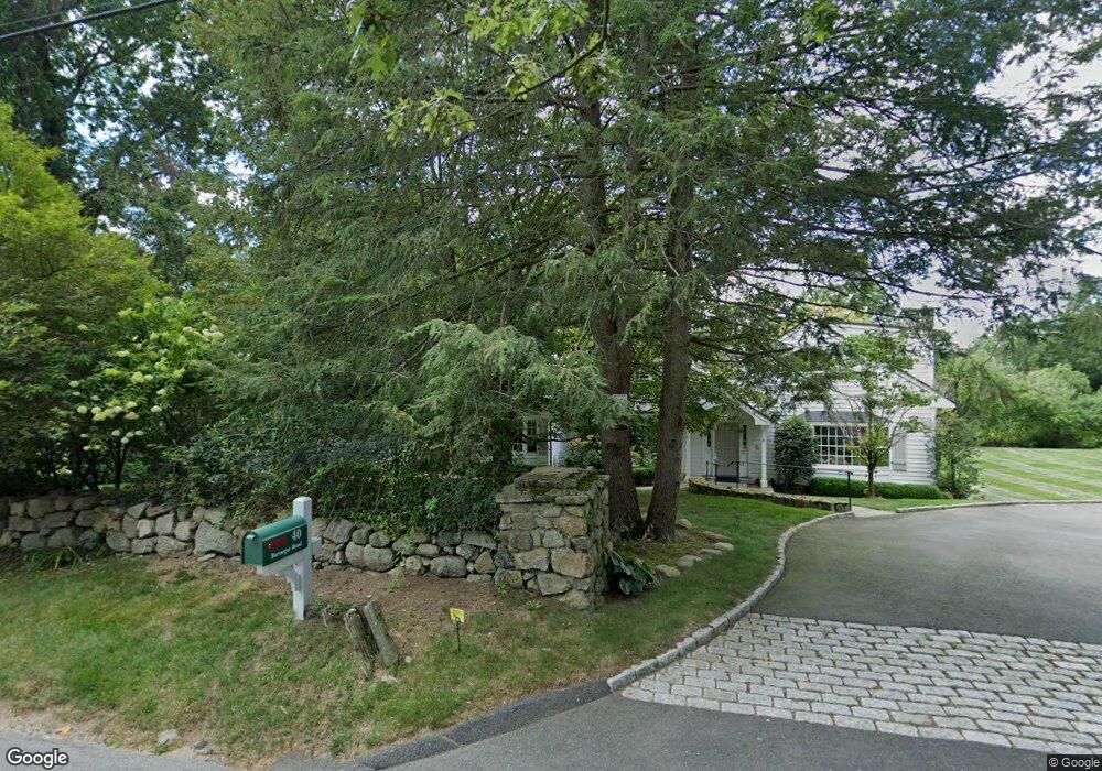
40 Barnegat Rd New Canaan, CT 06840
Estimated Value: $2,413,000 - $3,534,000
--
Bed
--
Bath
--
Sq Ft
2.06
Acres
About This Home
This home is located at 40 Barnegat Rd, New Canaan, CT 06840 and is currently estimated at $2,822,793. 40 Barnegat Rd is a home located in Fairfield County with nearby schools including West Elementary School, Saxe Middle School, and New Canaan High School.
Ownership History
Date
Name
Owned For
Owner Type
Purchase Details
Closed on
Apr 29, 1993
Sold by
Thorsen D Bruce and Thorsen Barbara
Bought by
Boettler Peter and Goettler Cynthia
Current Estimated Value
Home Financials for this Owner
Home Financials are based on the most recent Mortgage that was taken out on this home.
Original Mortgage
$362,000
Interest Rate
7.51%
Mortgage Type
Unknown
Create a Home Valuation Report for This Property
The Home Valuation Report is an in-depth analysis detailing your home's value as well as a comparison with similar homes in the area
Home Values in the Area
Average Home Value in this Area
Purchase History
| Date | Buyer | Sale Price | Title Company |
|---|---|---|---|
| Boettler Peter | $725,000 | -- |
Source: Public Records
Mortgage History
| Date | Status | Borrower | Loan Amount |
|---|---|---|---|
| Closed | Boettler Peter | $362,000 | |
| Previous Owner | Boettler Peter | $363,000 |
Source: Public Records
Tax History Compared to Growth
Tax History
| Year | Tax Paid | Tax Assessment Tax Assessment Total Assessment is a certain percentage of the fair market value that is determined by local assessors to be the total taxable value of land and additions on the property. | Land | Improvement |
|---|---|---|---|---|
| 2025 | $22,118 | $1,325,240 | $671,650 | $653,590 |
| 2024 | $21,389 | $1,325,240 | $671,650 | $653,590 |
| 2023 | $20,010 | $1,056,510 | $675,430 | $381,080 |
| 2022 | $19,408 | $1,056,510 | $675,430 | $381,080 |
| 2021 | $19,186 | $1,056,510 | $675,430 | $381,080 |
| 2020 | $19,186 | $1,056,510 | $675,430 | $381,080 |
| 2019 | $19,271 | $1,056,510 | $675,430 | $381,080 |
| 2018 | $19,347 | $1,140,720 | $729,610 | $411,110 |
| 2017 | $19,016 | $1,140,720 | $729,610 | $411,110 |
| 2016 | $18,605 | $1,140,720 | $729,610 | $411,110 |
| 2015 | $18,890 | $1,140,720 | $729,610 | $411,110 |
| 2014 | $17,727 | $1,140,720 | $729,610 | $411,110 |
Source: Public Records
Map
Nearby Homes
- 171 Proprietors Crossing
- 176 Logan Rd
- 119 Proprietors Crossing
- 928 West Rd
- 26 Pequot Ln
- 1421 Oenoke Ridge
- 1247 Oenoke Ridge
- 0 Rolling Meadow Ln Unit ONEH6302491
- 331 Dans Hwy
- 104 Dans Hwy
- 33 Peters Ln
- 62 Summersweet Ln
- 230 & 244 West Rd
- 104 Ramhorne Rd
- 22 Father Peters Ln
- 17 Eastwoods Rd
- 148 W Hills Rd
- 1580 Ponus Ridge
- 51 Reeder Ln
- 78 Trinity Pass
- 28 Barnegat Rd
- 70 Barnegat Rd
- 11 Barnegat Rd
- 12 Jonathan Rd
- 1745 Oenoke Ridge
- 100 Barnegat Rd
- 23 Jonathan Rd
- 108 Barnegat Rd
- 1 Barnegat Rd
- 1690 Oenoke Ridge
- 1106 West Rd
- 1734 Oenoke Ridge
- 42 Jonathan Rd
- 101 Barnegat Rd
- 1769 Oenoke Ridge
- 76 Jonathan Rd
- 39 Jonathan Rd
- 103 Barnegat Rd
- 65 Barnegat Rd
- 1082 West Rd