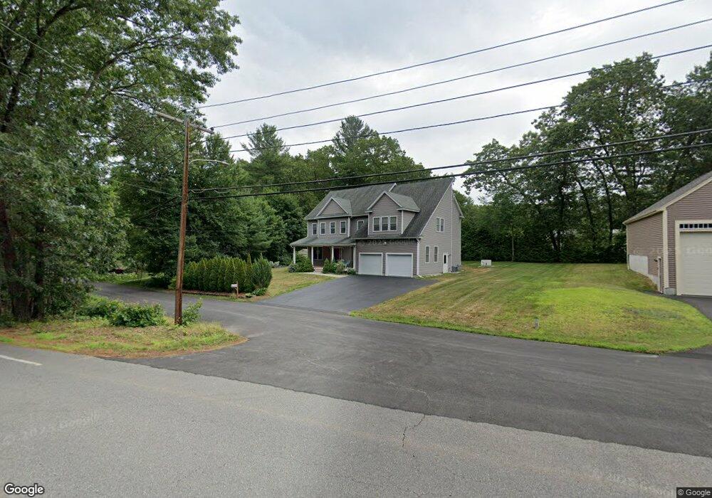
40 Beaverbrook Rd Unit 1 Westford, MA 01886
Estimated Value: $960,000 - $1,121,696
4
Beds
3
Baths
2,652
Sq Ft
$404/Sq Ft
Est. Value
About This Home
This home is located at 40 Beaverbrook Rd Unit 1, Westford, MA 01886 and is currently estimated at $1,072,674, approximately $404 per square foot. 40 Beaverbrook Rd Unit 1 is a home located in Middlesex County with nearby schools including Col John Robinson, John A. Crisafulli Elementary School, and Blanchard Middle School.
Ownership History
Date
Name
Owned For
Owner Type
Purchase Details
Closed on
Aug 30, 2017
Sold by
Daily Jason G and Daily Connie D
Bought by
Rawski Agnieszka Z
Current Estimated Value
Home Financials for this Owner
Home Financials are based on the most recent Mortgage that was taken out on this home.
Original Mortgage
$364,000
Outstanding Balance
$304,455
Interest Rate
3.96%
Mortgage Type
New Conventional
Estimated Equity
$768,219
Purchase Details
Closed on
Jun 27, 2012
Sold by
Gladu Raymond E and Gladu Sandra
Bought by
Daily Jason G and Daily Connie D
Home Financials for this Owner
Home Financials are based on the most recent Mortgage that was taken out on this home.
Original Mortgage
$351,200
Interest Rate
3.78%
Mortgage Type
New Conventional
Create a Home Valuation Report for This Property
The Home Valuation Report is an in-depth analysis detailing your home's value as well as a comparison with similar homes in the area
Home Values in the Area
Average Home Value in this Area
Purchase History
| Date | Buyer | Sale Price | Title Company |
|---|---|---|---|
| Rawski Agnieszka Z | $639,000 | -- | |
| Daily Jason G | $340,000 | -- |
Source: Public Records
Mortgage History
| Date | Status | Borrower | Loan Amount |
|---|---|---|---|
| Open | Rawski Agnieszka Z | $364,000 | |
| Previous Owner | Daily Jason G | $351,200 |
Source: Public Records
Tax History Compared to Growth
Tax History
| Year | Tax Paid | Tax Assessment Tax Assessment Total Assessment is a certain percentage of the fair market value that is determined by local assessors to be the total taxable value of land and additions on the property. | Land | Improvement |
|---|---|---|---|---|
| 2025 | $13,043 | $968,300 | $287,200 | $681,100 |
| 2024 | $12,726 | $924,200 | $273,500 | $650,700 |
| 2023 | $12,514 | $847,800 | $260,600 | $587,200 |
| 2022 | $12,504 | $775,700 | $200,300 | $575,400 |
| 2021 | $11,370 | $683,300 | $200,300 | $483,000 |
| 2020 | $11,181 | $684,700 | $200,300 | $484,400 |
| 2019 | $10,562 | $637,800 | $192,000 | $445,800 |
| 2018 | $9,048 | $629,400 | $183,600 | $445,800 |
| 2017 | $9,414 | $573,700 | $183,600 | $390,100 |
| 2016 | $9,364 | $574,500 | $183,600 | $390,900 |
| 2015 | $3,220 | $198,300 | $183,600 | $14,700 |
| 2014 | $5,428 | $327,000 | $176,400 | $150,600 |
Source: Public Records
Map
Nearby Homes
- 8 Sandy Beach Rd
- 16 Abbot St
- 66 Patten Rd
- 28 W Prescott St
- 9 Elm St
- 6 Coolidge St
- 12 Patten Rd
- 12 Brookfield Dr Unit A
- Lot 13 Monarch Path
- Lot 12 Monarch Path
- Lot 6 Noble Path
- Lot 7 Noble Path
- 41 Flagg Rd
- 21 Flagg Rd
- 66 N Main St Unit 66
- 64 N Main St Unit 64
- 26 Bayberry Rd
- 125 Concord Rd
- 3 Hillside Ave
- 34 West St
- 40 Beaverbrook Rd
- 42 Beaverbrook Rd
- 38 Beaverbrook Rd
- 41 Beaverbrook Rd
- 41 Beaverbrook Rd Unit R
- 4 Brian Dr
- 36 Beaverbrook Rd
- 44 Beaverbrook Rd
- 6 Brian Dr
- 39 Beaverbrook Rd
- 3 Green Needles Rd
- 1 Green Needles Rd
- 3 Brian Dr
- 34 Beaverbrook Rd
- 2 Brian Dr
- 2 Green Needles Rd
- 4 Green Needles Rd
- 28 Green Needles Rd
- 1 Brian Dr
- 1 Christopher Rd