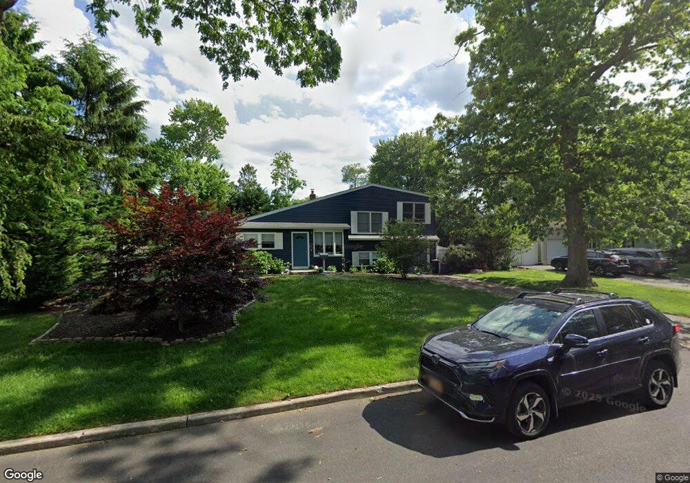
40 Briaroot Dr Smithtown, NY 11787
Estimated Value: $692,000 - $762,946
4
Beds
2
Baths
--
Sq Ft
0.25
Acres
About This Home
This home is located at 40 Briaroot Dr, Smithtown, NY 11787 and is currently estimated at $734,237. 40 Briaroot Dr is a home located in Suffolk County with nearby schools including Mount Pleasant Elementary School, Smithtown Christian School, and St Patrick Elementary School.
Ownership History
Date
Name
Owned For
Owner Type
Purchase Details
Closed on
Nov 20, 2015
Sold by
Daly Carrie E
Bought by
Ambrosini Christopher F and Schaffer Danielle L
Current Estimated Value
Home Financials for this Owner
Home Financials are based on the most recent Mortgage that was taken out on this home.
Original Mortgage
$9,450
Outstanding Balance
$7,463
Interest Rate
3.83%
Mortgage Type
Unknown
Estimated Equity
$726,774
Create a Home Valuation Report for This Property
The Home Valuation Report is an in-depth analysis detailing your home's value as well as a comparison with similar homes in the area
Home Values in the Area
Average Home Value in this Area
Purchase History
| Date | Buyer | Sale Price | Title Company |
|---|---|---|---|
| Ambrosini Christopher F | $315,000 | Coach Title Agency |
Source: Public Records
Mortgage History
| Date | Status | Borrower | Loan Amount |
|---|---|---|---|
| Open | Ambrosini Christopher F | $9,450 | |
| Open | Ambrosini Christopher F | $305,550 |
Source: Public Records
Tax History Compared to Growth
Tax History
| Year | Tax Paid | Tax Assessment Tax Assessment Total Assessment is a certain percentage of the fair market value that is determined by local assessors to be the total taxable value of land and additions on the property. | Land | Improvement |
|---|---|---|---|---|
| 2024 | $10,847 | $5,320 | $265 | $5,055 |
| 2023 | $10,847 | $4,130 | $265 | $3,865 |
| 2022 | $8,017 | $4,130 | $265 | $3,865 |
| 2021 | $8,017 | $4,130 | $265 | $3,865 |
| 2020 | $10,316 | $4,130 | $265 | $3,865 |
| 2019 | $10,316 | $0 | $0 | $0 |
| 2018 | -- | $4,130 | $265 | $3,865 |
| 2017 | $9,645 | $4,130 | $265 | $3,865 |
| 2016 | $10,202 | $4,130 | $265 | $3,865 |
| 2015 | -- | $4,130 | $265 | $3,865 |
| 2014 | -- | $4,130 | $265 | $3,865 |
Source: Public Records
Map
Nearby Homes
- 25 Estate Rd
- 12 Wadsworth Place
- 365 Route 111 Unit A-4
- 365 Route 111 Unit C-4
- 305 Devon Ln
- 206 Brooksite Dr
- 44 Apple Tree Dr
- 22 5th Ave
- 58 Sherbrooke Dr
- 83 Sunrise Ln
- 9 Graystone Ln
- 6 Keystone Ct
- 32 Merrivale Dr
- 639 Townline Rd
- 24 Sandra Dr
- 16 Wildwood Ln
- 72 Mount Pleasant Rd
- 5 Platt Ave
- 64 Brooksite Dr
- 18 Thrush Dr