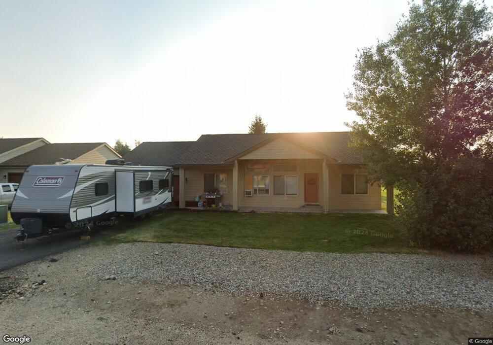
40 Buckskin Rd Donnelly, ID 83615
Estimated Value: $407,000 - $432,000
3
Beds
2
Baths
1,232
Sq Ft
$336/Sq Ft
Est. Value
About This Home
This home is located at 40 Buckskin Rd, Donnelly, ID 83615 and is currently estimated at $414,187, approximately $336 per square foot. 40 Buckskin Rd is a home located in Valley County with nearby schools including Donnelly Elementary School and McCall-Donnelly High School.
Ownership History
Date
Name
Owned For
Owner Type
Purchase Details
Closed on
Oct 20, 2020
Sold by
Griffin Gabe L and Griffin Lori L
Bought by
Angel David
Current Estimated Value
Home Financials for this Owner
Home Financials are based on the most recent Mortgage that was taken out on this home.
Original Mortgage
$218,500
Outstanding Balance
$193,990
Interest Rate
2.8%
Mortgage Type
New Conventional
Estimated Equity
$220,197
Purchase Details
Closed on
Feb 14, 2020
Sold by
Griffin Gabe
Bought by
Griffin Gabe L and Griffin Lori L
Purchase Details
Closed on
Apr 26, 2005
Sold by
Timberline Development Llc
Bought by
Griffin Gabe
Home Financials for this Owner
Home Financials are based on the most recent Mortgage that was taken out on this home.
Original Mortgage
$139,500
Interest Rate
4.12%
Mortgage Type
Adjustable Rate Mortgage/ARM
Create a Home Valuation Report for This Property
The Home Valuation Report is an in-depth analysis detailing your home's value as well as a comparison with similar homes in the area
Home Values in the Area
Average Home Value in this Area
Purchase History
| Date | Buyer | Sale Price | Title Company |
|---|---|---|---|
| Angel David | -- | First American Title Mccall | |
| Griffin Gabe L | -- | None Available | |
| Griffin Gabe | -- | -- |
Source: Public Records
Mortgage History
| Date | Status | Borrower | Loan Amount |
|---|---|---|---|
| Open | Angel David | $218,500 | |
| Previous Owner | Griffin Gabe | $139,500 |
Source: Public Records
Tax History Compared to Growth
Tax History
| Year | Tax Paid | Tax Assessment Tax Assessment Total Assessment is a certain percentage of the fair market value that is determined by local assessors to be the total taxable value of land and additions on the property. | Land | Improvement |
|---|---|---|---|---|
| 2025 | $666 | $373,708 | $26,590 | $347,118 |
| 2023 | $666 | $420,909 | $27,434 | $393,475 |
| 2022 | $825 | $381,130 | $27,434 | $353,696 |
| 2021 | $600 | $225,790 | $21,103 | $204,687 |
| 2020 | $1,062 | $183,903 | $26,187 | $157,716 |
| 2019 | $915 | $144,857 | $24,940 | $119,917 |
| 2018 | $898 | $134,645 | $23,379 | $111,266 |
| 2017 | $968 | $132,929 | $26,771 | $106,158 |
| 2016 | $893 | $120,183 | $25,000 | $95,183 |
| 2015 | $789 | $100,021 | $0 | $0 |
| 2013 | -- | $97,420 | $0 | $0 |
Source: Public Records
Map
Nearby Homes
- 13111 Cameron Dr
- Lot 4 Hideout Dr Unit 4
- 22 Charters Dr
- Lot 6 Hideout Dr Unit 6
- 16 Buckskin Dr
- 24 Mangum Cir Unit 1
- 24 Mangum Dr Unit # 1 Unit 1
- 20 #5 W Mangum Cir Unit 5
- 20 Mangum Cir Unit 8
- 35 1 Mangum Cir
- 32 Mangum Cir Unit 3
- 32 Mangum Cir
- 35 Mangum Cir Unit 1
- 34 Mangum Cir Unit 8
- 13098 Hill House Loop
- 13078 Hill House Loop
- 13091 Hill House Loop
- 13076 Hill House Loop
- 1816 Schultz
- 1816 Schultz Unit 15
- 42 Buckskin Dr
- 42 Buckskin Rd
- 41 Charters Dr
- 41 Charters Dr
- 43 Charters Dr
- 44 Buckskin Dr
- 44 Buckskin Rd
- 41 Buckskin Rd
- 41 Buckskin Dr
- 39 Buckskin Rd
- 39 Buckskin Dr
- 43 Buckskin Dr
- 37 Buckskin Rd
- 37 Buckskin Dr
- 46 Buckskin Rd
- 46 Buckskin Dr
- 45 Buckskin Dr
- 47 Charters Dr
- 40 Timberline Dr
- 35 Buckskin Rd