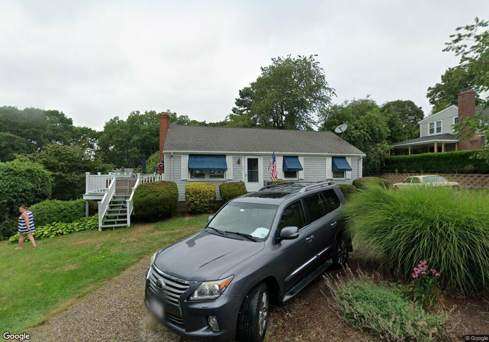
40 Cedar Point Dr Pocasset, MA 02559
Pocasset NeighborhoodEstimated Value: $613,000 - $734,000
3
Beds
1
Bath
912
Sq Ft
$758/Sq Ft
Est. Value
About This Home
This home is located at 40 Cedar Point Dr, Pocasset, MA 02559 and is currently estimated at $691,438, approximately $758 per square foot. 40 Cedar Point Dr is a home located in Barnstable County with nearby schools including Bourne High School, Cadence Academy Preschool - Bourne, and Heritage Christian Academy.
Ownership History
Date
Name
Owned For
Owner Type
Purchase Details
Closed on
Mar 4, 2014
Sold by
Mclarey Henry W and Mclarey Kathleen P
Bought by
40 Cedar Point Drive R and Mclarey
Current Estimated Value
Home Financials for this Owner
Home Financials are based on the most recent Mortgage that was taken out on this home.
Original Mortgage
$80,000
Outstanding Balance
$22,568
Interest Rate
4.39%
Mortgage Type
New Conventional
Estimated Equity
$668,870
Purchase Details
Closed on
Apr 7, 2010
Sold by
Mclarey Kathleen P and Mclarey Henry W
Bought by
40 Cedar Point Drive R and Mclarey
Create a Home Valuation Report for This Property
The Home Valuation Report is an in-depth analysis detailing your home's value as well as a comparison with similar homes in the area
Home Values in the Area
Average Home Value in this Area
Purchase History
| Date | Buyer | Sale Price | Title Company |
|---|---|---|---|
| 40 Cedar Point Drive R | -- | -- | |
| Mclarey Henry W | -- | -- | |
| Mclarey Henry W | -- | -- | |
| 40 Cedar Point Drive R | -- | -- | |
| Mclarey Henry W | -- | -- | |
| 40 Cedar Point Drive R | -- | -- | |
| 40 Cedar Point Drive R | -- | -- |
Source: Public Records
Mortgage History
| Date | Status | Borrower | Loan Amount |
|---|---|---|---|
| Open | Mclarey Henry W | $80,000 | |
| Closed | 40 Cedar Point Drive R | $80,000 |
Source: Public Records
Tax History Compared to Growth
Tax History
| Year | Tax Paid | Tax Assessment Tax Assessment Total Assessment is a certain percentage of the fair market value that is determined by local assessors to be the total taxable value of land and additions on the property. | Land | Improvement |
|---|---|---|---|---|
| 2025 | $4,470 | $572,400 | $385,300 | $187,100 |
| 2024 | $4,372 | $545,100 | $367,000 | $178,100 |
| 2023 | $4,251 | $482,500 | $324,800 | $157,700 |
| 2022 | $3,833 | $379,900 | $254,800 | $125,100 |
| 2021 | $3,723 | $345,700 | $231,800 | $113,900 |
| 2020 | $3,625 | $337,500 | $229,600 | $107,900 |
| 2019 | $3,489 | $332,000 | $229,600 | $102,400 |
| 2018 | $3,339 | $316,800 | $224,300 | $92,500 |
| 2017 | $3,232 | $313,800 | $222,200 | $91,600 |
| 2016 | $3,032 | $298,400 | $211,100 | $87,300 |
| 2015 | $2,837 | $281,700 | $194,400 | $87,300 |
Source: Public Records
Map
Nearby Homes
- 22 Nairn Rd
- 48 Red Brook Harbor Rd
- 3 Red Brook Pond Dr
- 171 Bellavista Dr
- 1094 County Rd
- 940 County Rd
- 34 Kenwood Rd
- 45 Kenwood Rd
- 254 Barlows Landing Rd
- 70 Wings Neck Rd
- 75 Winsor Rd
- 10 Squeteague Harbor Rd
- 24 Richmond Rd
- 940 County Rd
- 89 Harbor Dr
- 1234 Route 28a
- 709 County Rd
- 1234 Route 28a
- 7 4th Ave
- 174 Barlows Landing Rd
- 43 Spruce Dr
- 36 Cedar Point Dr
- 39 Spruce Dr
- 41 Cedar Point Dr
- 47 Spruce Dr
- 35 Cedar Point Dr
- 45 Cedar Point Dr
- 44 Spruce Dr
- 30 Cedar Point Dr
- 35 Seabreeze Dr
- 35 Spruce Dr
- 40 Spruce Dr
- 50 Cedar Point Dr
- 46 Spruce Dr
- 42 Spruce Dr
- 33 Cedar Point Dr
- 53 Spruce Dr
- 127 Elgin Rd
- 47 Cedar Point Dr
- 34 Spruce Dr