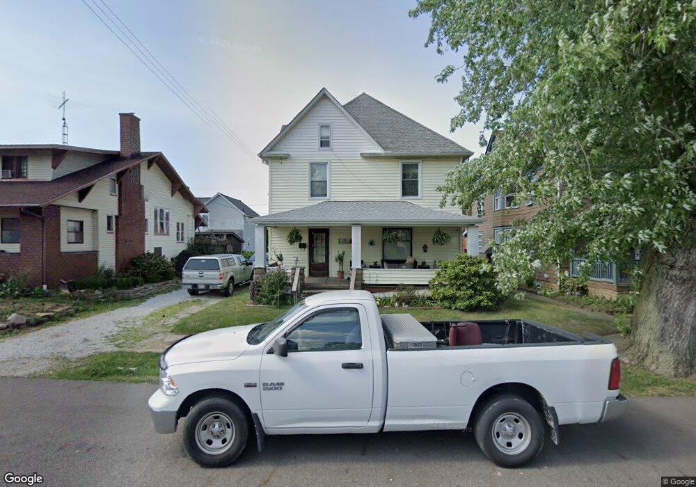
40 E High St Alliance, OH 44601
Estimated Value: $73,000 - $102,000
4
Beds
1
Bath
1,792
Sq Ft
$51/Sq Ft
Est. Value
About This Home
This home is located at 40 E High St, Alliance, OH 44601 and is currently estimated at $91,417, approximately $51 per square foot. 40 E High St is a home located in Stark County with nearby schools including Alliance Intermediate School at Northside, Alliance Elementary School at Rockhill, and Alliance Middle School.
Ownership History
Date
Name
Owned For
Owner Type
Purchase Details
Closed on
Feb 4, 2026
Sold by
Sarchione Harry E and Justice Karin I
Bought by
Justice Karin J and Thomas Brittney N
Current Estimated Value
Purchase Details
Closed on
May 16, 2012
Sold by
Rinehart Richard L and Rinehart Samantha A
Bought by
Sarchione Harry E and Justice Karin J
Purchase Details
Closed on
Jan 23, 1990
Purchase Details
Closed on
Sep 14, 1988
Create a Home Valuation Report for This Property
The Home Valuation Report is an in-depth analysis detailing your home's value as well as a comparison with similar homes in the area
Home Values in the Area
Average Home Value in this Area
Purchase History
| Date | Buyer | Sale Price | Title Company |
|---|---|---|---|
| Justice Karin J | $32,000 | None Listed On Document | |
| Sarchione Harry E | $10,000 | None Available | |
| -- | $21,000 | -- | |
| -- | $10,000 | -- |
Source: Public Records
Tax History
| Year | Tax Paid | Tax Assessment Tax Assessment Total Assessment is a certain percentage of the fair market value that is determined by local assessors to be the total taxable value of land and additions on the property. | Land | Improvement |
|---|---|---|---|---|
| 2025 | -- | $22,400 | $3,920 | $18,480 |
| 2024 | -- | $22,400 | $3,920 | $18,480 |
| 2023 | $725 | $17,610 | $2,140 | $15,470 |
| 2022 | $730 | $17,610 | $2,140 | $15,470 |
| 2021 | $732 | $17,610 | $2,140 | $15,470 |
| 2020 | $688 | $15,480 | $1,860 | $13,620 |
| 2019 | $679 | $15,480 | $1,860 | $13,620 |
| 2018 | $682 | $15,480 | $1,860 | $13,620 |
| 2017 | $613 | $13,660 | $1,540 | $12,120 |
| 2016 | $618 | $13,660 | $1,540 | $12,120 |
| 2015 | $624 | $13,660 | $1,540 | $12,120 |
| 2014 | $589 | $12,290 | $1,400 | $10,890 |
| 2013 | $294 | $12,290 | $1,400 | $10,890 |
Source: Public Records
Map
Nearby Homes
- 62 E High St
- 427 S Union Ave
- 0 E Oxford St
- 62 E Market St
- 163 W Market St
- 228 W Oxford St
- 361 E Main St
- 621 S Haines Ave
- 726 S Arch Ave
- 807 S Union Ave
- V/L S Freedom Ave
- 264 W Market St
- 452 E Summit St
- 46 Rosenberry St
- 234 Rosenberry St
- 231 Rosenberry St
- 118 S Mckinley Ave
- 203 Glamorgan St
- 535 S Mckinley Ave
- 226 Milner St
Your Personal Tour Guide
Ask me questions while you tour the home.