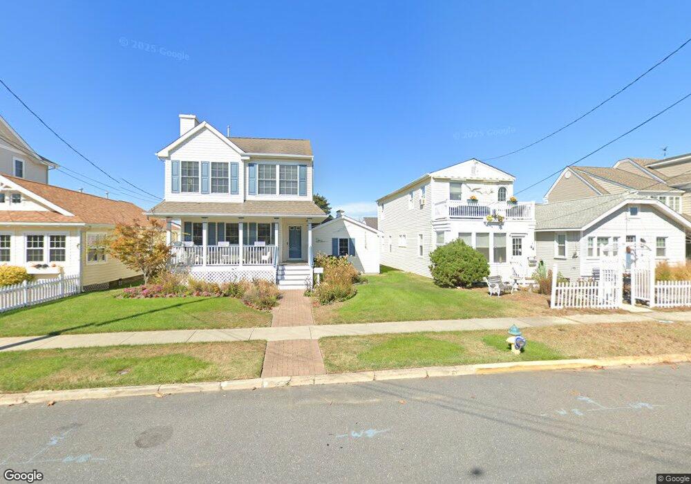
40 E Station Rd Unit 42 Ocean City, NJ 08226
Estimated Value: $1,259,145 - $1,762,000
Studio
--
Bath
1,740
Sq Ft
$827/Sq Ft
Est. Value
About This Home
This home is located at 40 E Station Rd Unit 42, Ocean City, NJ 08226 and is currently estimated at $1,439,036, approximately $827 per square foot. 40 E Station Rd Unit 42 is a home located in Cape May County with nearby schools including Ocean City Primary School, Ocean City Intermediate School, and Ocean City High School.
Ownership History
Date
Name
Owned For
Owner Type
Purchase Details
Closed on
Jan 7, 1999
Sold by
Warren Landi Junior
Bought by
Harris Maron and Visch Marianne
Current Estimated Value
Home Financials for this Owner
Home Financials are based on the most recent Mortgage that was taken out on this home.
Original Mortgage
$207,000
Outstanding Balance
$48,177
Interest Rate
6.8%
Estimated Equity
$1,390,859
Purchase Details
Closed on
Jun 26, 1997
Sold by
Wylie Alberta S
Bought by
Landi Warren
Create a Home Valuation Report for This Property
The Home Valuation Report is an in-depth analysis detailing your home's value as well as a comparison with similar homes in the area
Home Values in the Area
Average Home Value in this Area
Purchase History
| Date | Buyer | Sale Price | Title Company |
|---|---|---|---|
| Harris Maron | $257,000 | -- | |
| Landi Warren | $90,000 | -- |
Source: Public Records
Mortgage History
| Date | Status | Borrower | Loan Amount |
|---|---|---|---|
| Open | Harris Maron | $207,000 |
Source: Public Records
Tax History
| Year | Tax Paid | Tax Assessment Tax Assessment Total Assessment is a certain percentage of the fair market value that is determined by local assessors to be the total taxable value of land and additions on the property. | Land | Improvement |
|---|---|---|---|---|
| 2025 | $6,615 | $589,600 | $338,600 | $251,000 |
| 2024 | $6,615 | $589,600 | $338,600 | $251,000 |
| 2023 | $6,315 | $589,600 | $338,600 | $251,000 |
| 2022 | $6,067 | $589,600 | $338,600 | $251,000 |
| 2021 | $5,925 | $589,600 | $338,600 | $251,000 |
| 2020 | $5,766 | $589,600 | $338,600 | $251,000 |
| 2019 | $5,701 | $589,600 | $338,600 | $251,000 |
| 2018 | $5,648 | $589,600 | $338,600 | $251,000 |
| 2017 | $5,560 | $589,600 | $338,600 | $251,000 |
| 2016 | $5,348 | $589,600 | $338,600 | $251,000 |
| 2015 | $5,277 | $589,600 | $338,600 | $251,000 |
| 2014 | $5,200 | $589,600 | $338,600 | $251,000 |
Source: Public Records
Map
Nearby Homes
- 17 Sindia Rd
- 51 Simpson Rd Unit 2
- 3408 Haven Ave Unit 312
- 24 Haven Ave
- 112 W Atlantic Blvd
- 104 Crescent Rd
- 70 Bay Rd
- 32 Central Ave
- 524 W Surf Rd
- 114 Wesley Rd
- 57 Central Ave
- 230 W Seaspray Rd
- 176-80 Bay Rd
- 504 1st St
- 131 Central Ave Unit 6
- 703-5 North St
- 27 Ocean Rd
- 200 Bay Ave Unit 301
- 200 Bay Ave Unit 116
- 133 Central #2 Ave Unit 2
- 44 E Station Rd
- 46 E Station Rd
- 38 E Station Rd
- 15 Sindia Rd
- 34 E Station Rd
- 56 E Station Rd
- 9 Sindia Rd
- 66 E Station Rd
- 20 E Station Rd
- 33 E Station Rd
- 21 Sindia Rd
- 31 E Station Rd
- 45 E Station Rd
- 29 E Station Rd
- 18 Sindia Rd
- 14 Sindia Rd
- 72 E Station Rd
- 25 E Station Rd
- 51 E Station Rd Unit 2
- 51 E Station Rd Unit 2nd floor
Your Personal Tour Guide
Ask me questions while you tour the home.