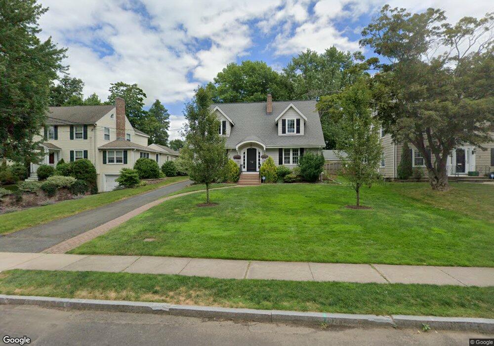
40 Foxcroft Rd West Hartford, CT 06119
Estimated Value: $773,693 - $812,000
3
Beds
4
Baths
2,331
Sq Ft
$337/Sq Ft
Est. Value
About This Home
This home is located at 40 Foxcroft Rd, West Hartford, CT 06119 and is currently estimated at $784,673, approximately $336 per square foot. 40 Foxcroft Rd is a home located in Hartford County with nearby schools including Morley School, King Philip Middle School, and Hall High School.
Ownership History
Date
Name
Owned For
Owner Type
Purchase Details
Closed on
Apr 28, 2000
Sold by
Fromherz Ann Louise
Bought by
Isenberg Gary M and Isenberg Jacquelyn R
Current Estimated Value
Purchase Details
Closed on
May 31, 1994
Sold by
Bornstein Andrea
Bought by
Sherwood Glenn and Sherwood Nancy
Create a Home Valuation Report for This Property
The Home Valuation Report is an in-depth analysis detailing your home's value as well as a comparison with similar homes in the area
Home Values in the Area
Average Home Value in this Area
Purchase History
| Date | Buyer | Sale Price | Title Company |
|---|---|---|---|
| Isenberg Gary M | $257,500 | -- | |
| Sherwood Glenn | $204,900 | -- |
Source: Public Records
Mortgage History
| Date | Status | Borrower | Loan Amount |
|---|---|---|---|
| Open | Sherwood Glenn | $417,000 | |
| Closed | Sherwood Glenn | $30,000 |
Source: Public Records
Tax History Compared to Growth
Tax History
| Year | Tax Paid | Tax Assessment Tax Assessment Total Assessment is a certain percentage of the fair market value that is determined by local assessors to be the total taxable value of land and additions on the property. | Land | Improvement |
|---|---|---|---|---|
| 2025 | $14,940 | $333,620 | $158,760 | $174,860 |
| 2024 | $13,640 | $322,070 | $158,760 | $163,310 |
| 2023 | $13,179 | $322,070 | $158,760 | $163,310 |
| 2022 | $13,102 | $322,070 | $158,760 | $163,310 |
| 2021 | $13,466 | $317,450 | $154,770 | $162,680 |
| 2020 | $13,176 | $315,210 | $153,160 | $162,050 |
| 2019 | $13,176 | $315,210 | $153,160 | $162,050 |
| 2018 | $12,924 | $315,210 | $153,160 | $162,050 |
| 2017 | $12,936 | $315,210 | $153,160 | $162,050 |
| 2016 | $10,620 | $268,800 | $112,210 | $156,590 |
| 2015 | $10,298 | $268,800 | $112,210 | $156,590 |
| 2014 | $10,045 | $268,800 | $112,210 | $156,590 |
Source: Public Records
Map
Nearby Homes
- 237 Fern St Unit 314
- 48 Walkley Rd
- 3 Trumbull Ln
- 16 Lilley Rd
- 105 Ardmore Rd
- 1196 Trout Brook Dr
- 1272 Trout Brook Dr
- 129 Middlebrook Rd
- 1294 Trout Brook Dr
- 1110 Trout Brook Dr
- 260 Oxford St Unit 262
- 54 Robin Rd Unit B2
- 869 Farmington Ave Unit 305
- 120 Whitney St
- 62 Whitney St
- 11 Lawler Rd
- 1006A Trout Brook Dr Unit 1006A
- 28 Whitney St
- 518 Prospect Ave
- 132 N Main St
- 42 Foxcroft Rd
- 34 Foxcroft Rd
- 32 Foxcroft Rd
- 59 Bainbridge Rd
- 61 Bainbridge Rd
- 55 Bainbridge Rd
- 107 Steele Rd
- 111 Steele Rd
- 105 Steele Rd
- 30 Foxcroft Rd
- 115 Steele Rd
- 39 Foxcroft Rd
- 41 Foxcroft Rd
- 35 Foxcroft Rd
- 103 Steele Rd
- 67 Bainbridge Rd
- 33 Foxcroft Rd
- 28 Foxcroft Rd
- 49 Bainbridge Rd
- 97 Steele Rd