
Seller's Agent in 2025
Theresa Lawyer
ELITE Realty Advisors
(781) 267-2551
1 in this area
20 Total Sales
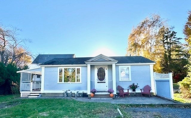

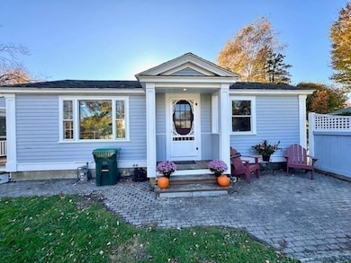

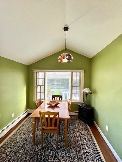
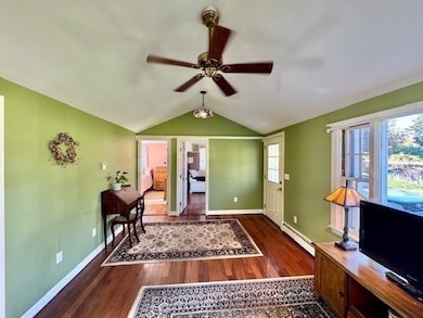
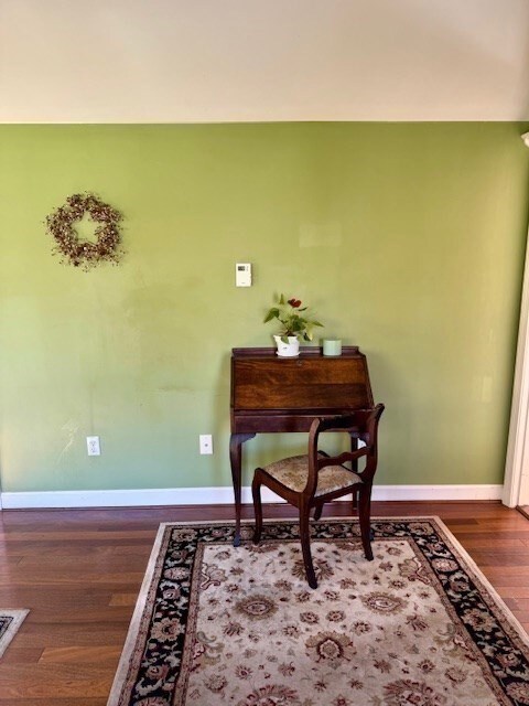
Charming cozy Cottage, in a popular beach town. This home welcomes its new owner's touches while still being move in ready. It is an Ideal home if you want to start your home owner’s journey plus also perfect for down sizing. Live here year round or just enjoy sweet summers here. You will have all the benefits of updated gas heating, new stove, large level open yard with garden beds, herb box, storage sheds and more and all this on Town Sewer(connecting shortly). Bonus room with closet for guests or home office. If you're looking for a location that embraces community, shopping, beaches, great restaurants and more this is the place for you.
| Date | Type | Sale Price | Title Company |
|---|---|---|---|
| Fiduciary Deed | $400,000 | -- | |
| Deed | $43,000 | -- | |
| Deed | $43,000 | -- |
| Date | Status | Loan Amount | Loan Type |
|---|---|---|---|
| Previous Owner | $40,000 | Purchase Money Mortgage |
| Date | Event | Price | List to Sale | Price per Sq Ft |
|---|---|---|---|---|
| 12/01/2025 12/01/25 | Sold | $400,000 | +5.5% | $705 / Sq Ft |
| 10/28/2025 10/28/25 | Pending | -- | -- | -- |
| 10/24/2025 10/24/25 | For Sale | $379,000 | -- | $668 / Sq Ft |
| Year | Tax Paid | Tax Assessment Tax Assessment Total Assessment is a certain percentage of the fair market value that is determined by local assessors to be the total taxable value of land and additions on the property. | Land | Improvement |
|---|---|---|---|---|
| 2025 | $3,744 | $378,200 | $318,800 | $59,400 |
| 2024 | $3,681 | $354,300 | $298,800 | $55,500 |
| 2023 | $3,500 | $314,700 | $268,900 | $45,800 |
| 2022 | $3,500 | $270,300 | $229,100 | $41,200 |
| 2021 | $3,383 | $256,500 | $219,100 | $37,400 |
| 2020 | $2,997 | $224,800 | $189,300 | $35,500 |
| 2019 | $2,982 | $222,900 | $189,300 | $33,600 |
| 2018 | $2,980 | $222,900 | $189,300 | $33,600 |
| 2017 | $2,836 | $206,700 | $179,300 | $27,400 |
| 2016 | $2,730 | $196,700 | $169,300 | $27,400 |
| 2015 | $2,614 | $196,700 | $169,300 | $27,400 |
| 2014 | $2,651 | $199,500 | $169,300 | $30,200 |
Seller's Agent in 2025
Theresa Lawyer
ELITE Realty Advisors
(781) 267-2551
1 in this area
20 Total Sales
Buyer's Agent in 2025
Ita Lynch
ELITE Realty Advisors
(781) 987-1930
1 in this area
41 Total Sales
Source: MLS Property Information Network (MLS PIN)
MLS Number: 73447729
APN: MARS-000010K-000019-000018
Disclaimer: Certain information contained herein is derived from information provided by parties other than Homes.com. All information provided is deemed reliable, but is not guaranteed to be accurate and should be independently verified.
![]() The property listing data and information, or the Images, set forth herein were provided to MLS Property Information Network, Inc. from third party sources, including sellers, lessors and public records, and were compiled by MLS Property Information Network, Inc. The property listing data and information, and the Images, are for the personal, non-commercial use of consumers having a good faith interest in purchasing or leasing listed properties of the type displayed to them and may not be used for any purpose other than to identify prospective properties which such consumers may have a good faith interest in purchasing or leasing. MLS Property Information Network, Inc. and its subscribers disclaim any and all representations and warranties as to the accuracy of the property listing data and information, or as to the accuracy of any of the Images, set forth herein.
The property listing data and information, or the Images, set forth herein were provided to MLS Property Information Network, Inc. from third party sources, including sellers, lessors and public records, and were compiled by MLS Property Information Network, Inc. The property listing data and information, and the Images, are for the personal, non-commercial use of consumers having a good faith interest in purchasing or leasing listed properties of the type displayed to them and may not be used for any purpose other than to identify prospective properties which such consumers may have a good faith interest in purchasing or leasing. MLS Property Information Network, Inc. and its subscribers disclaim any and all representations and warranties as to the accuracy of the property listing data and information, or as to the accuracy of any of the Images, set forth herein.
Ask me questions while you tour the home.