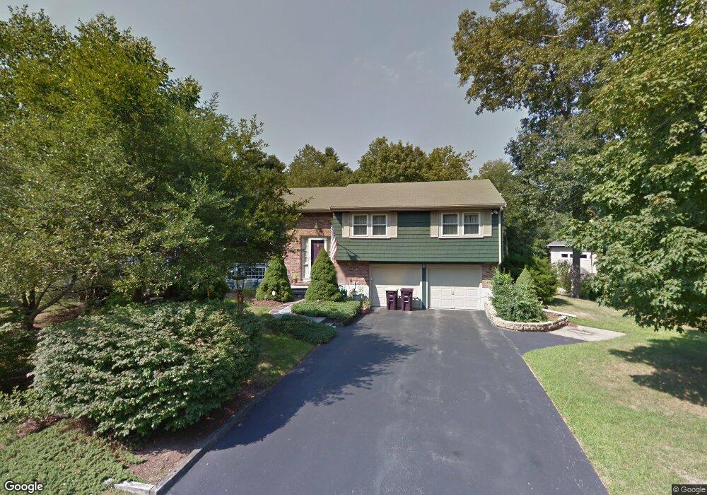
40 Heather Ln South Weymouth, MA 02190
South Weymouth NeighborhoodEstimated Value: $680,654 - $787,000
3
Beds
2
Baths
1,274
Sq Ft
$586/Sq Ft
Est. Value
About This Home
This home is located at 40 Heather Ln, South Weymouth, MA 02190 and is currently estimated at $746,164, approximately $585 per square foot. 40 Heather Ln is a home located in Norfolk County with nearby schools including Thomas V Nash, Abigail Adams Middle School, and Weymouth Middle School Chapman.
Ownership History
Date
Name
Owned For
Owner Type
Purchase Details
Closed on
Dec 13, 1996
Sold by
Ohearn Ex Zoa P
Bought by
Patriquin Stephen G and Patriquin Karen L
Current Estimated Value
Home Financials for this Owner
Home Financials are based on the most recent Mortgage that was taken out on this home.
Original Mortgage
$142,000
Outstanding Balance
$14,499
Interest Rate
7.75%
Mortgage Type
Purchase Money Mortgage
Estimated Equity
$731,665
Create a Home Valuation Report for This Property
The Home Valuation Report is an in-depth analysis detailing your home's value as well as a comparison with similar homes in the area
Home Values in the Area
Average Home Value in this Area
Purchase History
| Date | Buyer | Sale Price | Title Company |
|---|---|---|---|
| Patriquin Stephen G | $177,500 | -- |
Source: Public Records
Mortgage History
| Date | Status | Borrower | Loan Amount |
|---|---|---|---|
| Open | Patriquin Stephen G | $142,000 |
Source: Public Records
Tax History Compared to Growth
Tax History
| Year | Tax Paid | Tax Assessment Tax Assessment Total Assessment is a certain percentage of the fair market value that is determined by local assessors to be the total taxable value of land and additions on the property. | Land | Improvement |
|---|---|---|---|---|
| 2025 | $6,219 | $615,700 | $243,300 | $372,400 |
| 2024 | $5,807 | $565,400 | $231,700 | $333,700 |
| 2023 | $5,939 | $568,300 | $234,000 | $334,300 |
| 2022 | $5,793 | $505,500 | $216,700 | $288,800 |
| 2021 | $5,459 | $465,000 | $216,700 | $248,300 |
| 2020 | $5,307 | $445,200 | $216,700 | $228,500 |
| 2019 | $5,179 | $427,300 | $208,400 | $218,900 |
| 2018 | $4,761 | $380,900 | $198,400 | $182,500 |
| 2017 | $4,722 | $368,600 | $189,000 | $179,600 |
| 2016 | $4,573 | $357,300 | $181,800 | $175,500 |
| 2015 | $4,440 | $344,200 | $181,800 | $162,400 |
| 2014 | $4,313 | $324,300 | $169,100 | $155,200 |
Source: Public Records
Map
Nearby Homes
- 120 Randolph St
- 193 Randolph St
- 211 Randolph St
- 24 Fisher Rd
- 50 Hollis St
- 16 Jay Rd
- 68 Massapoag St Unit 7
- 308 Forest St
- 18 Fountain Ln Unit 2
- 27 Park Ave
- 92 Mercury St
- 354 Tilden Commons Ln
- 2 Mitchell Ln Unit B
- 45 Union St
- 60 Greentree Ln Unit 38
- 55 Greentree Ln Unit 19
- 11 Woodcrest Ct Unit 5
- 10 Woodcrest Ct Unit 4
- 7 Woodcrest Ct Unit 4
- 8 Woodcrest Ct Unit 4
- 28 Heather Ln
- 50 Heather Ln
- 20 Heather Ln
- 58 Heather Ln
- 43 Heather Ln
- 55 Heather Ln
- 35 Heather Ln
- 27 Heather Ln
- 62 Heather Ln
- 19 Heather Ln
- 19 Heather Ln Unit Rear
- 178 King Philip St
- 67 Heather Ln
- 186 King Philip St
- 68 Heather Ln
- 170 King Philip St
- 198 King Philip St
- 73 Heather Ln
- 206 King Philip St
- 162 King Philip St