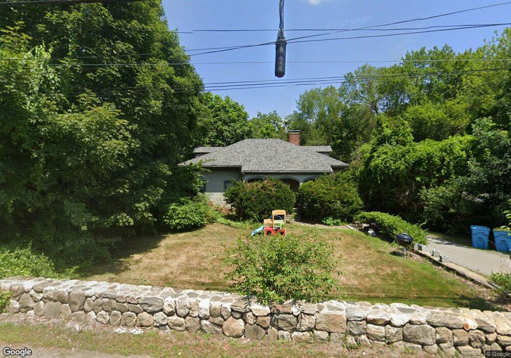
40 Hudson Rd Sudbury, MA 01776
Estimated Value: $664,582 - $753,000
2
Beds
1
Bath
1,151
Sq Ft
$601/Sq Ft
Est. Value
About This Home
This home is located at 40 Hudson Rd, Sudbury, MA 01776 and is currently estimated at $691,896, approximately $601 per square foot. 40 Hudson Rd is a home located in Middlesex County with nearby schools including General John Nixon Elementary School, Ephraim Curtis Middle School, and Lincoln-Sudbury Regional High School.
Ownership History
Date
Name
Owned For
Owner Type
Purchase Details
Closed on
Jul 10, 2001
Sold by
Mader Burt Bryant and Mader Gloria
Bought by
Hudson Rd T
Current Estimated Value
Home Financials for this Owner
Home Financials are based on the most recent Mortgage that was taken out on this home.
Original Mortgage
$90,000
Outstanding Balance
$35,133
Interest Rate
7.16%
Estimated Equity
$656,763
Create a Home Valuation Report for This Property
The Home Valuation Report is an in-depth analysis detailing your home's value as well as a comparison with similar homes in the area
Home Values in the Area
Average Home Value in this Area
Purchase History
| Date | Buyer | Sale Price | Title Company |
|---|---|---|---|
| Hudson Rd T | $308,250 | -- |
Source: Public Records
Mortgage History
| Date | Status | Borrower | Loan Amount |
|---|---|---|---|
| Open | Hudson Rd T | $90,000 |
Source: Public Records
Tax History Compared to Growth
Tax History
| Year | Tax Paid | Tax Assessment Tax Assessment Total Assessment is a certain percentage of the fair market value that is determined by local assessors to be the total taxable value of land and additions on the property. | Land | Improvement |
|---|---|---|---|---|
| 2025 | $8,961 | $612,100 | $346,900 | $265,200 |
| 2024 | $8,640 | $591,400 | $336,700 | $254,700 |
| 2023 | $8,181 | $518,800 | $323,600 | $195,200 |
| 2022 | $7,817 | $433,100 | $297,000 | $136,100 |
| 2021 | $8,229 | $437,000 | $297,000 | $140,000 |
| 2020 | $8,063 | $437,000 | $297,000 | $140,000 |
| 2019 | $7,827 | $437,000 | $297,000 | $140,000 |
| 2018 | $7,437 | $414,800 | $287,900 | $126,900 |
| 2017 | $7,144 | $402,700 | $285,000 | $117,700 |
| 2016 | $6,951 | $390,500 | $274,100 | $116,400 |
| 2015 | $6,595 | $374,700 | $260,900 | $113,800 |
| 2014 | $6,570 | $364,400 | $253,300 | $111,100 |
Source: Public Records
Map
Nearby Homes
- 427 Concord Rd
- 270 Old Lancaster Rd
- 24 Goodnow Rd
- 36 Old Forge Ln
- 63 Canterbury Dr
- 89 Bridle Path
- 36 Concord Rd
- 10 Bradley Place
- 94 Goodmans Hill Rd
- 23 Massasoit Ave
- 12 Camperdown Ln
- 25 Bridle Path
- 4 Elderberry Cir
- 14 Tanbark Rd
- 47 Fairbank Rd
- 7 Saddle Ridge Rd
- 55 Widow Rites Ln
- 45 Widow Rites Ln
- 1011 Boston Post Rd
- 54 Phillips Rd
- 40 Hudson Rd
- 2 the Meadows Lt 1b-2
- 43 Lot 43 Michael
- Lot 5 Arboretum Way
- Lot 2 Arboretum Way (18)
- Lot 2 Nolan Cir
- L 6 Arboretum Way
- 46 Hudson Rd
- 30 Hudson Rd
- 623 Peakham Rd
- 51 Hudson Rd
- 58 Hudson Rd
- 24 Hudson Rd
- 29 Hudson Rd Unit Bld 2 & 3
- 29 Hudson Rd Unit RESTAUR
- 29 Hudson Rd Unit 1
- 29 Hudson Rd Unit FRONT BD
- 29 Hudson Rd Unit Building 2
- 29 Hudson Rd Unit LL- Bld2
- 29 Hudson Rd Unit Building 1