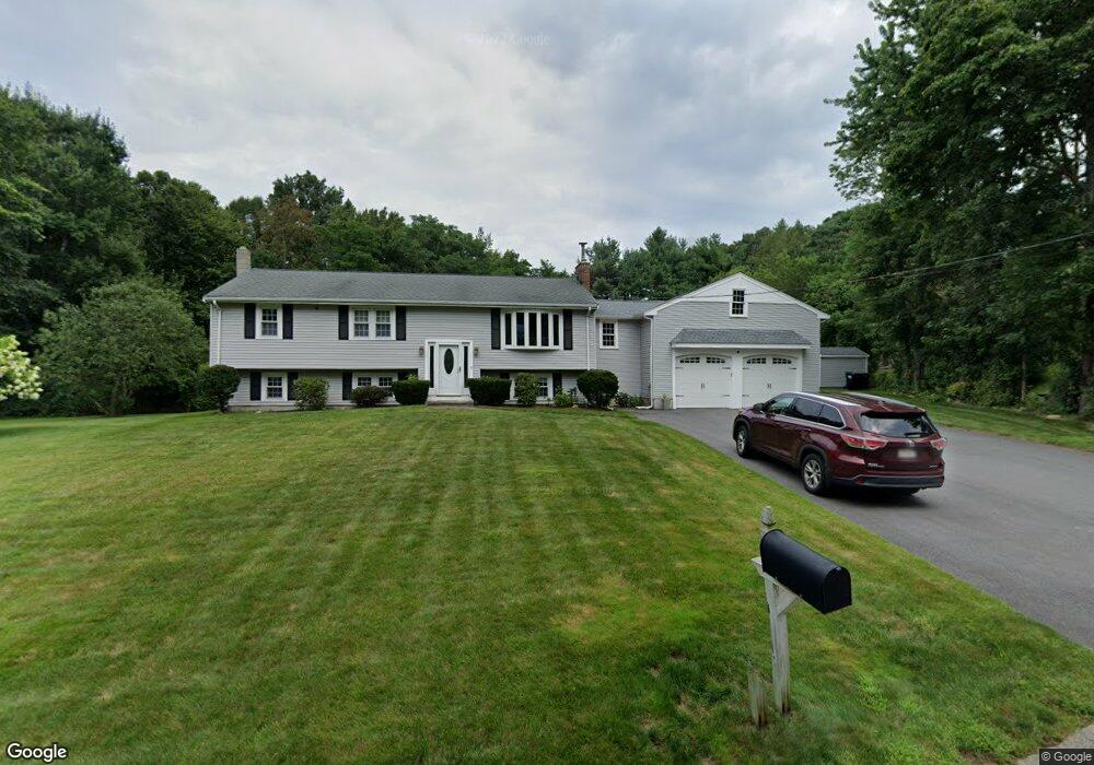
40 Indian Trail Hanson, MA 02341
Estimated Value: $642,000 - $725,000
3
Beds
3
Baths
1,270
Sq Ft
$531/Sq Ft
Est. Value
About This Home
This home is located at 40 Indian Trail, Hanson, MA 02341 and is currently estimated at $673,844, approximately $530 per square foot. 40 Indian Trail is a home located in Plymouth County.
Ownership History
Date
Name
Owned For
Owner Type
Purchase Details
Closed on
Oct 12, 2011
Sold by
Rochon Ray J and Rochon Kim M
Bought by
Rochon Ray J and Rochon Kim M
Current Estimated Value
Home Financials for this Owner
Home Financials are based on the most recent Mortgage that was taken out on this home.
Original Mortgage
$231,000
Outstanding Balance
$22,041
Interest Rate
4.25%
Mortgage Type
Purchase Money Mortgage
Estimated Equity
$651,803
Purchase Details
Closed on
Feb 28, 2003
Sold by
Welch Robert E and Welch Janet M
Bought by
Muir Kim M and Rachon Ray J
Home Financials for this Owner
Home Financials are based on the most recent Mortgage that was taken out on this home.
Original Mortgage
$242,200
Interest Rate
5.98%
Mortgage Type
Purchase Money Mortgage
Create a Home Valuation Report for This Property
The Home Valuation Report is an in-depth analysis detailing your home's value as well as a comparison with similar homes in the area
Home Values in the Area
Average Home Value in this Area
Purchase History
| Date | Buyer | Sale Price | Title Company |
|---|---|---|---|
| Rochon Ray J | -- | -- | |
| Muir Kim M | $337,200 | -- |
Source: Public Records
Mortgage History
| Date | Status | Borrower | Loan Amount |
|---|---|---|---|
| Open | Rochon Ray J | $231,000 | |
| Previous Owner | Muir Kim M | $241,600 | |
| Previous Owner | Muir Kim M | $15,000 | |
| Previous Owner | Muir Kim M | $242,000 | |
| Previous Owner | Muir Kim M | $242,200 |
Source: Public Records
Tax History Compared to Growth
Tax History
| Year | Tax Paid | Tax Assessment Tax Assessment Total Assessment is a certain percentage of the fair market value that is determined by local assessors to be the total taxable value of land and additions on the property. | Land | Improvement |
|---|---|---|---|---|
| 2025 | $7,778 | $581,300 | $181,000 | $400,300 |
| 2024 | $7,620 | $569,500 | $175,800 | $393,700 |
| 2023 | $7,375 | $520,100 | $175,800 | $344,300 |
| 2022 | $7,198 | $477,000 | $159,800 | $317,200 |
| 2021 | $6,487 | $429,600 | $153,700 | $275,900 |
| 2020 | $6,395 | $418,800 | $148,500 | $270,300 |
| 2019 | $6,071 | $390,900 | $145,600 | $245,300 |
| 2018 | $5,957 | $376,300 | $140,000 | $236,300 |
| 2017 | $4,847 | $303,300 | $133,300 | $170,000 |
| 2016 | $4,899 | $296,000 | $133,300 | $162,700 |
| 2015 | $4,653 | $292,300 | $133,300 | $159,000 |
Source: Public Records
Map
Nearby Homes
- Lot 6 Way
- Lot 2 Harvard Rd
- 109 Richard Rd
- 52 Richard Rd
- 29 Bayberry Rd
- 438 Maquan St
- 145 Gorwin Dr
- 161 Winter St Unit 24
- 125 Independence Ave
- 269 Lakeside Rd
- 166 Pine Grove Ave
- 479 Main St
- 42 Taylor Point Rd
- 456 Gorwin Dr
- 26 Stonebridge Dr
- 38 Stonebridge Dr Unit 38
- 20 Carol Ave
- 1054 Main St
- 80 Phillips St
- 72 Phillips St
- 26 Indian Trail
- 56 Indian Path
- 43 Indian Trail
- 48 Indian Path
- 607 Indian Head St
- 57 Indian Trail
- 585 Indian Head St
- 24 Indian Path
- 67 Indian Trail
- 617 Indian Head St
- 571 Indian Head St
- 31 Indian Path
- 631 Indian Head St
- 102 Indian Trail
- 62 Indian Path
- 116 Indian Trail
- 594 Indian Head St
- 41 Ransom Rd
- 41 Ransom Rd
- 61 Ransom Rd