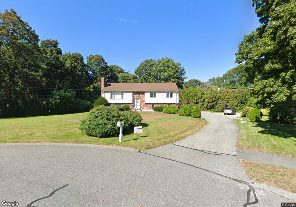
40 Ingleside Rd Lexington, MA 02420
Pheasant Brook Estates NeighborhoodEstimated Value: $1,703,000 - $1,940,000
5
Beds
4
Baths
2,441
Sq Ft
$736/Sq Ft
Est. Value
About This Home
This home is located at 40 Ingleside Rd, Lexington, MA 02420 and is currently estimated at $1,797,142, approximately $736 per square foot. 40 Ingleside Rd is a home located in Middlesex County with nearby schools including Harrington Elementary School, Jonas Clarke Middle School, and Lexington High School.
Ownership History
Date
Name
Owned For
Owner Type
Purchase Details
Closed on
Jul 17, 2012
Sold by
Simon Joseph and Simon Soosamma
Bought by
Simon Lt
Current Estimated Value
Purchase Details
Closed on
Dec 18, 1986
Bought by
Simon Joseph and Simon Soosamma
Create a Home Valuation Report for This Property
The Home Valuation Report is an in-depth analysis detailing your home's value as well as a comparison with similar homes in the area
Home Values in the Area
Average Home Value in this Area
Purchase History
| Date | Buyer | Sale Price | Title Company |
|---|---|---|---|
| Simon Lt | -- | -- | |
| Simon Joseph | -- | -- |
Source: Public Records
Mortgage History
| Date | Status | Borrower | Loan Amount |
|---|---|---|---|
| Previous Owner | Simon Joseph | $342,000 |
Source: Public Records
Tax History Compared to Growth
Tax History
| Year | Tax Paid | Tax Assessment Tax Assessment Total Assessment is a certain percentage of the fair market value that is determined by local assessors to be the total taxable value of land and additions on the property. | Land | Improvement |
|---|---|---|---|---|
| 2025 | $18,357 | $1,501,000 | $801,000 | $700,000 |
| 2024 | $17,640 | $1,440,000 | $763,000 | $677,000 |
| 2023 | $16,783 | $1,291,000 | $694,000 | $597,000 |
| 2022 | $15,718 | $1,139,000 | $631,000 | $508,000 |
| 2021 | $16,146 | $1,122,000 | $601,000 | $521,000 |
| 2020 | $15,371 | $1,094,000 | $601,000 | $493,000 |
| 2019 | $14,473 | $1,025,000 | $572,000 | $453,000 |
| 2018 | $14,171 | $991,000 | $545,000 | $446,000 |
| 2017 | $14,200 | $980,000 | $519,000 | $461,000 |
| 2016 | $14,016 | $960,000 | $495,000 | $465,000 |
| 2015 | $12,794 | $861,000 | $450,000 | $411,000 |
| 2014 | $10,190 | $657,000 | $409,000 | $248,000 |
Source: Public Records
Map
Nearby Homes
- 5 Carnegie Place
- 25 Maple St
- 197 Woburn St
- 20 Marrett Rd
- 22 Bryant Rd
- 10 Eliot Rd
- 35 Tower Rd
- 36 Independence Ave
- 1 Tricorne Rd
- 1437 Massachusetts Ave
- 218 Lowell St
- 71 Webb St
- 8 Blueberry Ln
- 475 Massachusetts Ave Unit B
- 15 Peachtree Rd
- 7 Whipple Rd
- 22 Tyler Rd
- 42 Winthrop Rd
- 500 Lexington St Unit 6
- 30 Whipple Rd
- 42 Ingleside Rd
- 38 Ingleside Rd
- 39 Ingleside Rd
- 34 Ingleside Rd
- 9 Carnegie Place
- 4 Solomon Pierce Rd
- 9 Solomon Pierce Rd
- 32 Ingleside Rd
- 11 Solomon Pierce Rd
- 7 Solomon Pierce Rd
- 35 Ingleside Rd
- 7 Carnegie Place
- 5 Solomon Pierce Rd
- 15 Solomon Pierce Rd
- 4 Clyde Place
- 16 Solomon Pierce Rd
- 2 Solomon Pierce Rd
- 17 Solomon Pierce Rd
- 3 Solomon Pierce Rd
- 30 Ingleside Rd