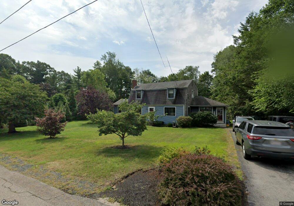
40 Katy Did Ln Hanson, MA 02341
Estimated Value: $712,949 - $864,000
3
Beds
2
Baths
2,336
Sq Ft
$338/Sq Ft
Est. Value
About This Home
This home is located at 40 Katy Did Ln, Hanson, MA 02341 and is currently estimated at $789,237, approximately $337 per square foot. 40 Katy Did Ln is a home located in Plymouth County.
Ownership History
Date
Name
Owned For
Owner Type
Purchase Details
Closed on
Apr 8, 2021
Sold by
Soule Steven G and Soule Dianne M
Bought by
Soule Steven G and Soule Dianne M
Current Estimated Value
Purchase Details
Closed on
Aug 20, 2004
Sold by
Ayre Robert B and Ayre Carol
Bought by
Soule Steven G and Soule Dianne M
Home Financials for this Owner
Home Financials are based on the most recent Mortgage that was taken out on this home.
Original Mortgage
$33,000
Interest Rate
6.03%
Mortgage Type
Purchase Money Mortgage
Create a Home Valuation Report for This Property
The Home Valuation Report is an in-depth analysis detailing your home's value as well as a comparison with similar homes in the area
Home Values in the Area
Average Home Value in this Area
Purchase History
| Date | Buyer | Sale Price | Title Company |
|---|---|---|---|
| Soule Steven G | -- | None Available | |
| Soule Steven G | $440,000 | -- |
Source: Public Records
Mortgage History
| Date | Status | Borrower | Loan Amount |
|---|---|---|---|
| Previous Owner | Soule Steven G | $307,000 | |
| Previous Owner | Soule Steven G | $312,000 | |
| Previous Owner | Soule Steven G | $33,000 |
Source: Public Records
Tax History Compared to Growth
Tax History
| Year | Tax Paid | Tax Assessment Tax Assessment Total Assessment is a certain percentage of the fair market value that is determined by local assessors to be the total taxable value of land and additions on the property. | Land | Improvement |
|---|---|---|---|---|
| 2025 | $7,608 | $568,600 | $190,900 | $377,700 |
| 2024 | $7,459 | $557,500 | $185,400 | $372,100 |
| 2023 | $7,223 | $509,400 | $185,400 | $324,000 |
| 2022 | $7,052 | $467,300 | $168,500 | $298,800 |
| 2021 | $6,331 | $419,300 | $162,000 | $257,300 |
| 2020 | $6,155 | $403,100 | $156,500 | $246,600 |
| 2019 | $5,870 | $378,000 | $153,500 | $224,500 |
| 2018 | $5,803 | $366,600 | $147,600 | $219,000 |
| 2017 | $5,630 | $352,300 | $140,600 | $211,700 |
| 2016 | $5,680 | $343,200 | $140,600 | $202,600 |
| 2015 | $5,386 | $338,300 | $140,600 | $197,700 |
Source: Public Records
Map
Nearby Homes
- 438 Maquan St
- 479 Main St
- 20 Carol Ave
- 109 Richard Rd
- Lot 6 Way
- Lot 2 Harvard Rd
- 52 Richard Rd
- 166 Pine Grove Ave
- 29 Bayberry Rd
- 42 Taylor Point Rd
- 145 Gorwin Dr
- 269 Lakeside Rd
- 36 Meadow Ln
- 1054 Main St
- 161 Winter St Unit 24
- 125 Independence Ave
- 267 Reed St
- 76 Union St
- 72 Phillips St
- 111 Plymouth St
- 26 Katy Did Ln
- 53 Katy Did Ln
- 35 Katy Did Ln
- 426 Indian Head St
- 410 Indian Head St
- 19 Katy Did Ln
- 72 Katy Did Ln
- 71 Katy Did Ln
- 384 Indian Head St
- 448 Indian Head St
- 409 Indian Head St
- 472B Indian Head St
- 472 Indian Head St
- 364 Indian Head St
- 80 Katy Did Ln
- 387 Indian Head St
- 377 Indian Head St
- 360 Indian Head St
- 457 Indian Head St
- 359 Indian Head St