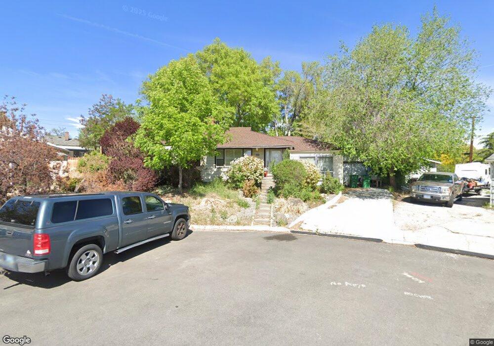
40 Keegan Cir Reno, NV 89503
West University NeighborhoodEstimated Value: $355,000 - $544,000
3
Beds
1
Bath
1,135
Sq Ft
$414/Sq Ft
Est. Value
About This Home
This home is located at 40 Keegan Cir, Reno, NV 89503 and is currently estimated at $469,399, approximately $413 per square foot. 40 Keegan Cir is a home located in Washoe County with nearby schools including Peavine Elementary School, Archie Clayton Pre-AP Academy, and Reno High School.
Ownership History
Date
Name
Owned For
Owner Type
Purchase Details
Closed on
Nov 8, 2006
Sold by
Pearce Edward W
Bought by
Pearce Edward W and Fairbanks Mary Z
Current Estimated Value
Home Financials for this Owner
Home Financials are based on the most recent Mortgage that was taken out on this home.
Original Mortgage
$120,000
Outstanding Balance
$11,839
Interest Rate
6.28%
Mortgage Type
Unknown
Estimated Equity
$457,560
Purchase Details
Closed on
Apr 1, 1999
Sold by
Pearce Edward W
Bought by
Pearce Edward W
Home Financials for this Owner
Home Financials are based on the most recent Mortgage that was taken out on this home.
Original Mortgage
$70,000
Interest Rate
6.91%
Create a Home Valuation Report for This Property
The Home Valuation Report is an in-depth analysis detailing your home's value as well as a comparison with similar homes in the area
Home Values in the Area
Average Home Value in this Area
Purchase History
| Date | Buyer | Sale Price | Title Company |
|---|---|---|---|
| Pearce Edward W | $91,500 | First American Title | |
| Pearce Edward W | -- | Western Title Company Inc |
Source: Public Records
Mortgage History
| Date | Status | Borrower | Loan Amount |
|---|---|---|---|
| Open | Pearce Edward W | $120,000 | |
| Previous Owner | Pearce Edward W | $70,000 |
Source: Public Records
Tax History Compared to Growth
Tax History
| Year | Tax Paid | Tax Assessment Tax Assessment Total Assessment is a certain percentage of the fair market value that is determined by local assessors to be the total taxable value of land and additions on the property. | Land | Improvement |
|---|---|---|---|---|
| 2025 | $1,356 | $72,560 | $43,622 | $28,938 |
| 2024 | $1,356 | $71,987 | $43,255 | $28,732 |
| 2023 | $1,317 | $68,718 | $42,005 | $26,713 |
| 2022 | $1,280 | $54,570 | $33,075 | $21,495 |
| 2021 | $1,243 | $43,789 | $22,565 | $21,224 |
| 2020 | $1,203 | $46,237 | $22,050 | $24,187 |
| 2019 | $1,170 | $45,173 | $22,050 | $23,123 |
| 2018 | $1,134 | $38,003 | $15,619 | $22,384 |
| 2017 | $1,106 | $35,853 | $13,340 | $22,513 |
| 2016 | $1,076 | $35,634 | $13,230 | $22,404 |
| 2015 | $1,073 | $31,666 | $9,923 | $21,743 |
| 2014 | $1,043 | $29,710 | $8,379 | $21,331 |
| 2013 | -- | $27,363 | $6,174 | $21,189 |
Source: Public Records
Map
Nearby Homes
- 90/100 Arden Cir
- 1217 Keystone Ave
- 1510 Majestic Dr Unit one
- 850 W 11th St
- 1415 Kings Row
- 1600 Majestic Dr
- 840 Brookfield Dr
- 1375 Wesley Dr
- 1670 Majestic Dr
- 895 Stoker Ave
- 1480 Grandview Ave
- 960 Ralston St
- 1855 Prince Way
- 1702 Grandview Ave
- 1130 Bon Rea Way
- 1275 Washington St
- 880 Ruby Ave
- 1801 Carlin St
- 1540 King Edward Dr
- 1785 Stardust St
- 1040 Keystone Ave
- 1061 Whitaker Dr
- 30 Keegan Cir
- 1000 Keystone Ave
- 992 Kimbal Dr
- 988 Kimbal Dr
- 20 Keegan Cir
- 984 Kimbal Dr
- 991 Whitaker Dr
- 978 Kimbal Dr
- 1051 Keystone Ave
- 1025 Keystone Ave
- 1060 Whitaker Dr
- 969 Whitaker Dr
- 1040 Whitaker Dr
- 972 Kimbal Dr
- 960 Keystone Ave
- 1001 Keystone Ave
- 993 Kimbal Dr
- 1020 Whitaker Dr