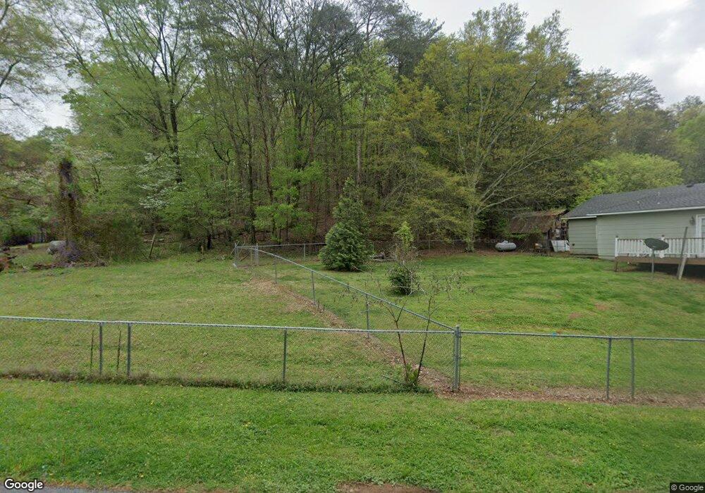
40 Lanham Rd Aragon, GA 30104
Estimated Value: $141,590 - $285,000
2
Beds
2
Baths
1,393
Sq Ft
$149/Sq Ft
Est. Value
About This Home
This home is located at 40 Lanham Rd, Aragon, GA 30104 and is currently estimated at $207,148, approximately $148 per square foot. 40 Lanham Rd is a home located in Polk County with nearby schools including Rockmart Middle School.
Ownership History
Date
Name
Owned For
Owner Type
Purchase Details
Closed on
Mar 4, 2003
Sold by
Citi Financial Mortgage Co
Bought by
York Robert
Current Estimated Value
Purchase Details
Closed on
Oct 17, 2000
Sold by
Head C Michael (Exe Of Remonda Faye Head
Bought by
Head C Michael
Purchase Details
Closed on
Jul 31, 2000
Sold by
Head Ramonda Faye
Bought by
Head C Michael (Exe Of Ramonda Faye Head
Purchase Details
Closed on
May 1, 1990
Sold by
Head Richard B
Bought by
Head Remonda
Purchase Details
Closed on
Dec 26, 1985
Sold by
Dirby Phillip
Bought by
Head Richard B
Purchase Details
Closed on
Jul 16, 1971
Sold by
Kirby Hoyt
Bought by
Kirby Phillip
Purchase Details
Closed on
Aug 1, 1969
Sold by
Lanham T C
Bought by
Kirby Hoyt
Purchase Details
Closed on
Jan 1, 1901
Bought by
Lanham T C
Create a Home Valuation Report for This Property
The Home Valuation Report is an in-depth analysis detailing your home's value as well as a comparison with similar homes in the area
Home Values in the Area
Average Home Value in this Area
Purchase History
| Date | Buyer | Sale Price | Title Company |
|---|---|---|---|
| York Robert | -- | -- | |
| Head C Michael | -- | -- | |
| Head C Michael (Exe Of Ramonda Faye Head | -- | -- | |
| Head Remonda | -- | -- | |
| Head Richard B | -- | -- | |
| Kirby Phillip | -- | -- | |
| Kirby Hoyt | -- | -- | |
| Lanham T C | -- | -- |
Source: Public Records
Tax History Compared to Growth
Tax History
| Year | Tax Paid | Tax Assessment Tax Assessment Total Assessment is a certain percentage of the fair market value that is determined by local assessors to be the total taxable value of land and additions on the property. | Land | Improvement |
|---|---|---|---|---|
| 2024 | $567 | $27,124 | $12,245 | $14,879 |
| 2023 | $552 | $23,270 | $12,245 | $11,025 |
| 2022 | $505 | $21,297 | $8,163 | $13,134 |
| 2021 | $512 | $21,297 | $8,163 | $13,134 |
| 2020 | $513 | $21,297 | $8,163 | $13,134 |
| 2019 | $608 | $22,652 | $16,558 | $6,094 |
| 2018 | $618 | $22,444 | $16,558 | $5,886 |
| 2017 | $611 | $22,444 | $16,558 | $5,886 |
| 2016 | $759 | $27,892 | $22,006 | $5,886 |
| 2015 | $762 | $27,916 | $22,006 | $5,910 |
| 2014 | $768 | $27,916 | $22,006 | $5,910 |
Source: Public Records
Map
Nearby Homes
- 163 Portland Cir
- 54 Taylorsville Rd
- 71 Caseys Ridge Rd
- 11 Jenna Dr
- 1 E 4th St
- 11 Magnolia St
- 135 Oak Hollow Way
- 19 Walnut St
- 18 Elm St
- 2170 Taylorsville Rd
- 58 Elm St
- 66 Elm St
- 19 Williams St
- 0 Rome Hwy 101 Unit 25352772
- 0 Rome Hwy 101 Unit 10445422
- 100 Hixville Rd
- 180 Flint Hill Rd
- 65 Long Station Rd
- 330 Flint Hill Rd
- 8 White River Rd
- 37 Lanham Rd
- 56 Lanham Rd
- 130 Portland Cir
- 51 Lanham Rd
- 15 Lanham Rd
- 168 Portland Cir
- 16 Crumley Rd
- 939 Portland Rd
- 26 Crumley Rd
- 146 Portland Cir
- 912 Portland Rd
- 921 Portland Rd
- 50 Crumley Rd
- 909 Portland Rd
- 1234 Portland Rd
- 88 Portland Cir
- 861 Portland Rd
- 49 Portland Cir
- 33 Portland Cir
- 839 Portland Rd
