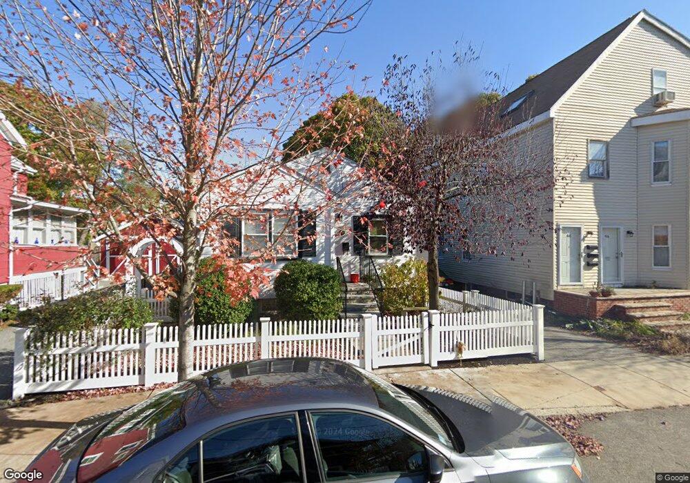
40 Magoun St Unit 42 Cambridge, MA 02140
North Cambridge NeighborhoodEstimated Value: $750,000 - $979,000
2
Beds
2
Baths
792
Sq Ft
$1,125/Sq Ft
Est. Value
About This Home
This home is located at 40 Magoun St Unit 42, Cambridge, MA 02140 and is currently estimated at $890,791, approximately $1,124 per square foot. 40 Magoun St Unit 42 is a home located in Middlesex County with nearby schools including Benjamin Banneker Charter Public School, International School of Boston, and Lesley Ellis School.
Ownership History
Date
Name
Owned For
Owner Type
Purchase Details
Closed on
Dec 17, 1993
Sold by
Jones J Bruce and Miller Louise C
Bought by
Dame Thomas M and Healey-Dane Geraldine
Current Estimated Value
Home Financials for this Owner
Home Financials are based on the most recent Mortgage that was taken out on this home.
Original Mortgage
$142,650
Interest Rate
7.03%
Mortgage Type
Purchase Money Mortgage
Purchase Details
Closed on
Sep 19, 1988
Sold by
Fisher Edward E
Bought by
Jones J Bruce
Create a Home Valuation Report for This Property
The Home Valuation Report is an in-depth analysis detailing your home's value as well as a comparison with similar homes in the area
Home Values in the Area
Average Home Value in this Area
Purchase History
| Date | Buyer | Sale Price | Title Company |
|---|---|---|---|
| Dame Thomas M | $158,500 | -- | |
| Dame Thomas M | $158,500 | -- | |
| Jones J Bruce | $152,000 | -- |
Source: Public Records
Mortgage History
| Date | Status | Borrower | Loan Amount |
|---|---|---|---|
| Open | Jones J Bruce | $168,500 | |
| Closed | Jones J Bruce | $24,000 | |
| Closed | Jones J Bruce | $184,000 | |
| Closed | Jones J Bruce | $142,650 |
Source: Public Records
Tax History Compared to Growth
Tax History
| Year | Tax Paid | Tax Assessment Tax Assessment Total Assessment is a certain percentage of the fair market value that is determined by local assessors to be the total taxable value of land and additions on the property. | Land | Improvement |
|---|---|---|---|---|
| 2025 | $4,820 | $759,000 | $489,200 | $269,800 |
| 2024 | $4,534 | $765,800 | $509,600 | $256,200 |
| 2023 | $4,380 | $747,400 | $519,800 | $227,600 |
| 2022 | $4,210 | $711,100 | $509,600 | $201,500 |
| 2021 | $4,087 | $698,600 | $511,300 | $187,300 |
| 2020 | $4,024 | $699,900 | $522,300 | $177,600 |
| 2019 | $3,744 | $630,300 | $466,200 | $164,100 |
| 2018 | $1,309 | $544,000 | $392,600 | $151,400 |
| 2017 | $3,324 | $512,100 | $368,100 | $144,000 |
| 2016 | $3,196 | $457,200 | $319,000 | $138,200 |
| 2015 | $3,158 | $403,900 | $280,400 | $123,500 |
| 2014 | $3,078 | $367,300 | $245,400 | $121,900 |
Source: Public Records
Map
Nearby Homes
- 23 Brookford St
- 23 Brookford St Unit 2
- 23 Brookford St Unit 1
- 19 Cottage Park Ave
- 127 Harvey St
- 127 Harvey St Unit 127
- 97 Elmwood St Unit 313
- 97 Elmwood St Unit 110
- 97 Elmwood St Unit 310
- 69 Harvey St Unit 1
- 3 Seagrave Rd
- 112 Jackson St
- 24 Washburn Ave Unit 1
- 124 Jackson St
- 39 Seven Pines Ave
- 22 Harrington Rd
- 49 Clifton St
- 69 Clarendon Ave Unit A
- 32 Cameron Ave
- 67-69 Cameron Ave
- 46 Magoun St
- 36 Magoun St
- 48 Magoun St
- 50 Magoun St
- 32 Magoun St
- 32 Magoun St Unit 2
- 32 Magoun St Unit U:1
- 52 Magoun St
- 27 Brookford St
- 30 Magoun St
- 43 Magoun St Unit 1
- 43 Magoun St
- 15 Brookford St
- 19 Brookford St Unit room A
- 19 Brookford St Unit 1
- 19 Brookford St
- 19 Brookford St
- 19 Brookford St Unit 2
- 37 Magoun St
- 37 Magoun St Unit 37 Magoun