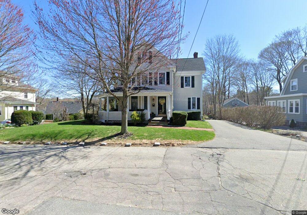
40 Maple St Milton, MA 02186
Columbine Cliffs NeighborhoodEstimated Value: $979,000 - $2,002,000
4
Beds
3
Baths
2,840
Sq Ft
$478/Sq Ft
Est. Value
About This Home
This home is located at 40 Maple St, Milton, MA 02186 and is currently estimated at $1,358,059, approximately $478 per square foot. 40 Maple St is a home located in Norfolk County with nearby schools including Milton High School, Conservatory Lab Upper School, and Saint John Paul II Catholic Academy.
Ownership History
Date
Name
Owned For
Owner Type
Purchase Details
Closed on
Apr 25, 2017
Sold by
Vrettas William A and Vrettas Jennifer D
Bought by
40 Maple Street Rt
Current Estimated Value
Purchase Details
Closed on
Jun 5, 1998
Sold by
Mckay Robert J and Mckay Clara N
Bought by
Dean Jennifer E
Home Financials for this Owner
Home Financials are based on the most recent Mortgage that was taken out on this home.
Original Mortgage
$194,750
Interest Rate
7.05%
Mortgage Type
Purchase Money Mortgage
Create a Home Valuation Report for This Property
The Home Valuation Report is an in-depth analysis detailing your home's value as well as a comparison with similar homes in the area
Home Values in the Area
Average Home Value in this Area
Purchase History
| Date | Buyer | Sale Price | Title Company |
|---|---|---|---|
| 40 Maple Street Rt | -- | None Available | |
| Dean Jennifer E | $205,000 | -- |
Source: Public Records
Mortgage History
| Date | Status | Borrower | Loan Amount |
|---|---|---|---|
| Previous Owner | Dean Jennifer E | $100,000 | |
| Previous Owner | Dean Jennifer E | $194,750 |
Source: Public Records
Tax History
| Year | Tax Paid | Tax Assessment Tax Assessment Total Assessment is a certain percentage of the fair market value that is determined by local assessors to be the total taxable value of land and additions on the property. | Land | Improvement |
|---|---|---|---|---|
| 2025 | $10,964 | $988,600 | $513,800 | $474,800 |
| 2024 | $10,673 | $977,400 | $489,300 | $488,100 |
| 2023 | $10,621 | $931,700 | $466,100 | $465,600 |
| 2022 | $10,328 | $828,200 | $466,100 | $362,100 |
| 2021 | $9,929 | $756,200 | $411,300 | $344,900 |
| 2020 | $9,954 | $758,700 | $403,500 | $355,200 |
| 2019 | $9,664 | $733,200 | $391,800 | $341,400 |
| 2018 | $8,848 | $640,700 | $306,800 | $333,900 |
| 2017 | $8,289 | $611,300 | $292,200 | $319,100 |
| 2016 | $8,713 | $645,400 | $334,000 | $311,400 |
| 2015 | $7,204 | $516,800 | $243,500 | $273,300 |
Source: Public Records
Map
Nearby Homes
- 32-32R Temple St
- 72 Columbine Rd
- 67 Idaho St
- 1241-1255 Adams St Unit F213
- 1241-1255 Adams St Unit B302
- 1245 Adams St Unit B503
- 259 Central Ave
- 44 Allen Cir
- 88 Wharf St Unit 105
- 14 Avondale St
- 260 Canton Ave
- 23 Maryknoll St
- 30 Pleasant Hill Ave Unit 32
- 424 Brook Rd
- 14 Valley Rd
- 988 Morton St
- 85 Forbes Rd
- 214 Brook Rd
- 8 Faunce Rd Unit A
- 8 Violet St
- 46 Maple St
- 34 Maple St
- 89 Central Ave
- 79 Central Ave Unit 81
- 97 Central Ave
- 28 Maple St
- 28 Maple St Unit 1
- 28 Maple St Unit 28
- 37 Maple St Unit 37
- 50 Maple St
- 33 Maple St
- 47 Maple St
- 47 Maple St Unit 1
- 47 Maple St Unit 2
- 35 Maple St Unit 37
- 41 Maple St Unit 43
- 99 Central Ave
- 49 Maple St
- 101 Central Ave
- 56 Maple St
Your Personal Tour Guide
Ask me questions while you tour the home.