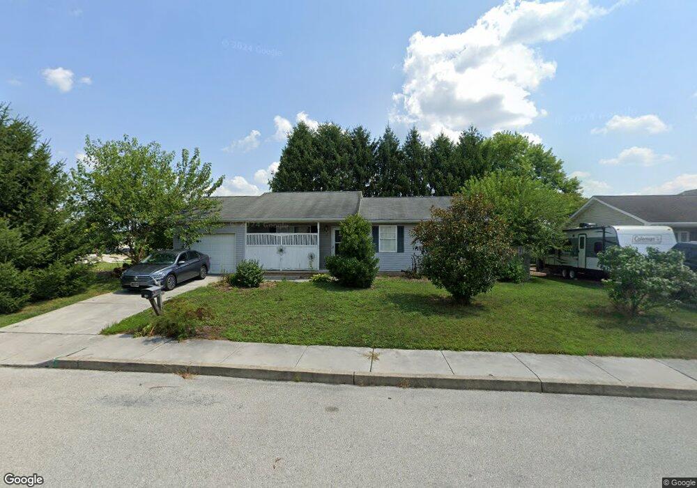
40 Mason Dixon Dr Unit 73 Littlestown, PA 17340
Estimated Value: $268,000 - $294,000
3
Beds
2
Baths
960
Sq Ft
$291/Sq Ft
Est. Value
About This Home
This home is located at 40 Mason Dixon Dr Unit 73, Littlestown, PA 17340 and is currently estimated at $279,772, approximately $291 per square foot. 40 Mason Dixon Dr Unit 73 is a home located in Adams County with nearby schools including Rolling Acres El School, Maple Avenue Middle School, and Littlestown Senior High School.
Ownership History
Date
Name
Owned For
Owner Type
Purchase Details
Closed on
Apr 18, 2013
Sold by
Stair Roger L and Greer Stacy L
Bought by
Greer Stacey L
Current Estimated Value
Home Financials for this Owner
Home Financials are based on the most recent Mortgage that was taken out on this home.
Original Mortgage
$124,000
Outstanding Balance
$88,198
Interest Rate
3.64%
Mortgage Type
New Conventional
Estimated Equity
$191,574
Purchase Details
Closed on
Aug 19, 2008
Sold by
Stair Roger L and Stair Bonnie L
Bought by
Stair Roger L and Greer Stacy I
Create a Home Valuation Report for This Property
The Home Valuation Report is an in-depth analysis detailing your home's value as well as a comparison with similar homes in the area
Home Values in the Area
Average Home Value in this Area
Purchase History
| Date | Buyer | Sale Price | Title Company |
|---|---|---|---|
| Greer Stacey L | $168,100 | None Available | |
| Stair Roger L | -- | -- |
Source: Public Records
Mortgage History
| Date | Status | Borrower | Loan Amount |
|---|---|---|---|
| Open | Greer Stacey L | $124,000 |
Source: Public Records
Tax History Compared to Growth
Tax History
| Year | Tax Paid | Tax Assessment Tax Assessment Total Assessment is a certain percentage of the fair market value that is determined by local assessors to be the total taxable value of land and additions on the property. | Land | Improvement |
|---|---|---|---|---|
| 2025 | $3,864 | $168,100 | $39,300 | $128,800 |
| 2024 | $3,724 | $168,100 | $39,300 | $128,800 |
| 2023 | $3,580 | $168,100 | $39,300 | $128,800 |
| 2022 | $3,558 | $168,100 | $39,300 | $128,800 |
| 2021 | $3,453 | $168,100 | $39,300 | $128,800 |
| 2020 | $3,411 | $168,100 | $39,300 | $128,800 |
| 2019 | $3,309 | $168,100 | $39,300 | $128,800 |
| 2018 | $3,249 | $168,100 | $39,300 | $128,800 |
| 2017 | $3,165 | $168,100 | $39,300 | $128,800 |
| 2016 | -- | $168,100 | $39,300 | $128,800 |
| 2015 | -- | $168,100 | $39,300 | $128,800 |
| 2014 | -- | $168,100 | $39,300 | $128,800 |
Source: Public Records
Map
Nearby Homes
- 15 Yorktowne Ct Unit 97
- 117 Charles St
- 115 Charles St
- 129 W King St
- 61 E King St
- 22 Rita Marie Ave
- 211 E King St
- 52 Stayman Way Unit 81
- 140 Apple Grove Ln Unit 425
- 135 Apple Grove Ln Unit 438
- 535 Lumber St
- 559 Lumber St
- 449 Glenwyn Dr
- 440 N Queen St
- 567 Lumber St
- 1024 Frederick Pike Unit 6
- 161 Stoners Cir
- 41 Smith Cir
- 162 Newark St
- 5 Manor Cir Unit 103
- 52 Mason Dixon Dr Unit 74
- 37 Mason Dixon Dr Unit 81
- 41 Mason Dixon Dr Unit 80
- 58 Mason Dixon Dr Unit 75
- 10 Gettysburg Ct Unit 59
- 31 Mason Dixon Dr Unit 82
- 51 Mason Dixon Dr Unit 79
- 23 Gettysburg Ct Unit 70
- 25 Mason Dixon Dr Unit 83
- 59 Mason Dixon Dr Unit 78
- 64 Mason Dixon Dr Unit 76
- 20 Mason Dixon Dr Unit 58
- 65 Mason Dixon Dr Unit 77
- 17 Mason Dixon Dr Unit 84
- 29 Gettysburg Ct Unit 69
- 40 Gettysburg Ct Unit 61
- 216 Boyer St Unit 88
- 33 Gettysburg Ct Unit 68
- 417 S Columbus Ave Unit 85
- 222 Boyer St Unit 91