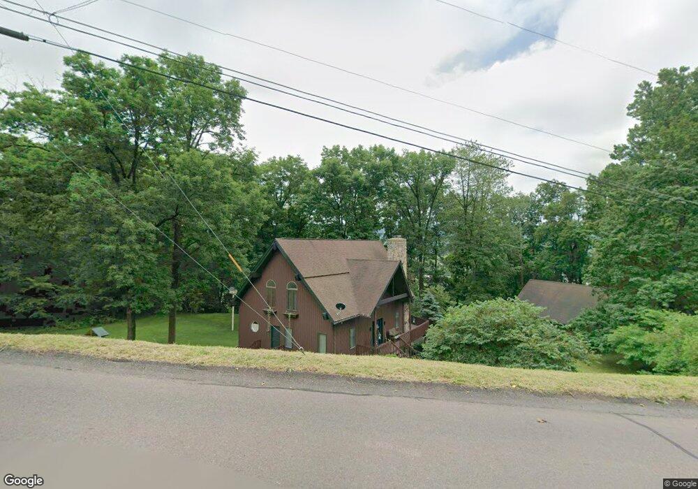
40 Michael Dr Bloomsburg, PA 17815
Estimated Value: $235,389 - $334,000
--
Bed
--
Bath
1,440
Sq Ft
$202/Sq Ft
Est. Value
About This Home
This home is located at 40 Michael Dr, Bloomsburg, PA 17815 and is currently estimated at $291,097, approximately $202 per square foot. 40 Michael Dr is a home located in Columbia County with nearby schools including Memorial Elementary School, Bloomsburg Area Middle School, and Bloomsburg Area High School.
Ownership History
Date
Name
Owned For
Owner Type
Purchase Details
Closed on
Dec 6, 2011
Sold by
Samson Yvette J and Bohling Peter H
Bought by
Plotts John L and Plotts Jamie L
Current Estimated Value
Home Financials for this Owner
Home Financials are based on the most recent Mortgage that was taken out on this home.
Original Mortgage
$220,000
Outstanding Balance
$88,389
Interest Rate
4.01%
Mortgage Type
New Conventional
Estimated Equity
$202,708
Purchase Details
Closed on
Jun 17, 2010
Sold by
Samson Yvette J and Bohling Peter H
Bought by
Samson Yvette J
Home Financials for this Owner
Home Financials are based on the most recent Mortgage that was taken out on this home.
Original Mortgage
$204,800
Interest Rate
4.78%
Mortgage Type
New Conventional
Purchase Details
Closed on
Sep 10, 2008
Sold by
Thompson Gregory C and Michelle A Thompson A
Bought by
Samson Yvette J and Bohling Peter H
Home Financials for this Owner
Home Financials are based on the most recent Mortgage that was taken out on this home.
Original Mortgage
$214,800
Interest Rate
6.09%
Mortgage Type
New Conventional
Create a Home Valuation Report for This Property
The Home Valuation Report is an in-depth analysis detailing your home's value as well as a comparison with similar homes in the area
Home Values in the Area
Average Home Value in this Area
Purchase History
| Date | Buyer | Sale Price | Title Company |
|---|---|---|---|
| Plotts John L | $275,000 | None Available | |
| Samson Yvette J | $93,137 | None Available | |
| Samson Yvette J | $268,500 | None Available |
Source: Public Records
Mortgage History
| Date | Status | Borrower | Loan Amount |
|---|---|---|---|
| Open | Plotts John L | $220,000 | |
| Previous Owner | Samson Yvette J | $204,800 | |
| Previous Owner | Samson Yvette J | $214,800 |
Source: Public Records
Tax History Compared to Growth
Tax History
| Year | Tax Paid | Tax Assessment Tax Assessment Total Assessment is a certain percentage of the fair market value that is determined by local assessors to be the total taxable value of land and additions on the property. | Land | Improvement |
|---|---|---|---|---|
| 2025 | $4,553 | $50,481 | $0 | $0 |
| 2024 | $4,478 | $50,482 | $12,408 | $38,074 |
| 2023 | $4,150 | $50,482 | $12,408 | $38,074 |
| 2022 | $3,999 | $50,482 | $12,408 | $38,074 |
| 2021 | $3,914 | $50,482 | $12,408 | $38,074 |
| 2020 | $3,753 | $50,482 | $12,408 | $38,074 |
| 2019 | $3,690 | $50,482 | $12,408 | $38,074 |
| 2018 | $3,604 | $50,482 | $12,408 | $38,074 |
| 2017 | $3,420 | $50,482 | $12,408 | $38,074 |
| 2016 | -- | $50,482 | $12,408 | $38,074 |
| 2015 | -- | $50,482 | $12,408 | $38,074 |
| 2014 | -- | $50,482 | $12,408 | $38,074 |
Source: Public Records
Map
Nearby Homes
- 575 Crestwood Dr
- 1219 Maple St
- 638 E 4th St
- 829 Lightstreet Rd
- 1238 Cherry St
- 4 York Rd
- 650652 Old Berwick Rd
- 520 E 4th St
- 1311 Sassafras St
- 712 Country Club Dr
- 925 Mcguire Rd
- 1246 Cherry St
- 1 Bittersweet Dr
- 601 Honeysuckle Ln
- 1251 Chestnut St
- 758 Poplar St
- 413 East St
- 315 E 3rd St
- 240 E 5th St
- 9 Clifton Dr