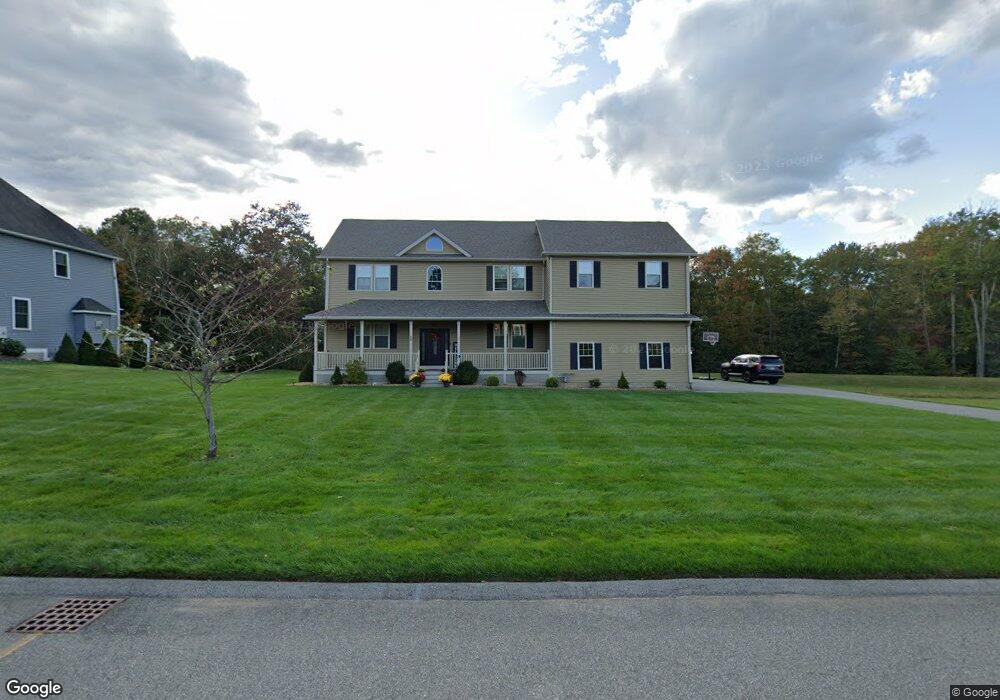
40 Mulcahy Dr West Springfield, MA 01089
Estimated Value: $642,000 - $756,385
4
Beds
3
Baths
3,030
Sq Ft
$230/Sq Ft
Est. Value
About This Home
This home is located at 40 Mulcahy Dr, West Springfield, MA 01089 and is currently estimated at $697,846, approximately $230 per square foot. 40 Mulcahy Dr is a home with nearby schools including St Thomas The Apostle School.
Create a Home Valuation Report for This Property
The Home Valuation Report is an in-depth analysis detailing your home's value as well as a comparison with similar homes in the area
Home Values in the Area
Average Home Value in this Area
Tax History Compared to Growth
Tax History
| Year | Tax Paid | Tax Assessment Tax Assessment Total Assessment is a certain percentage of the fair market value that is determined by local assessors to be the total taxable value of land and additions on the property. | Land | Improvement |
|---|---|---|---|---|
| 2025 | $10,297 | $692,500 | $168,900 | $523,600 |
| 2024 | $9,589 | $647,500 | $168,900 | $478,600 |
| 2023 | $8,713 | $560,700 | $142,000 | $418,700 |
| 2022 | $8,142 | $516,600 | $129,100 | $387,500 |
| 2021 | $7,659 | $453,200 | $129,600 | $323,600 |
| 2020 | $7,732 | $455,100 | $129,600 | $325,500 |
| 2019 | $7,718 | $455,100 | $129,600 | $325,500 |
| 2018 | $7,759 | $455,100 | $129,600 | $325,500 |
| 2017 | $7,759 | $455,100 | $129,600 | $325,500 |
| 2016 | $2,125 | $125,100 | $125,100 | $0 |
| 2015 | $2,085 | $122,700 | $122,700 | $0 |
| 2014 | $2,227 | $135,700 | $135,700 | $0 |
Source: Public Records
Map
Nearby Homes
- 11 Annie's Way
- 59 Clayton Dr
- 50 Overlook Dr
- 39 Bonnie Brae Dr
- 86 Birnie Ave
- 80 Brush Hill Ave Unit 28
- 80 Brush Hill Ave Unit 32
- 42 Gregory Ln
- 64 Apple Ridge Rd
- 89-111 Whitney Ave
- 34 High Meadow Dr
- 36 Shady Brook
- 87 Blanchwood Ave
- 86 Beaumont Ave
- 51 Beaumont Ave
- 212 Poplar St
- 66 Wayfield Ave
- 287 Whitney Ave
- 43 Wishing Well Way
- lot b Homestead Ave