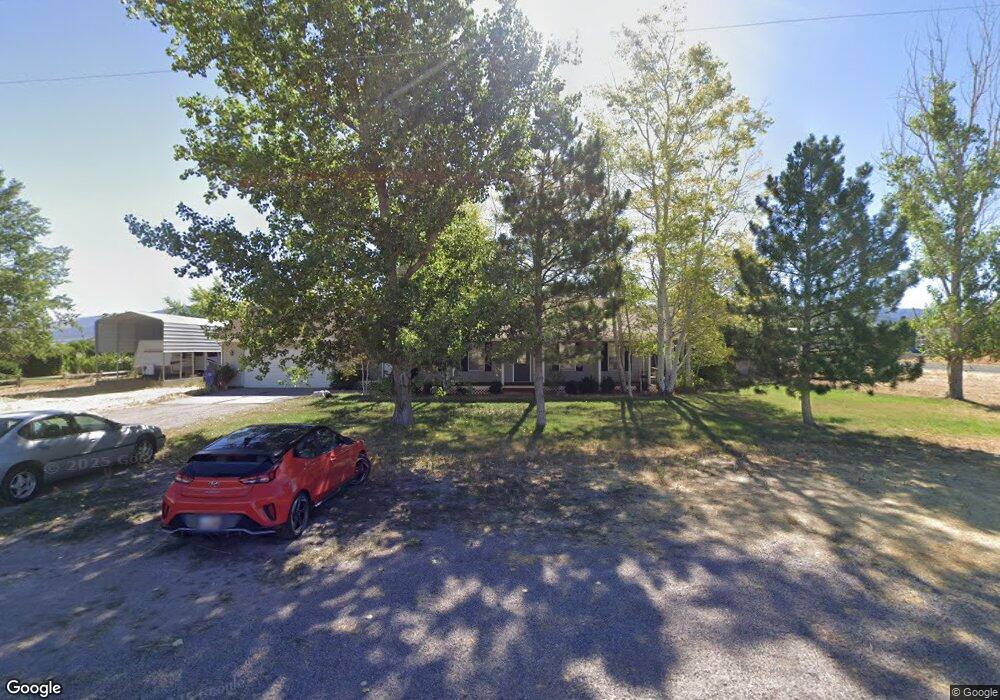
40 N 200 W Kanosh, UT 84637
Estimated Value: $426,000 - $628,000
2
Beds
2
Baths
3,762
Sq Ft
$136/Sq Ft
Est. Value
About This Home
This home is located at 40 N 200 W, Kanosh, UT 84637 and is currently estimated at $513,333, approximately $136 per square foot. 40 N 200 W is a home located in Millard County.
Ownership History
Date
Name
Owned For
Owner Type
Purchase Details
Closed on
Jan 28, 2019
Sold by
Anderson Daniel C and Anderson Jessica A
Bought by
Chevalier Robert and Chevalier Emmaline
Current Estimated Value
Purchase Details
Closed on
Dec 23, 2016
Sold by
Anderson Daniel C
Bought by
Anderson Daniel C and Anderson Jessica A
Home Financials for this Owner
Home Financials are based on the most recent Mortgage that was taken out on this home.
Original Mortgage
$200,000
Interest Rate
3.94%
Mortgage Type
New Conventional
Purchase Details
Closed on
Mar 29, 2016
Sold by
Ssr Family Living Trust
Bought by
Anderson Daniel C and Anderson Jessica A
Home Financials for this Owner
Home Financials are based on the most recent Mortgage that was taken out on this home.
Original Mortgage
$171,830
Interest Rate
3.65%
Mortgage Type
FHA
Create a Home Valuation Report for This Property
The Home Valuation Report is an in-depth analysis detailing your home's value as well as a comparison with similar homes in the area
Home Values in the Area
Average Home Value in this Area
Purchase History
| Date | Buyer | Sale Price | Title Company |
|---|---|---|---|
| Chevalier Robert | -- | -- | |
| Anderson Daniel C | -- | First American Title | |
| Anderson Daniel C | -- | First American Title | |
| Anderson Daniel C | -- | First American Title |
Source: Public Records
Mortgage History
| Date | Status | Borrower | Loan Amount |
|---|---|---|---|
| Previous Owner | Anderson Daniel C | $200,000 | |
| Previous Owner | Anderson Daniel C | $171,830 |
Source: Public Records
Tax History Compared to Growth
Tax History
| Year | Tax Paid | Tax Assessment Tax Assessment Total Assessment is a certain percentage of the fair market value that is determined by local assessors to be the total taxable value of land and additions on the property. | Land | Improvement |
|---|---|---|---|---|
| 2025 | $1,998 | $261,713 | $32,981 | $228,732 |
| 2024 | $1,998 | $273,734 | $19,709 | $254,025 |
| 2023 | $2,412 | $273,734 | $19,709 | $254,025 |
| 2022 | $1,629 | $153,025 | $15,766 | $137,259 |
| 2021 | $1,368 | $123,895 | $13,710 | $110,185 |
| 2020 | $1,184 | $108,334 | $12,464 | $95,870 |
| 2019 | $1,068 | $98,195 | $11,435 | $86,760 |
| 2018 | $1,031 | $97,155 | $10,395 | $86,760 |
| 2017 | $1,078 | $97,155 | $10,395 | $86,760 |
| 2016 | $996 | $93,624 | $7,796 | $85,828 |
| 2015 | $996 | $93,624 | $7,796 | $85,828 |
| 2014 | -- | $93,624 | $7,796 | $85,828 |
| 2013 | -- | $93,624 | $7,796 | $85,828 |
Source: Public Records
Map
Nearby Homes
- 115 W 200 S
- 135 E 200 N
- 58 E 300 South St
- 8610 S Highway 91
- 5098 W Hatton Rd
- Parcel # 8816
- 145 N 200 E
- 60 W Center St
- 50 N 100 Rd E
- 1565 W Sunflower Ln Unit 3
- 1615 W Sunflower Ln
- 1615 W Sunflower Ln Unit 4
- 1565 W Sunflower Ln
- 0 Tbd Black Rock Rd Unit LotWP001
- 2000 N West Frontage I-15
- 1100 S 725 Rd W
- 310 S 500 West Rd
- 190 W 400 St S
- 760 E 700 St S
- 155 E 500 St S