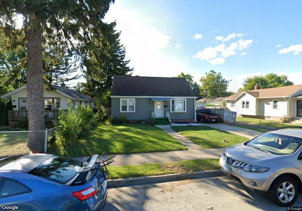
40 N Sumac Ave Waukegan, IL 60085
West Waukegan NeighborhoodEstimated Value: $199,000 - $261,000
4
Beds
2
Baths
1,365
Sq Ft
$171/Sq Ft
Est. Value
About This Home
This home is located at 40 N Sumac Ave, Waukegan, IL 60085 and is currently estimated at $232,869, approximately $170 per square foot. 40 N Sumac Ave is a home located in Lake County with nearby schools including Whittier Elementary School, Robert E. Abbott Middle School, and Waukegan High School.
Ownership History
Date
Name
Owned For
Owner Type
Purchase Details
Closed on
Apr 30, 2001
Sold by
Guardiano Apolinar and Guardiano Lea C
Bought by
Ochoa Arturo and Ochoa Maria L
Current Estimated Value
Home Financials for this Owner
Home Financials are based on the most recent Mortgage that was taken out on this home.
Original Mortgage
$118,146
Outstanding Balance
$44,768
Interest Rate
7.23%
Mortgage Type
FHA
Estimated Equity
$188,101
Purchase Details
Closed on
Nov 12, 1996
Sold by
Campos Leonides M and Campos Aurora B
Bought by
Guardiano Apolinar and Guardiano Lea C
Home Financials for this Owner
Home Financials are based on the most recent Mortgage that was taken out on this home.
Original Mortgage
$89,675
Interest Rate
7.94%
Create a Home Valuation Report for This Property
The Home Valuation Report is an in-depth analysis detailing your home's value as well as a comparison with similar homes in the area
Home Values in the Area
Average Home Value in this Area
Purchase History
| Date | Buyer | Sale Price | Title Company |
|---|---|---|---|
| Ochoa Arturo | $120,000 | -- | |
| Guardiano Apolinar | -- | Chicago Title Insurance Co |
Source: Public Records
Mortgage History
| Date | Status | Borrower | Loan Amount |
|---|---|---|---|
| Open | Ochoa Arturo | $118,146 | |
| Previous Owner | Guardiano Apolinar | $89,675 | |
| Closed | Ochoa Arturo | $5,000 |
Source: Public Records
Tax History Compared to Growth
Tax History
| Year | Tax Paid | Tax Assessment Tax Assessment Total Assessment is a certain percentage of the fair market value that is determined by local assessors to be the total taxable value of land and additions on the property. | Land | Improvement |
|---|---|---|---|---|
| 2024 | $3,667 | $52,370 | $10,496 | $41,874 |
| 2023 | $3,471 | $46,887 | $9,397 | $37,490 |
| 2022 | $3,471 | $41,501 | $7,996 | $33,505 |
| 2021 | $3,480 | $39,377 | $7,396 | $31,981 |
| 2020 | $3,478 | $36,684 | $6,890 | $29,794 |
| 2019 | $3,448 | $33,615 | $6,314 | $27,301 |
| 2018 | $2,944 | $29,153 | $8,125 | $21,028 |
| 2017 | $2,815 | $25,792 | $7,188 | $18,604 |
| 2016 | $2,536 | $22,412 | $6,246 | $16,166 |
| 2015 | $2,375 | $20,059 | $5,590 | $14,469 |
| 2014 | $2,555 | $20,642 | $5,431 | $15,211 |
| 2012 | $3,387 | $22,364 | $5,884 | $16,480 |
Source: Public Records
Map
Nearby Homes
- 24 Washington Terrace
- 0 Brookside Ave
- 102 Baldwin Ave
- 49 S Lewis Ave
- 2115 Lydia St
- 12601 W Atlantic Ave
- 2116 & 2101 Williamsburg Dr
- 132 Dorchester Ct
- 2726 W Hidden Glen Dr
- 615 Tiffany Dr
- 1521 Catalpa Ave
- 1416 Hamilton Ct
- 1213 Grand Ave
- 3170 W Monroe St Unit 309
- 621 N Austin Ave
- 23 N Jackson St
- 34887 N Austin Ave
- 603 N Austin Ave
- 1005 N Lewis Ave
- 3027 Belvidere Rd
- 38 N Sumac Ave
- 46 N Sumac Ave
- 34 N Sumac Ave
- 50 N Sumac Ave
- 2415 Dunlay Ct
- 2413 Dunlay Ct
- 30 N Sumac Ave
- 100 N Sumac Ave
- 2421 Dunlay Ct
- 28 N Sumac Ave
- 41 N Sumac Ave
- 43 N Sumac Ave
- 37 N Sumac Ave
- 104 N Sumac Ave
- 33 N Sumac Ave
- 49 N Sumac Ave
- 2425 Dunlay Ct
- 2411 Dunlay Ct Unit A
- 2411 Dunlay Ct Unit 6
- 2411 Dunlay Ct Unit 5