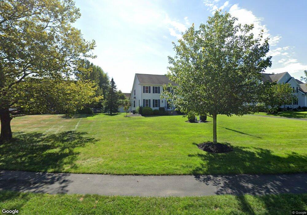
40 Pokanoket Path Wrentham, MA 02093
Estimated Value: $998,000 - $1,125,000
4
Beds
3
Baths
2,965
Sq Ft
$356/Sq Ft
Est. Value
About This Home
This home is located at 40 Pokanoket Path, Wrentham, MA 02093 and is currently estimated at $1,055,537, approximately $355 per square foot. 40 Pokanoket Path is a home located in Norfolk County with nearby schools including Delaney Elementary School and Charles E Roderick.
Ownership History
Date
Name
Owned For
Owner Type
Purchase Details
Closed on
Jul 31, 2001
Sold by
Diplacido Dev
Bought by
Macdonnell Daniel J and Macdonnell Judith A
Current Estimated Value
Home Financials for this Owner
Home Financials are based on the most recent Mortgage that was taken out on this home.
Original Mortgage
$230,000
Outstanding Balance
$89,914
Interest Rate
7.18%
Mortgage Type
Purchase Money Mortgage
Estimated Equity
$965,623
Create a Home Valuation Report for This Property
The Home Valuation Report is an in-depth analysis detailing your home's value as well as a comparison with similar homes in the area
Home Values in the Area
Average Home Value in this Area
Purchase History
| Date | Buyer | Sale Price | Title Company |
|---|---|---|---|
| Macdonnell Daniel J | $411,032 | -- |
Source: Public Records
Mortgage History
| Date | Status | Borrower | Loan Amount |
|---|---|---|---|
| Open | Macdonnell Daniel J | $230,000 |
Source: Public Records
Tax History Compared to Growth
Tax History
| Year | Tax Paid | Tax Assessment Tax Assessment Total Assessment is a certain percentage of the fair market value that is determined by local assessors to be the total taxable value of land and additions on the property. | Land | Improvement |
|---|---|---|---|---|
| 2025 | $10,188 | $879,000 | $303,600 | $575,400 |
| 2024 | $9,696 | $808,000 | $303,600 | $504,400 |
| 2023 | $9,503 | $753,000 | $276,000 | $477,000 |
| 2022 | $8,590 | $628,400 | $212,500 | $415,900 |
| 2021 | $8,521 | $605,600 | $222,600 | $383,000 |
| 2020 | $8,875 | $622,800 | $200,800 | $422,000 |
| 2019 | $8,743 | $619,200 | $216,200 | $403,000 |
| 2018 | $8,090 | $568,100 | $216,600 | $351,500 |
| 2017 | $7,926 | $556,200 | $212,400 | $343,800 |
| 2016 | $7,761 | $543,500 | $206,300 | $337,200 |
| 2015 | $7,784 | $519,600 | $198,300 | $321,300 |
| 2014 | $7,799 | $509,400 | $190,700 | $318,700 |
Source: Public Records
Map
Nearby Homes
- Lot 1 - Blueberry 2 Car Plan at King Philip Estates
- Lot 8 - Blueberry 2 Car Plan at King Philip Estates
- Lot 5 - Hughes 2 car Plan at King Philip Estates
- Lot 6 - Blueberry 3 Car Plan at King Philip Estates
- Lot 2 - Camden 2 Car Plan at King Philip Estates
- Lot 7 - Cedar Plan at King Philip Estates
- Lot 4 - Hemingway 2 Car Plan at King Philip Estates
- Lot 3 - Blueberry 2 Car Plan at King Philip Estates
- Lot 3 - 14 Earle Stewart Ln
- 11 Earle Stewart Ln
- 131 Creek St Unit 7
- 791 South St Unit 5
- 570 Franklin St
- 319 Taunton St
- 10 Nature View Dr
- 15 Nature View Dr
- 440 Chestnut St
- 50 Green St
- 80 Carriage House Ln
- 1204 South St
- 35 Pokanoket Path
- 30 Pokanoket Path
- 50 Pokanoket Path
- 25 Pokanoket Path
- 60 Pokanoket Path
- 75 Pokanoket Path
- 65 Pokanoket Path
- 55 Pokanoket Path
- 15 Pokanoket Path
- 25 Weetamoo Way
- 35 Weetamoo Way
- 124 Riverside Dr
- 5 Pokanoket Path
- 70 Pokanoket Path
- 15 Weetamoo Way
- 45 Weetamoo Way
- 120 Riverside Dr
- 145 Annawon Ave
- 130 Riverside Dr
- 55 Weetamoo Way