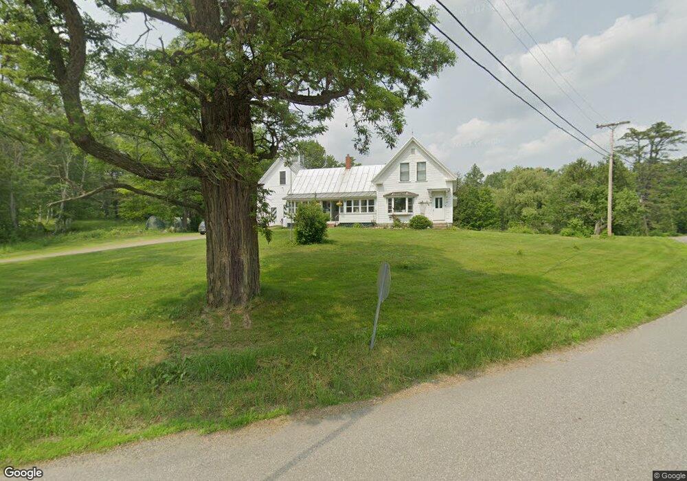
40 River Rd Phillips, ME 04966
Estimated Value: $179,036 - $388,000
About This Home
This home is located at 40 River Rd, Phillips, ME 04966 and is currently estimated at $318,009, approximately $132 per square foot. 40 River Rd is a home with nearby schools including Mt. Abram Regional High School.
Ownership History
We collect this data history from publicly available records. To have your information removed, we recommend requesting removal directly through your county’s website.
Purchase Details
Home Financials for this Owner
Home Financials are based on the most recent Mortgage that was taken out on this home.Purchase History
We collect this data history from publicly available records. To have your information removed, we recommend requesting removal directly through your county’s website.
| Date | Buyer | Sale Price | Title Company |
|---|---|---|---|
| $86,000 | None Available |
Mortgage History
We collect this data history from publicly available records. To have your information removed, we recommend requesting removal directly through your county’s website.
| Date | Status | Borrower | Loan Amount |
|---|---|---|---|
| Open | $31,120 |
Tax History
We collect this data history from publicly available records. To have your information removed, we recommend requesting removal directly through your county’s website.
| Year | Tax Paid | Tax Assessment Tax Assessment Total Assessment is a certain percentage of the fair market value that is determined by local assessors to be the total taxable value of land and additions on the property. | Land | Improvement |
|---|---|---|---|---|
| 2024 | $2,288 | $102,600 | $17,500 | $85,100 |
| 2023 | $1,970 | $102,600 | $17,500 | $85,100 |
| 2022 | $1,980 | $102,600 | $17,500 | $85,100 |
| 2021 | $2,104 | $102,620 | $17,500 | $85,120 |
| 2020 | $2,247 | $102,620 | $17,500 | $85,120 |
| 2019 | $2,288 | $102,620 | $17,500 | $85,120 |
| 2018 | $2,350 | $102,620 | $17,500 | $85,120 |
| 2017 | $2,227 | $102,620 | $17,500 | $85,120 |
| 2016 | $2,196 | $102,620 | $17,500 | $85,120 |
| 2015 | $2,217 | $102,620 | $17,500 | $85,120 |
| 2013 | $2,134 | $102,620 | $17,500 | $85,120 |
Map
- 79 Main St
- 83 Main St
- 150 River
- 25 Ross Ave
- 212 Mile Square Rd
- 186 Park St
- 0 Mile Square Rd
- 60 Mount Blue Pond Rd
- Lot #4 Woods Rd
- 353 Salem Rd
- 288 Cross Rd
- 182 Airport Rd
- 118 Tory Hill Rd
- Lot 45 Tory Hill Rd
- 77 Toothaker Pond Rd
- 140 E Madrid Rd
- MR11 L35 Burbank Hill Rd
- 4 Cousineaus Tory Hill Heights
- Map 5 Lot 26 & 26 1 Bray Hill Rd
- 67 Callahan Rd
Ask me questions while you tour the home.