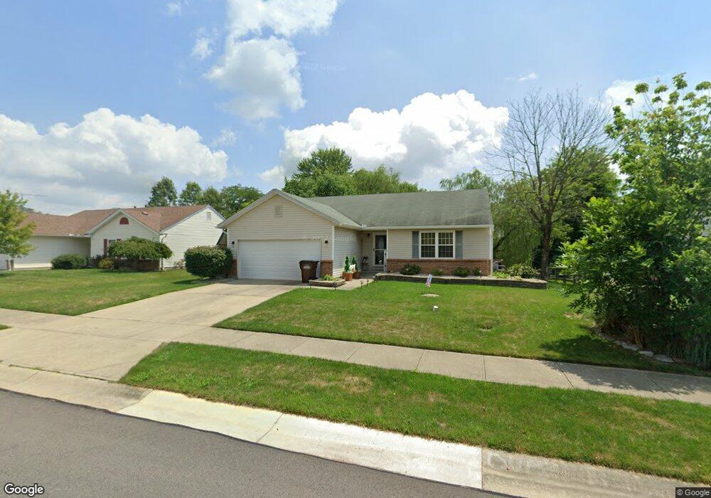
40 Robin Way Amelia, OH 45102
Estimated Value: $263,849 - $301,000
3
Beds
3
Baths
1,224
Sq Ft
$232/Sq Ft
Est. Value
About This Home
This home is located at 40 Robin Way, Amelia, OH 45102 and is currently estimated at $284,212, approximately $232 per square foot. 40 Robin Way is a home located in Clermont County with nearby schools including Amelia Elementary School, West Clermont Middle School, and West Clermont High School.
Ownership History
Date
Name
Owned For
Owner Type
Purchase Details
Closed on
Jul 31, 2009
Sold by
Wile Phillip K and Wile Carolyn L
Bought by
Hudson Kenneth B and Haffey Hudson Melanie A
Current Estimated Value
Home Financials for this Owner
Home Financials are based on the most recent Mortgage that was taken out on this home.
Original Mortgage
$148,166
Outstanding Balance
$97,975
Interest Rate
5.49%
Mortgage Type
FHA
Estimated Equity
$186,237
Purchase Details
Closed on
Mar 11, 1999
Sold by
Crossmann Communities Of
Bought by
Wile Phillip K and Mccoon Carolyn L
Home Financials for this Owner
Home Financials are based on the most recent Mortgage that was taken out on this home.
Original Mortgage
$118,279
Interest Rate
6.78%
Mortgage Type
FHA
Create a Home Valuation Report for This Property
The Home Valuation Report is an in-depth analysis detailing your home's value as well as a comparison with similar homes in the area
Home Values in the Area
Average Home Value in this Area
Purchase History
| Date | Buyer | Sale Price | Title Company |
|---|---|---|---|
| Hudson Kenneth B | $150,900 | Prodigy Title Agency | |
| Wile Phillip K | $121,125 | -- |
Source: Public Records
Mortgage History
| Date | Status | Borrower | Loan Amount |
|---|---|---|---|
| Open | Hudson Kenneth B | $148,166 | |
| Previous Owner | Wile Phillip K | $118,279 |
Source: Public Records
Tax History
| Year | Tax Paid | Tax Assessment Tax Assessment Total Assessment is a certain percentage of the fair market value that is determined by local assessors to be the total taxable value of land and additions on the property. | Land | Improvement |
|---|---|---|---|---|
| 2024 | $3,736 | $73,150 | $14,910 | $58,240 |
| 2023 | $3,742 | $73,150 | $14,910 | $58,240 |
| 2022 | $3,034 | $51,560 | $10,500 | $41,060 |
| 2021 | $2,999 | $51,560 | $10,500 | $41,060 |
| 2020 | $3,000 | $51,560 | $10,500 | $41,060 |
| 2019 | $2,493 | $46,870 | $10,290 | $36,580 |
| 2018 | $2,518 | $46,870 | $10,290 | $36,580 |
| 2017 | $2,555 | $46,870 | $10,290 | $36,580 |
| 2016 | $2,468 | $41,480 | $9,100 | $32,380 |
| 2015 | $2,305 | $41,480 | $9,100 | $32,380 |
| 2014 | $2,305 | $41,480 | $9,100 | $32,380 |
| 2013 | $2,396 | $42,700 | $10,500 | $32,200 |
Source: Public Records
Map
Nearby Homes
- 27 Heron Dr
- 253 Deer Creek Dr
- 263 Deer Creek Dr
- 11 Finch Ct
- 21 Mallard Dr
- 1554 Denny Dr
- 3330 Huntsman Trace Unit 803C
- 27 Locustwood Ct
- 9 Woodside Park Dr
- 288 Samplewood Ln
- 185 Woodside Park Dr
- 1969 Ohio 125
- 1821 Ohio 125
- 9 Letitia Ave
- 1700 White Birch
- 52 Huntington Ave
- 0 Ohio 125
- 65 Wooded Ridge Dr
- 12 Ledgerwoods Dr Unit 8
- 212 Wooded Ridge Dr
Your Personal Tour Guide
Ask me questions while you tour the home.