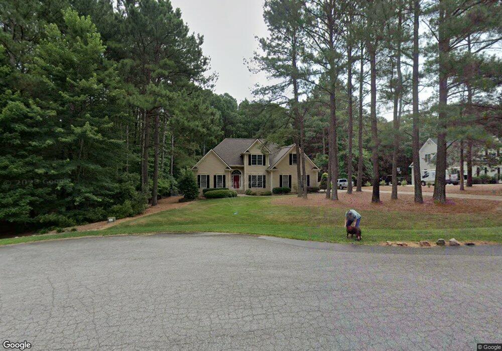
40 Santorini Way Wake Forest, NC 27587
Estimated Value: $477,000 - $581,000
3
Beds
3
Baths
2,433
Sq Ft
$226/Sq Ft
Est. Value
About This Home
This home is located at 40 Santorini Way, Wake Forest, NC 27587 and is currently estimated at $548,792, approximately $225 per square foot. 40 Santorini Way is a home located in Franklin County with nearby schools including Long Mill Elementary, Cedar Creek Middle, and Franklinton High School.
Ownership History
Date
Name
Owned For
Owner Type
Purchase Details
Closed on
Sep 27, 2023
Sold by
Rust Ronald Lenn Leisy Revocable and Marla Rae Leisy Revocable Trust
Bought by
Leisy Revocable Living Trust and Leisy
Current Estimated Value
Purchase Details
Closed on
Feb 15, 2021
Sold by
Rahn Steven D and Rahn Ann M
Bought by
Leisy Ronald Lenn and The Roandl Lenn Leisy Revocabl
Purchase Details
Closed on
Aug 16, 2005
Sold by
Chadmor Homes Inc
Bought by
Rahn Steven D and Rahn Ann M
Home Financials for this Owner
Home Financials are based on the most recent Mortgage that was taken out on this home.
Original Mortgage
$235,120
Interest Rate
5.57%
Mortgage Type
New Conventional
Create a Home Valuation Report for This Property
The Home Valuation Report is an in-depth analysis detailing your home's value as well as a comparison with similar homes in the area
Home Values in the Area
Average Home Value in this Area
Purchase History
| Date | Buyer | Sale Price | Title Company |
|---|---|---|---|
| Leisy Revocable Living Trust | -- | None Listed On Document | |
| Leisy Ronald Lenn | $392,000 | None Available | |
| Rahn Steven D | $294,000 | None Available |
Source: Public Records
Mortgage History
| Date | Status | Borrower | Loan Amount |
|---|---|---|---|
| Previous Owner | Rahn Steven D | $235,120 |
Source: Public Records
Tax History Compared to Growth
Tax History
| Year | Tax Paid | Tax Assessment Tax Assessment Total Assessment is a certain percentage of the fair market value that is determined by local assessors to be the total taxable value of land and additions on the property. | Land | Improvement |
|---|---|---|---|---|
| 2024 | $3,188 | $518,920 | $90,000 | $428,920 |
| 2023 | $2,679 | $291,650 | $60,000 | $231,650 |
| 2022 | $2,669 | $291,650 | $60,000 | $231,650 |
| 2021 | $2,681 | $291,650 | $60,000 | $231,650 |
| 2020 | $2,697 | $291,650 | $60,000 | $231,650 |
| 2019 | $2,687 | $291,650 | $60,000 | $231,650 |
| 2018 | $2,668 | $291,650 | $60,000 | $231,650 |
| 2017 | $2,516 | $249,860 | $50,000 | $199,860 |
| 2016 | $2,604 | $249,860 | $50,000 | $199,860 |
| 2015 | $2,604 | $249,860 | $50,000 | $199,860 |
| 2014 | $2,447 | $249,860 | $50,000 | $199,860 |
Source: Public Records
Map
Nearby Homes
- 145 Traylee Dr
- 90 Scotts Pine Cir
- 145 Wiggins Rd
- 3217 Donlin Dr
- 30 Cherry Bark Dr
- 155 Cherry Bark Dr
- 105 Cherry Bark Dr
- 115 Cherry Bark Dr
- 65 Chestnut Oak Dr
- 240 Barn Hill Ln
- 25 Chestnut Oak Dr
- 60 Chestnut Oak Dr
- 95 Cherry Bark Dr
- 170 Cherry Bark Dr
- 55 Cherry Bark Ln
- 190 Cherry Bark Dr
- 10 Gambel Dr
- 125 Spanish Oak Dr
- 35 Spanish Oak Dr
- 70 Spanish Oak Dr
- 30 Santorini Way
- 50 Santorini Way
- 20 Santorini Way
- 45 Santorini Way
- 35 Santorini Way
- 140 Traylee Dr
- 172 Glendale Dr
- 10 Santorini Way
- 25 Santorini Way
- 10 Scotts Pine Cir
- 15 Santorini Way
- 120 Traylee Dr
- 15 Princeton Manor Dr
- 25 Princeton Manor Dr
- 20 Scotts Pine Cir
- 173 Glendale Dr
- 110 Traylee Dr
- 174 Glendale Dr
- 15 Scotts Pine Cir
- 170 Traylee Dr