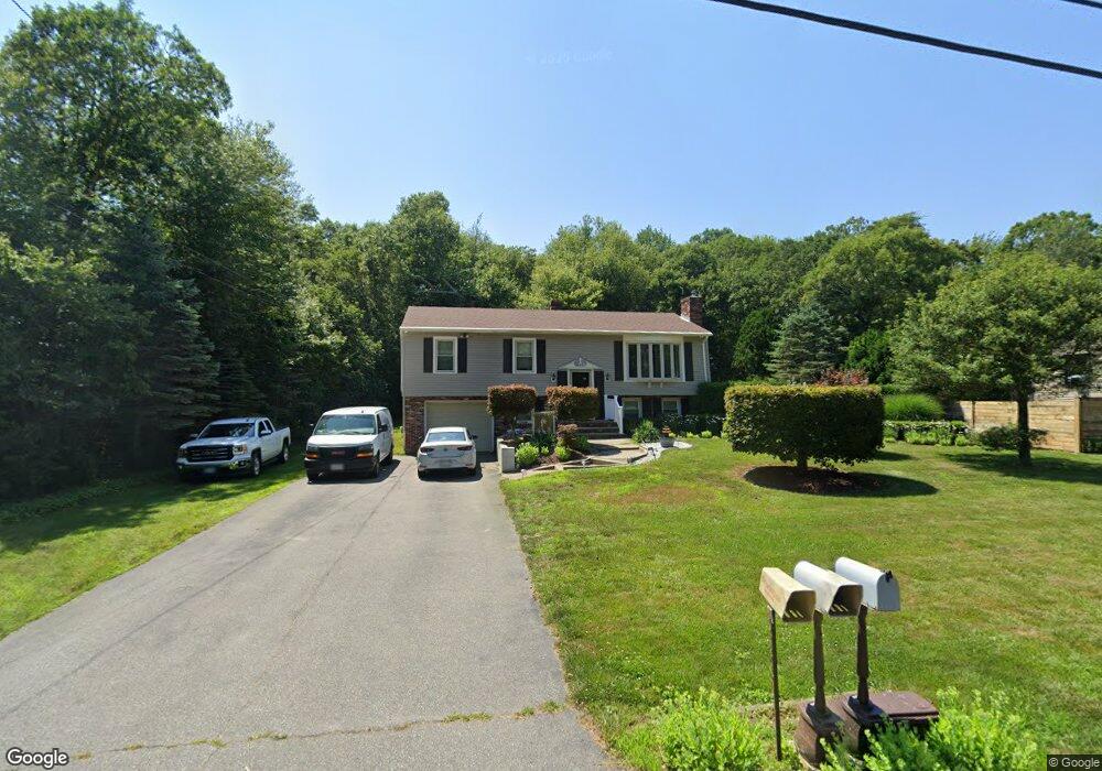
40 Shaw Rd Fairhaven, MA 02719
East Fairhaven NeighborhoodEstimated Value: $464,000 - $494,383
3
Beds
1
Bath
1,174
Sq Ft
$411/Sq Ft
Est. Value
About This Home
This home is located at 40 Shaw Rd, Fairhaven, MA 02719 and is currently estimated at $482,096, approximately $410 per square foot. 40 Shaw Rd is a home located in Bristol County with nearby schools including Fairhaven High School, City On A Hill Charter Public School New Bedford, and St. Joseph School.
Ownership History
Date
Name
Owned For
Owner Type
Purchase Details
Closed on
May 17, 1994
Sold by
Bankers Trust Co
Bought by
Dasilva Daniel P and Dasilva Nancy J
Current Estimated Value
Home Financials for this Owner
Home Financials are based on the most recent Mortgage that was taken out on this home.
Original Mortgage
$80,100
Interest Rate
7.93%
Mortgage Type
Purchase Money Mortgage
Purchase Details
Closed on
Mar 11, 1994
Sold by
Barrows Carl A and Bankers Tr Co Ca
Bought by
Bankers Tr Co
Create a Home Valuation Report for This Property
The Home Valuation Report is an in-depth analysis detailing your home's value as well as a comparison with similar homes in the area
Home Values in the Area
Average Home Value in this Area
Purchase History
| Date | Buyer | Sale Price | Title Company |
|---|---|---|---|
| Dasilva Daniel P | $89,000 | -- | |
| Bankers Tr Co | $132,800 | -- |
Source: Public Records
Mortgage History
| Date | Status | Borrower | Loan Amount |
|---|---|---|---|
| Open | Bankers Tr Co | $60,000 | |
| Closed | Bankers Tr Co | $80,100 | |
| Previous Owner | Bankers Tr Co | $108,000 | |
| Previous Owner | Bankers Tr Co | $72,920 |
Source: Public Records
Tax History
| Year | Tax Paid | Tax Assessment Tax Assessment Total Assessment is a certain percentage of the fair market value that is determined by local assessors to be the total taxable value of land and additions on the property. | Land | Improvement |
|---|---|---|---|---|
| 2025 | $34 | $364,900 | $176,600 | $188,300 |
| 2024 | $3,317 | $359,400 | $176,600 | $182,800 |
| 2023 | $3,181 | $319,700 | $154,700 | $165,000 |
| 2022 | $3,124 | $305,700 | $143,800 | $161,900 |
| 2021 | $3,135 | $277,700 | $130,100 | $147,600 |
| 2020 | $3,071 | $277,700 | $130,100 | $147,600 |
| 2019 | $2,893 | $247,900 | $107,900 | $140,000 |
| 2018 | $2,781 | $236,700 | $102,700 | $134,000 |
| 2017 | $2,823 | $234,500 | $102,700 | $131,800 |
| 2016 | $2,704 | $222,000 | $102,700 | $119,300 |
| 2015 | $2,674 | $220,100 | $102,700 | $117,400 |
Source: Public Records
Map
Nearby Homes
- 3 Earle St
- 421 Huttleston Ave
- 0 Whalers Way
- 33 Narragansett Blvd
- 28 Brant Beach Ave
- 0 Marina Dr Unit 72497908
- 0 Marina Dr Unit 72497877
- 41 Starboard Way
- 3.5 Golf St
- 190 Sconticut Neck Rd
- 1 Harvard St
- 15 Bayview Ave
- 27 Bayview Ave
- 58 Bayview Ave
- 9 Hitching Post Rd
- 15 Hitching Post Rd
- 21 Hitching Post Rd
- 13 Park Place
- 181 Washington St
- 8 Manor Dr