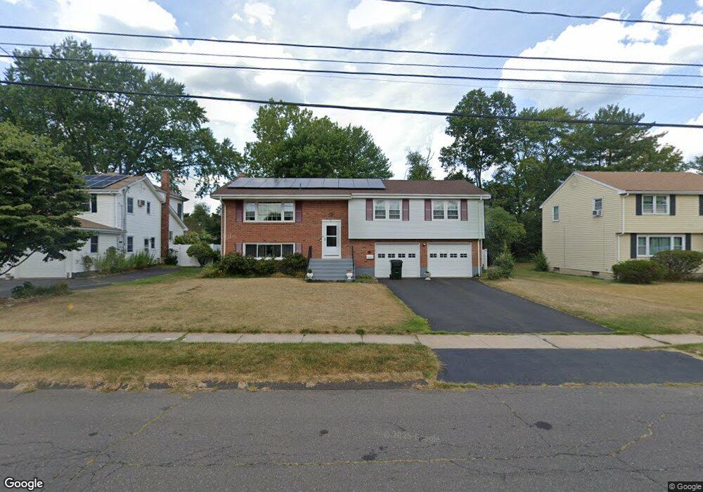
40 Shepard Rd West Hartford, CT 06110
Estimated Value: $443,954 - $496,000
3
Beds
3
Baths
1,629
Sq Ft
$285/Sq Ft
Est. Value
About This Home
This home is located at 40 Shepard Rd, West Hartford, CT 06110 and is currently estimated at $463,739, approximately $284 per square foot. 40 Shepard Rd is a home located in Hartford County with nearby schools including Wolcott School, Sedgwick Middle School, and Conard High School.
Create a Home Valuation Report for This Property
The Home Valuation Report is an in-depth analysis detailing your home's value as well as a comparison with similar homes in the area
Home Values in the Area
Average Home Value in this Area
Tax History Compared to Growth
Tax History
| Year | Tax Paid | Tax Assessment Tax Assessment Total Assessment is a certain percentage of the fair market value that is determined by local assessors to be the total taxable value of land and additions on the property. | Land | Improvement |
|---|---|---|---|---|
| 2025 | $9,166 | $204,680 | $49,280 | $155,400 |
| 2024 | $8,668 | $204,680 | $49,280 | $155,400 |
| 2023 | $8,376 | $204,680 | $49,280 | $155,400 |
| 2022 | $8,326 | $204,680 | $49,280 | $155,400 |
| 2021 | $7,726 | $182,140 | $54,740 | $127,400 |
| 2020 | $7,005 | $167,580 | $46,130 | $121,450 |
| 2019 | $7,005 | $167,580 | $46,130 | $121,450 |
| 2018 | $6,871 | $167,580 | $46,130 | $121,450 |
| 2017 | $6,877 | $167,580 | $46,130 | $121,450 |
| 2016 | $7,205 | $182,350 | $54,250 | $128,100 |
| 2015 | $6,986 | $182,350 | $54,250 | $128,100 |
| 2014 | $6,111 | $163,520 | $54,250 | $109,270 |
Source: Public Records
Map
Nearby Homes
- 43 Burnham Dr
- 25 Fowler Dr
- 16 Thornton Dr
- 228 Reservoir Rd
- 42 Avery Rd
- 281 South Rd
- 305 Hampton Ct
- 135 Village Square Dr Unit 1
- 24 Thorne Rd Unit 24
- 1 Valley Crest Dr
- 236 Sterling Dr Unit 236
- 218 Sterling Dr Unit 218
- 479 S Main St
- 31 Dacosta Dr
- 32 Miles Standish Dr
- 198 Brittany Farms Rd Unit D
- 107 Westgate St
- 18 Federal St
- 148 Colonial St
- 164 Brittany Farms Rd Unit A