Estimated Value: $663,043 - $787,000
3
Beds
2
Baths
1,500
Sq Ft
$474/Sq Ft
Est. Value
About This Home
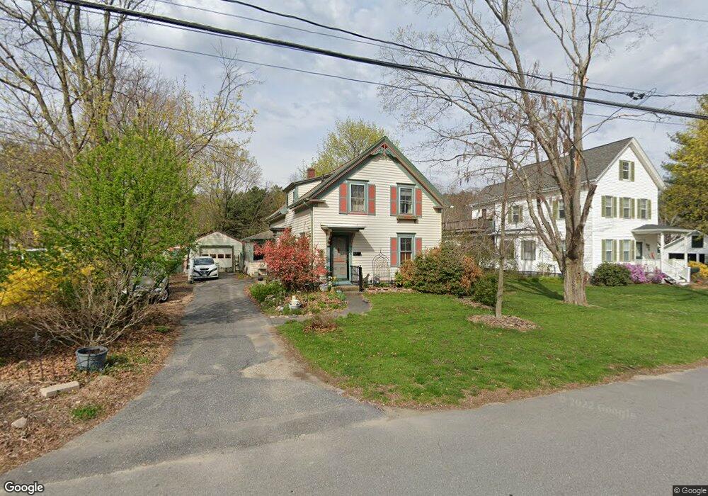
This home is located at 40 Spruce St, Acton, MA 01720 and is currently estimated at $711,511, approximately $474 per square foot. 40 Spruce St is a home located in Middlesex County with nearby schools including Acton-Boxborough Regional High School and The Imago School.
Ownership History
Date
Name
Owned For
Owner Type
Purchase Details
Closed on
Apr 1, 1998
Sold by
Spruce Rt and Manalan David A
Bought by
Gogan Robert M and Addison Frann S
Current Estimated Value
Home Financials for this Owner
Home Financials are based on the most recent Mortgage that was taken out on this home.
Original Mortgage
$125,000
Outstanding Balance
$23,294
Interest Rate
6.89%
Mortgage Type
Purchase Money Mortgage
Estimated Equity
$688,217
Create a Home Valuation Report for This Property
The Home Valuation Report is an in-depth analysis detailing your home's value as well as a comparison with similar homes in the area
Home Values in the Area
Average Home Value in this Area
Purchase History
| Date | Buyer | Sale Price | Title Company |
|---|---|---|---|
| Gogan Robert M | $200,000 | -- |
Source: Public Records
Mortgage History
| Date | Status | Borrower | Loan Amount |
|---|---|---|---|
| Open | Gogan Robert M | $125,000 |
Source: Public Records
Tax History Compared to Growth
Tax History
| Year | Tax Paid | Tax Assessment Tax Assessment Total Assessment is a certain percentage of the fair market value that is determined by local assessors to be the total taxable value of land and additions on the property. | Land | Improvement |
|---|---|---|---|---|
| 2025 | $8,894 | $518,600 | $265,600 | $253,000 |
| 2024 | $8,088 | $485,200 | $265,600 | $219,600 |
| 2023 | $8,095 | $461,000 | $241,400 | $219,600 |
| 2022 | $8,284 | $425,900 | $210,000 | $215,900 |
| 2021 | $7,540 | $372,700 | $194,400 | $178,300 |
| 2020 | $7,171 | $372,700 | $194,400 | $178,300 |
| 2019 | $6,814 | $351,800 | $194,400 | $157,400 |
| 2018 | $6,370 | $328,700 | $194,400 | $134,300 |
| 2017 | $6,265 | $328,700 | $194,400 | $134,300 |
| 2016 | $6,321 | $328,700 | $194,400 | $134,300 |
| 2015 | $6,096 | $320,000 | $194,400 | $125,600 |
| 2014 | $5,987 | $307,800 | $194,400 | $113,400 |
Source: Public Records
Map
Nearby Homes
- 285 Central St Unit 285
- 5 Elm St Unit 1
- 9 Elm St Unit 1
- 89 Windsor Ave
- 31 Mohawk Dr
- 92 Willow St Unit 3
- 92 Willow St Unit 2
- 90 Willow St Unit 1
- 4,7,8 Crestwood Ln
- 68 Macintosh Ln
- 134 Russet Ln
- 4 Huron Rd
- 12 Olde Lantern Rd
- 3 Heather Hill Rd
- 169 Main St
- 19 Railroad St Unit C2
- 131 Main St
- 129 Main St Unit 129
- 129 Main St
- 96 Cedarwood Rd
- 42 Spruce St
- 34 Spruce St
- 35 Spruce St
- 39 Spruce St
- 30 Spruce St
- 50 Spruce St Unit 50
- 52 Spruce St Unit 52
- 56 Spruce St Unit 56
- 307 Central St Unit 2
- 307 Central St Unit 1
- 51 Spruce St
- 62 Spruce St Unit 62
- 60 Spruce St Unit 60
- 70 Spruce St
- 70 Spruce St Unit 70
- 309 Central St
- 305 Central St
- 235 Arlington St
- 295 Cental St Unit 295
- 303 Central St