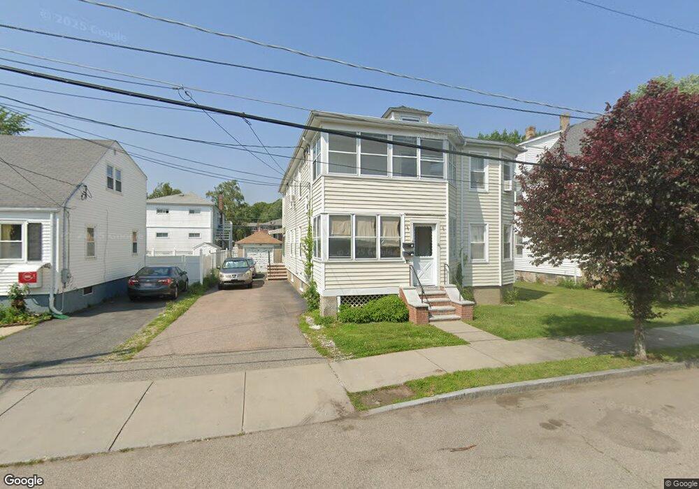
40 Sturtevant Ave Norwood, MA 02062
South Norwood NeighborhoodEstimated Value: $734,000 - $877,000
4
Beds
2
Baths
2,280
Sq Ft
$350/Sq Ft
Est. Value
About This Home
This home is located at 40 Sturtevant Ave, Norwood, MA 02062 and is currently estimated at $798,572, approximately $350 per square foot. 40 Sturtevant Ave is a home located in Norfolk County with nearby schools including Norwood High School, St Catherine Of Siena School, and Norwood Montessori School.
Ownership History
Date
Name
Owned For
Owner Type
Purchase Details
Closed on
Dec 16, 2009
Sold by
Hadryan Mary A and Canto Sophie A
Bought by
Dicrescenzo David M and Salahi Lara
Current Estimated Value
Home Financials for this Owner
Home Financials are based on the most recent Mortgage that was taken out on this home.
Original Mortgage
$315,425
Outstanding Balance
$211,980
Interest Rate
5.5%
Mortgage Type
FHA
Estimated Equity
$586,592
Create a Home Valuation Report for This Property
The Home Valuation Report is an in-depth analysis detailing your home's value as well as a comparison with similar homes in the area
Home Values in the Area
Average Home Value in this Area
Purchase History
| Date | Buyer | Sale Price | Title Company |
|---|---|---|---|
| Dicrescenzo David M | $350,000 | -- |
Source: Public Records
Mortgage History
| Date | Status | Borrower | Loan Amount |
|---|---|---|---|
| Open | Dicrescenzo David M | $315,425 |
Source: Public Records
Tax History
| Year | Tax Paid | Tax Assessment Tax Assessment Total Assessment is a certain percentage of the fair market value that is determined by local assessors to be the total taxable value of land and additions on the property. | Land | Improvement |
|---|---|---|---|---|
| 2025 | $72 | $679,800 | $248,000 | $431,800 |
| 2024 | $6,417 | $612,900 | $227,200 | $385,700 |
| 2023 | $6,016 | $582,900 | $208,900 | $374,000 |
| 2022 | $6,062 | $563,900 | $189,900 | $374,000 |
| 2021 | $5,476 | $482,900 | $183,000 | $299,900 |
| 2020 | $5,130 | $460,100 | $175,000 | $285,100 |
| 2019 | $4,637 | $425,800 | $161,000 | $264,800 |
| 2018 | $4,536 | $409,000 | $153,400 | $255,600 |
| 2017 | $4,190 | $375,800 | $153,400 | $222,400 |
| 2016 | $4,073 | $366,300 | $162,400 | $203,900 |
| 2015 | $3,840 | $334,800 | $152,600 | $182,200 |
| 2014 | $3,582 | $309,300 | $140,600 | $168,700 |
Source: Public Records
Map
Nearby Homes
- 1086 Washington St
- 26 Saint Josephs Ave
- 225 Sunnyside Rd
- 53 Tremont St
- 14 Wood Dr
- 74 Alandale Pkwy
- 23-25 Hoyle St
- 70 Endicott St Unit 401
- 50 Gay St
- 785 Washington St Unit 206
- 12 5th St
- 5 Endicott St Unit 3
- 213 Pleasant St
- 27 Brothers Way
- 220 E Cross St
- 31 Downing St
- 20 Coolidge Ave
- 14 Florence Ave
- 1 Lenox St Unit 314
- 1 Lenox St Unit 102
- 38 Sturtevant Ave
- 34 Sturtevant Ave
- 45 Dean St
- 42 Sturtevant Ave
- 51 Dean St
- 41 Sturtevant Ave
- 41 Sturtevant Ave Unit 1
- 41 Sturtevant Ave Unit 3
- 53 Dean St
- 39 Sturtevant Ave
- 47 Sturtevant Ave
- 41 Dean St Unit 43
- 37 Sturtevant Ave
- 53 Sturtevant Ave
- 30 Sturtevant Ave
- 30 Sturtevant Ave Unit 2
- 37 Dean St
- 62 Sturtevant Ave
- 28 Sturtevant Ave
- 61 Sturtevant Ave
Your Personal Tour Guide
Ask me questions while you tour the home.