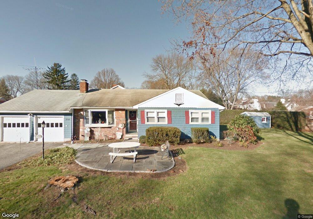
40 Tamarac Rd Westport, CT 06880
Westport Village NeighborhoodEstimated Value: $2,633,000 - $4,008,000
6
Beds
6
Baths
4,237
Sq Ft
$807/Sq Ft
Est. Value
About This Home
This home is located at 40 Tamarac Rd, Westport, CT 06880 and is currently estimated at $3,418,637, approximately $806 per square foot. 40 Tamarac Rd is a home located in Fairfield County with nearby schools including Saugatuck Elementary School, Bedford Middle School, and Staples High School.
Ownership History
Date
Name
Owned For
Owner Type
Purchase Details
Closed on
Aug 20, 2019
Sold by
40 Tamarac Road Llc
Bought by
Solosy William and Solosy Meghann
Current Estimated Value
Home Financials for this Owner
Home Financials are based on the most recent Mortgage that was taken out on this home.
Original Mortgage
$1,570,500
Outstanding Balance
$1,378,285
Interest Rate
3.8%
Mortgage Type
Adjustable Rate Mortgage/ARM
Estimated Equity
$2,040,352
Purchase Details
Closed on
Oct 24, 2017
Sold by
Durner Muriel O
Bought by
40 Tamarac Road Llc
Home Financials for this Owner
Home Financials are based on the most recent Mortgage that was taken out on this home.
Original Mortgage
$940,000
Interest Rate
3.78%
Mortgage Type
Construction
Create a Home Valuation Report for This Property
The Home Valuation Report is an in-depth analysis detailing your home's value as well as a comparison with similar homes in the area
Home Values in the Area
Average Home Value in this Area
Purchase History
| Date | Buyer | Sale Price | Title Company |
|---|---|---|---|
| Solosy William | $1,745,000 | -- | |
| Solosy William | $1,745,000 | -- | |
| 40 Tamarac Road Llc | $625,000 | -- | |
| 40 Tamarac Road Llc | $625,000 | -- |
Source: Public Records
Mortgage History
| Date | Status | Borrower | Loan Amount |
|---|---|---|---|
| Open | Solosy William | $1,570,500 | |
| Closed | Solosy William | $1,570,500 | |
| Previous Owner | 40 Tamarac Road Llc | $940,000 |
Source: Public Records
Tax History Compared to Growth
Tax History
| Year | Tax Paid | Tax Assessment Tax Assessment Total Assessment is a certain percentage of the fair market value that is determined by local assessors to be the total taxable value of land and additions on the property. | Land | Improvement |
|---|---|---|---|---|
| 2025 | $23,234 | $1,231,900 | $422,600 | $809,300 |
| 2024 | $22,938 | $1,231,900 | $422,600 | $809,300 |
| 2023 | $22,605 | $1,231,900 | $422,600 | $809,300 |
| 2022 | $22,260 | $1,231,900 | $422,600 | $809,300 |
| 2021 | $21,774 | $1,205,000 | $422,600 | $782,400 |
| 2020 | $20,291 | $1,335,500 | $448,900 | $886,600 |
| 2019 | $12,082 | $1,365,100 | $448,900 | $916,200 |
| 2018 | $9,413 | $558,300 | $448,900 | $109,400 |
| 2017 | $9,413 | $558,300 | $448,900 | $109,400 |
| 2016 | $9,413 | $558,300 | $448,900 | $109,400 |
| 2015 | $8,683 | $480,000 | $328,000 | $152,000 |
| 2014 | $8,611 | $480,000 | $328,000 | $152,000 |
Source: Public Records
Map
Nearby Homes
- 7 Wild Rose Rd
- 3 Hickory Hill Rd
- 19A Darbrook Rd
- 4 Woods Grove Rd
- 2 Webb Rd
- 60 Wilton Rd Unit 2C
- 15 Cross Hwy
- 26 Crescent Park Rd
- 9 Crescent Park Rd
- 113 Kings Hwy N
- 3 Ln
- 21 Wright St
- 26 Hitchcock Rd
- 41 Richmondville Ave Unit 104
- 41 Richmondville Ave Unit Duplex 2
- 41 Richmondville Ave Unit 303
- 41 Richmondville Ave Unit 111
- 41 Richmondville Ave Unit 101
- 41 Richmondville Ave Unit 105
- 32 Webb Rd
- 10 Evergreen Pkwy
- 41 Tamarac Rd
- 8 Evergreen Pkwy
- 12 Evergreen Pkwy
- 4 Evergreen Pkwy
- 34 Tamarac Rd
- 39 Tamarac Rd
- 7 Evergreen Pkwy
- 5 Evergreen Pkwy
- 16 Evergreen Pkwy
- 9 Evergreen Pkwy
- 37 Tamarac Rd
- 11 Evergreen Pkwy
- 30 Tamarac Rd
- 37 Evergreen Ave
- 32 Tamarac Rd
- 35 Tamarac Rd
- 18 Evergreen Pkwy
- 28 Tamarac Rd