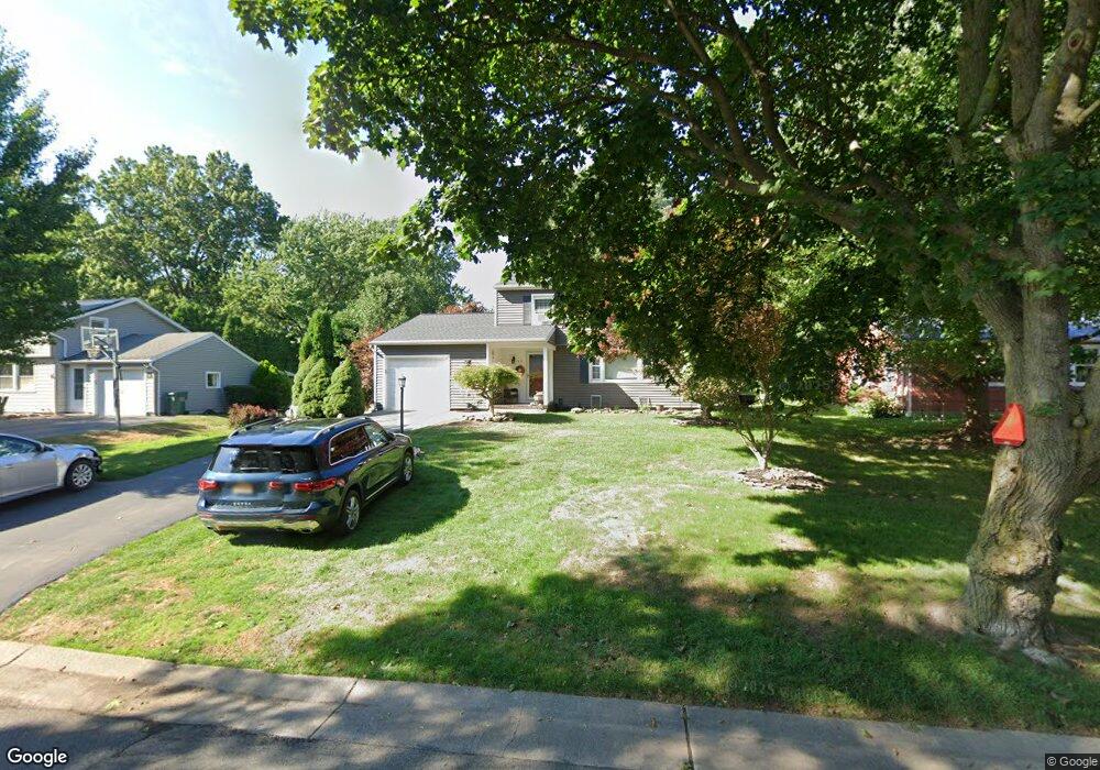
40 Thorncliff Rd Spencerport, NY 14559
Estimated Value: $270,000 - $309,000
3
Beds
2
Baths
1,532
Sq Ft
$189/Sq Ft
Est. Value
About This Home
This home is located at 40 Thorncliff Rd, Spencerport, NY 14559 and is currently estimated at $290,258, approximately $189 per square foot. 40 Thorncliff Rd is a home located in Monroe County with nearby schools including A M Cosgrove Middle School and Spencerport High School.
Ownership History
Date
Name
Owned For
Owner Type
Purchase Details
Closed on
Aug 5, 2021
Sold by
Desanto Jesse and De Santo Jennifer Dry
Bought by
De Santo Jennifer Dry
Current Estimated Value
Home Financials for this Owner
Home Financials are based on the most recent Mortgage that was taken out on this home.
Original Mortgage
$114,000
Outstanding Balance
$103,630
Interest Rate
2.88%
Mortgage Type
New Conventional
Estimated Equity
$186,628
Purchase Details
Closed on
Nov 14, 2002
Sold by
Farr Frederick George
Bought by
Desanto Jesse and Dry De Santo
Create a Home Valuation Report for This Property
The Home Valuation Report is an in-depth analysis detailing your home's value as well as a comparison with similar homes in the area
Home Values in the Area
Average Home Value in this Area
Purchase History
| Date | Buyer | Sale Price | Title Company |
|---|---|---|---|
| De Santo Jennifer Dry | -- | Chicago Title Rochester | |
| Desanto Jesse | $106,000 | Daniel Schum |
Source: Public Records
Mortgage History
| Date | Status | Borrower | Loan Amount |
|---|---|---|---|
| Open | De Santo Jennifer Dry | $114,000 |
Source: Public Records
Tax History Compared to Growth
Tax History
| Year | Tax Paid | Tax Assessment Tax Assessment Total Assessment is a certain percentage of the fair market value that is determined by local assessors to be the total taxable value of land and additions on the property. | Land | Improvement |
|---|---|---|---|---|
| 2024 | $6,753 | $232,600 | $37,500 | $195,100 |
| 2023 | $5,625 | $125,800 | $29,200 | $96,600 |
| 2022 | $6,069 | $125,800 | $29,200 | $96,600 |
| 2021 | $6,036 | $125,800 | $29,200 | $96,600 |
| 2020 | $5,224 | $125,800 | $29,200 | $96,600 |
| 2019 | $4,810 | $125,800 | $29,200 | $96,600 |
| 2018 | $5,178 | $125,800 | $29,200 | $96,600 |
| 2017 | $2,053 | $114,400 | $29,200 | $85,200 |
| 2016 | $4,810 | $114,400 | $29,200 | $85,200 |
| 2015 | -- | $114,400 | $29,200 | $85,200 |
| 2014 | -- | $114,400 | $29,200 | $85,200 |
Source: Public Records
Map
Nearby Homes
- 2283 S Union St
- 76 Hawthorne Dr
- 326 Village Walk Cir
- 49 Hillcrest Dr
- 87 Highview Dr
- 24 Birdsong Terrace
- 78 Clark St
- 154 Amity St
- 64 Coleman Ave
- 92 Coolidge Ave
- 28 Coolidge Ave
- 0000 Bay Leaf Cir Lot#119
- 000
- 00 Bay Leaf Circle Lot#117
- 0 Unit R1620030
- 62 Clearview Dr
- 15 Chambers St
- 4028 Canal Rd
- 57 Glenn Haven
- 607 Trimmer Rd
- 48 Thorncliff Rd
- 32 Thorncliff Rd
- 95 Nichols St
- 89 Nichols St
- 58 Thorncliff Rd
- 26 Thorncliff Rd
- 101 Nichols St
- 41 Thorncliff Rd
- 83 Nichols St
- 35 Thorncliff Rd
- 47 Thorncliff Rd
- 64 Thorncliff Rd
- 29 Thorncliff Rd
- 107 Nichols St
- 53 Thorncliff Rd
- 23 Thorncliff Rd
- 70 Thorncliff Rd
- 113 Nichols St
- 59 Thorncliff Rd
- 65 Thorncliff Rd