Estimated Value: $299,893 - $466,000
3
Beds
2
Baths
1,593
Sq Ft
$219/Sq Ft
Est. Value
About This Home
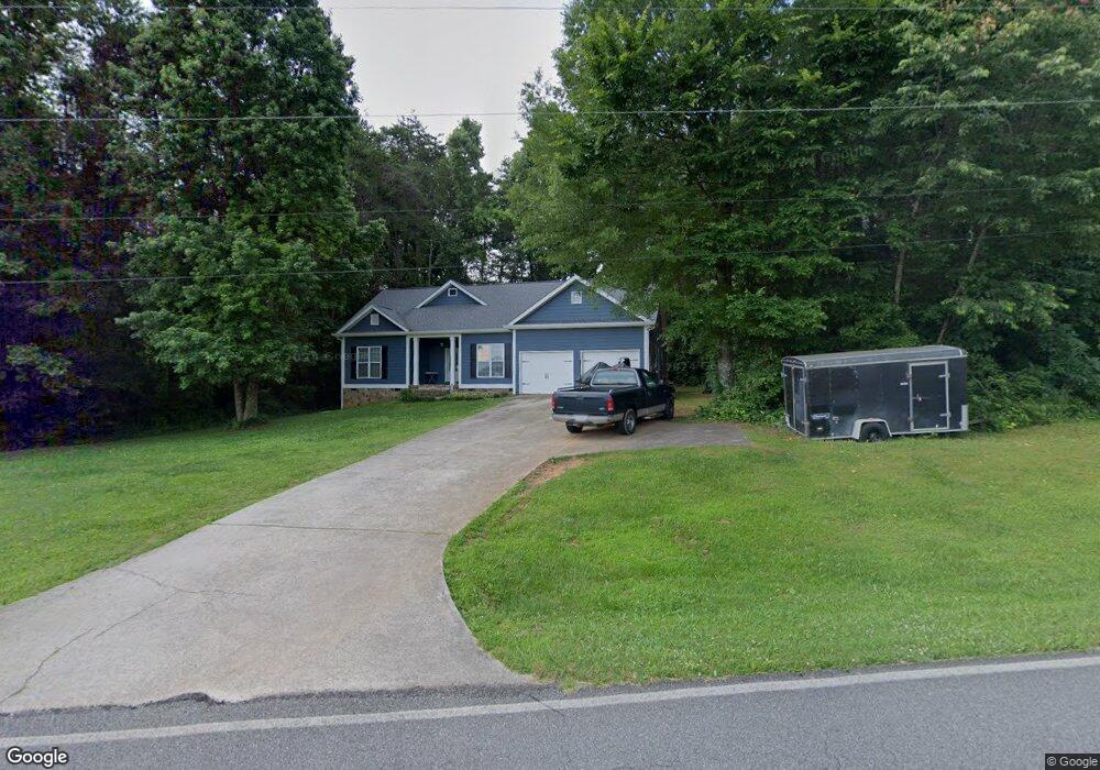
This home is located at 40 Vaughn Dairy Rd, Rydal, GA 30171 and is currently estimated at $349,223, approximately $219 per square foot. 40 Vaughn Dairy Rd is a home located in Bartow County with nearby schools including Pine Log Elementary School, Adairsville Middle School, and Adairsville High School.
Ownership History
Date
Name
Owned For
Owner Type
Purchase Details
Closed on
Jul 22, 2021
Sold by
Johnson Elizabeth A
Bought by
Depasquale Erik and Bounds Johnette
Current Estimated Value
Home Financials for this Owner
Home Financials are based on the most recent Mortgage that was taken out on this home.
Original Mortgage
$180,000
Outstanding Balance
$162,518
Interest Rate
3%
Mortgage Type
New Conventional
Estimated Equity
$186,705
Create a Home Valuation Report for This Property
The Home Valuation Report is an in-depth analysis detailing your home's value as well as a comparison with similar homes in the area
Home Values in the Area
Average Home Value in this Area
Purchase History
| Date | Buyer | Sale Price | Title Company |
|---|---|---|---|
| Depasquale Erik | $225,000 | -- |
Source: Public Records
Mortgage History
| Date | Status | Borrower | Loan Amount |
|---|---|---|---|
| Open | Depasquale Erik | $180,000 |
Source: Public Records
Tax History
| Year | Tax Paid | Tax Assessment Tax Assessment Total Assessment is a certain percentage of the fair market value that is determined by local assessors to be the total taxable value of land and additions on the property. | Land | Improvement |
|---|---|---|---|---|
| 2025 | $2,579 | $107,229 | $14,000 | $93,229 |
| 2024 | $2,579 | $107,229 | $14,000 | $93,229 |
| 2023 | $2,606 | $87,087 | $14,000 | $73,087 |
| 2022 | $2,211 | $87,087 | $14,000 | $73,087 |
| 2021 | $979 | $67,064 | $14,000 | $53,064 |
| 2020 | $1,052 | $67,064 | $14,000 | $53,064 |
| 2019 | $985 | $64,116 | $14,000 | $50,116 |
| 2018 | $615 | $50,760 | $4,720 | $46,040 |
| 2017 | $617 | $50,760 | $4,720 | $46,040 |
| 2016 | $619 | $50,760 | $4,720 | $46,040 |
| 2015 | $1,192 | $47,160 | $4,720 | $42,440 |
| 2014 | $1,171 | $45,120 | $5,400 | $39,720 |
| 2013 | -- | $37,800 | $5,400 | $32,400 |
Source: Public Records
Map
Nearby Homes
- 122 Palisade Dr
- 300 Eminence Peak
- 301 Eminence Peak
- 151 Palisade Dr
- 40 Jennifer Ln
- 104 E Valley Rd NE
- 0 Cherokee Hills Dr Unit 7323862
- 0 Cherokee Hills Dr Unit 129186
- 338 E Valley Rd NE
- 16 Thunder Hawk Ln NE
- 34 E Heritage Dr NE
- 0 Highway 411 NE Unit 7622657
- 61 Indian Springs Dr NE
- 000 Us-411
- 3793 Hwy 140 NE
- 3805 Hwy 140 NE
- 3797 Hwy 140 NE
- 3801 Hwy 140 NE
- 3863 Hwy 140 NE
- 3809 Hwy 140 NE
- 50 Vaughn Dairy Rd
- 147 Sugar Hill Rd NE
- 100 Vaughn Dairy Rd
- 100 Vaughn Dairy Rd
- 143 Sugar Hill Rd NE
- 151 Sugar Hill Rd NE
- 151 Sugar Hill Rd NE
- 0 Drive Unit 7690776
- 157 Palisade Dr NE
- 4200 Highway 411 NE
- 4200 U S 411
- 155 Sugar Hill Rd NE
- 153 Sugar Hill Rd NE
- 4185 Highway 411 NE
- 4197 Highway 411 NE
- 0 Hwy 411 Unit 10208587
- 0 Hwy 411 Unit 8254506
- 0 Hwy 411 Unit 7335055
- 0 Hwy 411
- 4191 Highway 411 NE
Your Personal Tour Guide
Ask me questions while you tour the home.