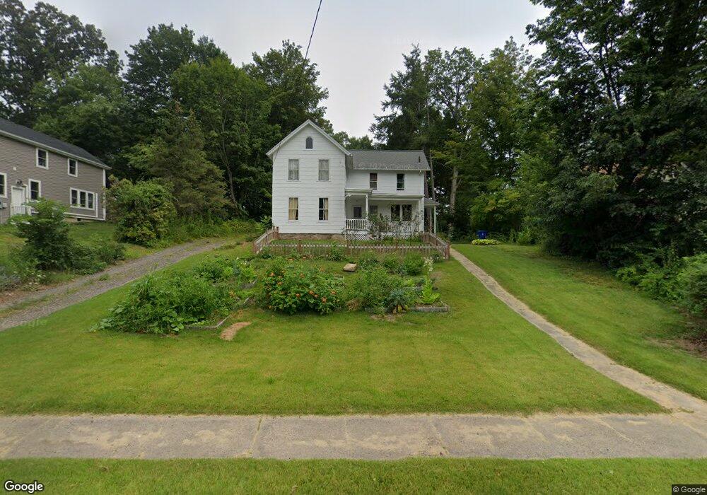
40 Webster St Unionville, CT 06085
Estimated Value: $342,860 - $437,000
3
Beds
1
Bath
1,369
Sq Ft
$279/Sq Ft
Est. Value
About This Home
This home is located at 40 Webster St, Unionville, CT 06085 and is currently estimated at $381,715, approximately $278 per square foot. 40 Webster St is a home located in Hartford County with nearby schools including Union School, West Woods Upper Elementary School, and Irving A. Robbins Middle School.
Ownership History
Date
Name
Owned For
Owner Type
Purchase Details
Closed on
Jun 24, 2002
Sold by
Ahearn John V and Ahearn Kirstin R
Bought by
Frechette Elizabeth
Current Estimated Value
Purchase Details
Closed on
Apr 28, 1997
Sold by
Koonty Jeffrey R and Koonty Tammy
Bought by
Ahearn John and Ahearn Kristin R
Purchase Details
Closed on
Jan 2, 1987
Sold by
Tryon Arthur L
Bought by
Karsky Bradford
Create a Home Valuation Report for This Property
The Home Valuation Report is an in-depth analysis detailing your home's value as well as a comparison with similar homes in the area
Home Values in the Area
Average Home Value in this Area
Purchase History
| Date | Buyer | Sale Price | Title Company |
|---|---|---|---|
| Frechette Elizabeth | $209,000 | -- | |
| Ahearn John | $148,000 | -- | |
| Karsky Bradford | $142,500 | -- |
Source: Public Records
Mortgage History
| Date | Status | Borrower | Loan Amount |
|---|---|---|---|
| Open | Karsky Bradford | $32,200 | |
| Closed | Karsky Bradford | $25,000 |
Source: Public Records
Tax History
| Year | Tax Paid | Tax Assessment Tax Assessment Total Assessment is a certain percentage of the fair market value that is determined by local assessors to be the total taxable value of land and additions on the property. | Land | Improvement |
|---|---|---|---|---|
| 2025 | $4,783 | $179,690 | $80,010 | $99,680 |
| 2024 | $4,573 | $179,690 | $80,010 | $99,680 |
| 2023 | $4,350 | $179,690 | $80,010 | $99,680 |
| 2022 | $4,422 | $150,810 | $72,870 | $77,940 |
| 2021 | $4,345 | $150,810 | $72,870 | $77,940 |
| 2020 | $4,218 | $150,810 | $72,870 | $77,940 |
| 2019 | $4,218 | $150,810 | $72,870 | $77,940 |
| 2018 | $4,099 | $150,810 | $72,870 | $77,940 |
| 2017 | $3,744 | $140,340 | $67,790 | $72,550 |
| 2016 | $3,618 | $140,340 | $67,790 | $72,550 |
| 2015 | $3,510 | $140,340 | $67,790 | $72,550 |
| 2014 | $3,429 | $140,310 | $67,760 | $72,550 |
Source: Public Records
Map
Nearby Homes
- 55 Depot Place
- 42 Keene Place
- 23 Keyes St
- 8 Old Field Rd
- 32 Canterbury Ln
- 8 Gateshead Way
- 8919 Taine Mountain Rd
- 61 Litchfield Rd
- 26 George Washington Turnpike
- 726 Lovely St
- 29 Crocus Ln
- 27 Canterbury Ln Unit 27
- 9 Putnam Ln
- 18 Ledgewood Dr
- 12 Woodside St
- 39 Heritage Dr Unit 39
- 52 Wood Creek Rd
- 24 Green Woods Ln
- 19 Village View Ln
- 50 Woodhaven Dr
- 34 Webster St
- 48 Webster St
- 37 Webster St
- 22 Webster St
- 58 Webster St
- 10 Hillside Ave
- 45 Webster St
- 27 Moses Place
- 20 Hillside Ave
- 32 Nottingham Blvd
- 64 Webster St
- 30 Hillside Ave
- 65 Webster St
- 23 Moses Place
- 26 Nottingham Blvd
- 72 Webster St
- 37 Hillside Ave
- 18 Webster St Unit 20
- 32 Nottingham Bouleward
- 24 Nottingham Blvd
Your Personal Tour Guide
Ask me questions while you tour the home.