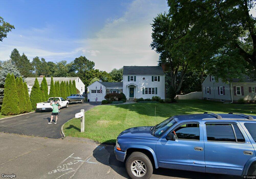
40 Woodridge Cir Trumbull, CT 06611
West Trumbull NeighborhoodEstimated Value: $609,000 - $736,000
3
Beds
3
Baths
2,156
Sq Ft
$314/Sq Ft
Est. Value
About This Home
This home is located at 40 Woodridge Cir, Trumbull, CT 06611 and is currently estimated at $676,902, approximately $313 per square foot. 40 Woodridge Cir is a home located in Fairfield County with nearby schools including Frenchtown Elementary School, Madison Middle School, and Trumbull High School.
Ownership History
Date
Name
Owned For
Owner Type
Purchase Details
Closed on
Sep 12, 2024
Sold by
Kane Jody
Bought by
Carle Matthew and Carle Allison
Current Estimated Value
Home Financials for this Owner
Home Financials are based on the most recent Mortgage that was taken out on this home.
Original Mortgage
$623,817
Outstanding Balance
$617,143
Interest Rate
6.73%
Mortgage Type
Purchase Money Mortgage
Estimated Equity
$59,759
Purchase Details
Closed on
Oct 14, 2021
Sold by
Jones Peter C and Jones Robin F
Bought by
Jones Reid F and Jones Jonathan P
Purchase Details
Closed on
Apr 16, 1981
Bought by
Jones Peter C and Jones Robin F
Create a Home Valuation Report for This Property
The Home Valuation Report is an in-depth analysis detailing your home's value as well as a comparison with similar homes in the area
Home Values in the Area
Average Home Value in this Area
Purchase History
| Date | Buyer | Sale Price | Title Company |
|---|---|---|---|
| Carle Matthew | $656,650 | None Available | |
| Carle Matthew | $656,650 | None Available | |
| Jones Reid F | -- | None Available | |
| Jones Reid F | -- | None Available | |
| Jones Peter C | -- | -- |
Source: Public Records
Mortgage History
| Date | Status | Borrower | Loan Amount |
|---|---|---|---|
| Open | Carle Matthew | $623,817 | |
| Closed | Carle Matthew | $623,817 | |
| Previous Owner | Jones Peter C | $300,000 | |
| Previous Owner | Jones Peter C | $165,000 | |
| Previous Owner | Jones Peter C | $150,000 | |
| Previous Owner | Jones Peter C | $75,000 |
Source: Public Records
Tax History
| Year | Tax Paid | Tax Assessment Tax Assessment Total Assessment is a certain percentage of the fair market value that is determined by local assessors to be the total taxable value of land and additions on the property. | Land | Improvement |
|---|---|---|---|---|
| 2025 | $10,551 | $287,140 | $148,610 | $138,530 |
| 2024 | $10,253 | $287,140 | $148,610 | $138,530 |
| 2023 | $10,089 | $287,140 | $148,610 | $138,530 |
| 2022 | $9,926 | $287,140 | $148,610 | $138,530 |
| 2021 | $9,367 | $257,600 | $123,830 | $133,770 |
| 2020 | $9,187 | $257,600 | $123,830 | $133,770 |
| 2018 | $8,981 | $257,600 | $123,830 | $133,770 |
| 2017 | $8,815 | $257,600 | $123,830 | $133,770 |
| 2016 | $8,588 | $257,600 | $123,830 | $133,770 |
| 2015 | $8,632 | $257,900 | $123,800 | $134,100 |
| 2014 | $8,449 | $257,900 | $123,800 | $134,100 |
Source: Public Records
Map
Nearby Homes
- 5385 Main St
- 8 Koger Rd
- 26 Grove St
- 5 Arrowhead Rd
- 26 Craig Ln
- 6 Winding Way Unit 6
- 75 Parkway Dr
- 45 Frenchtown Rd
- 34 Bassick Rd
- 11 Whalley Rd
- 36 Lillian Dr
- 11 Linda Dr
- 20 Chatfield Dr
- 715 Frenchtown Rd Unit 3
- 28 Grandview Dr
- 7 Lafayette Dr
- 18 Maple St
- 215 Fernwood Rd
- Lot 31 Valley View Rd
- 15 Glenbrook Rd
- 36 Woodridge Cir
- 42 Woodridge Cir
- 32 Woodridge Cir
- 46 Woodridge Cir
- 287 Edison Rd
- 281 Edison Rd
- 30 Woodridge Cir
- 293 Edison Rd
- 50 Woodridge Cir
- 275 Edison Rd
- 301 Edison Rd
- 39 Woodridge Cir
- 43 Woodridge Cir
- 35 Woodridge Cir
- 26 Woodridge Cir
- 45 Woodridge Cir
- 269 Edison Rd
- 307 Edison Rd
- 31 Woodridge Cir
- 54 Woodridge Cir
Your Personal Tour Guide
Ask me questions while you tour the home.